Mini 5 Pro in Windy Vineyard Surveying: Why Better Height
Mini 5 Pro in Windy Vineyard Surveying: Why Better Height Holding Changes the Whole Job
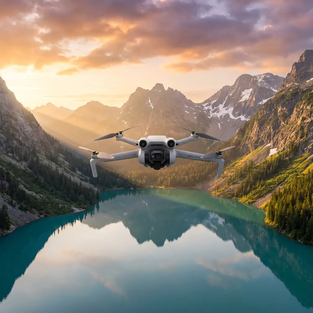
META: A field-based look at how Mini 5 Pro could simplify windy vineyard surveying, with a focus on altitude stability, fused sensor logic, and safer low-level data collection.
Wind exposes every weakness in a small drone.
I learned that the hard way on a vineyard block built along a sloped hillside, where the rows looked tidy from the road but turned into a vertical control problem the second the drone got into the air. The mission sounded simple: fly low, follow the vines, collect repeatable imagery, and finish before the weather shifted. What actually happened was familiar to anyone who has mapped agriculture in uneven terrain. Gusts pushed the aircraft sideways. Terrain changes kept altering relative height above canopy. The pilot kept making tiny altitude corrections. Those tiny corrections added up to inconsistent image geometry and a less reliable survey.
That is why the most interesting conversation around a future-facing aircraft like the Mini 5 Pro is not just obstacle avoidance, subject tracking, QuickShots, Hyperlapse, D-Log, or ActiveTrack, useful as those may be. For vineyard work in wind, the bigger story is altitude intelligence. If a compact drone can hold relative height more cleanly while reacting fast enough to changing motion, it becomes far more useful for agricultural surveying.
A technical reference buried in a Harbin Institute of Technology hexacopter design paper points in exactly that direction. The appendix describes a compact, low-power altitude sensing approach built around fusing a MEMS barometer and an IMU. That matters more than it may seem at first glance.
The real vineyard problem is not “how high am I?”
It is “how high am I right now, relative to the crop, despite motion and disturbance?”
Those are very different questions.
Absolute altitude is often less useful in a vineyard than relative altitude change. Growers and survey teams care about repeatability over rows, edge consistency, and stable image overlap. A drone drifting a little in absolute elevation may still do acceptable work if its relative height over the canopy remains consistent. But if its vertical estimate becomes noisy or lags behind real motion, the data starts to suffer quickly.
The reference material makes a crucial distinction here: the focus was on measuring relative height changes accurately rather than absolute altitude. For vineyard surveying, that is operationally significant. When flying over rising and falling ground in wind, relative vertical stability helps maintain more consistent ground sampling conditions, cleaner overlap, and fewer surprises during stitching or crop analysis.
That is one reason I am watching what the Mini 5 Pro category could do next. A small aircraft that borrows from this sensor-fusion logic would not need to be physically large to become substantially more capable in agriculture.
Why barometer-only altitude can struggle in the field
A barometric altimeter has long been used in aviation to stabilize height information. The reference says barometric altitude instruments have already been used to compensate inertial navigation systems, alongside radar altimeters in other aviation contexts, to provide stable altitude information. That history matters. It tells us the idea is not experimental fluff. It is rooted in real navigation practice.
But vineyard work is rarely clean lab work.
Pressure-based altitude can be stable, yet it is not always agile. Wind, local pressure variation, and environmental changes can introduce error. The source material specifically notes that GPS can help remove absolute altitude errors caused by atmospheric pressure variation, and that a reference barometer can reduce weather-related influence on pressure altitude. In a practical vineyard scenario, this means a drone that leans only on pressure data may hold altitude well in one moment and then slowly bias itself as conditions shift.
Now add slope and gusts. The problem gets worse. The drone is moving dynamically, and the altitude system needs both steadiness and responsiveness.
Why acceleration-only altitude is not the answer either
The same reference highlights the other side of the problem beautifully. Accelerometers respond quickly, but they drift. Anyone who has worked with inertial systems knows the issue: integrate acceleration twice and the altitude estimate can wander badly unless something stabilizes it.
The source explicitly explains the architecture: a fast-response accelerometer is compensated by the barometer, producing strong height measurement performance. It also states that with a low-cost attitude and heading reference system including GPS plus a barometric altimeter, the system demonstrates how to stabilize the double integration of acceleration while preserving high dynamic height measurement performance.
That is not abstract theory. In vineyard operations, it translates into something pilots can feel in the sticks and analysts can see in the deliverables:
- faster response when the aircraft is bumped by gusts
- less vertical wandering over row transitions
- fewer abrupt pilot corrections
- more uniform data capture near canopy level
That combination is exactly what small-drone agriculture needs.
Why this matters specifically for a Mini 5 Pro
People often assume compact drones are mostly about convenience. Easy to carry. Easy to launch. Good enough for quick visuals. That view misses what makes a small aircraft transformative when it is intelligently stabilized.
A Mini 5 Pro used in vineyard work is likely to be deployed where larger platforms feel excessive: quick block checks, slope-by-slope monitoring, post-wind event inspections, reflight comparisons during the growing cycle, and low-altitude imaging between weather windows. In those jobs, setup speed is valuable, but vertical consistency is what determines whether the output is usable.
If Mini 5 Pro advances the way many operators hope, the biggest practical gain may not be a headline camera feature. It may be the aircraft’s ability to manage altitude more gracefully in disturbed air, especially when paired with obstacle sensing and automated tracking logic.
Obstacle avoidance, for example, is often framed as collision prevention alone. In vineyards, it also affects flight path smoothness. A drone that sees obstacles but cannot maintain clean height behavior under wind still creates uneven survey results. The smarter combination is obstacle awareness plus stable vertical estimation.
The same goes for ActiveTrack and subject tracking. On paper these are cinematic tools. In the field, the underlying requirement is sensor confidence. If the aircraft is trying to track a moving utility vehicle, worker, or inspection route through vineyard lanes while wind pushes it around, stable altitude estimation supports safer, more believable tracking. The shot quality improves, yes, but so does mission reliability.
A past vineyard headache, and how this kind of system would have helped
A few seasons ago, I was documenting canopy variation across a terraced vineyard after a storm front. The air was not wild enough to cancel, but it was unstable enough to ruin lazy assumptions. The rows stepped down the slope, and every pass forced a choice: fly conservatively high and lose detail, or fly lower and spend the whole mission babysitting altitude.
We chose lower.
The result was a mess of micro-corrections. Every gust changed the aircraft’s attitude. Every terrain shift altered visual separation from the canopy. The data was usable, but only after more cleanup than the job should have required. The real issue was not pilot skill. It was that the platform lacked the kind of fused vertical awareness described in the reference.
That paper’s system was designed as a low-cost, low-power small altitude sensor, which is exactly the sort of engineering mindset that fits a compact drone platform. The relevance to Mini 5 Pro is obvious. If you can combine low power draw, compact hardware, and accurate vertical information, you improve the one thing small aircraft often struggle with under wind: disciplined low-level consistency.
The reference even mentions that typical stair-climbing motion could be recorded in real time. For a drone operator, that detail is more than a curiosity. It suggests the fused sensor approach can capture changing vertical movement patterns responsively rather than smoothing them into sluggish estimates. Replace stairs with terraces, embankments, and undulating vineyard lanes, and the significance becomes practical fast.
Sensor fusion is not glamorous, but it is what makes field work feel easy
Pilots notice polished features. Survey teams notice output quality. Engineers notice what sits underneath.
The Harbin reference names one sensor architecture directly: the Xsens MTi-G. That is another traceable detail worth paying attention to. The significance is not the brand alone. It is that the system architecture relied on an integrated sensing approach, including orientation and GPS context, rather than a single-source altitude guess. In drone operations, orientation error matters because attitude mistakes contaminate vertical estimation. The source also discusses analyzing attitude error effects on height estimation, which is a critical point for windy missions.
Why?
Because in gusty flight, the drone is constantly tilting. If the system mishandles orientation, the acceleration data feeding the height estimate becomes less trustworthy. That leads to false vertical correction, overreaction, or sluggish compensation. In a vineyard pass, that can mean subtle but harmful variation in image scale and overlap. Better fusion logic cuts that risk.
This is the hidden value proposition for a Mini 5 Pro aimed at real work rather than just casual flying. Not bigger. Smarter.
What a better windy-vineyard workflow could look like
Imagine a compact drone that launches from the edge of a block, acquires stable position quickly, and then flies a low-altitude route over vine rows with enough vertical confidence to resist both pressure drift and inertial drift. The barometric channel gives steadiness. The IMU gives fast reaction. GPS helps correct longer-term altitude bias from atmospheric effects. A reference logic model smooths the result into something operationally dependable.
Now add modern flight features on top:
- obstacle avoidance to reduce branch and post risk at row edges
- ActiveTrack or subject tracking for moving inspection support
- D-Log for visual analysis where lighting contrast is harsh
- Hyperlapse and QuickShots for documenting field conditions without separate flights
Those features become more useful when the aircraft’s core height behavior is solid. That is the key point. Advanced flight modes are only as good as the stability beneath them.
For teams planning vineyard surveys in windy conditions, I would not evaluate Mini 5 Pro only by camera specs or top-level marketing features. I would ask a more serious set of questions:
How does it handle relative altitude over changing terrain?
How quickly does it recover from vertical disturbance?
How much pilot correction does it demand in gusts?
How cleanly does it fuse barometric, inertial, and positional data?
Those answers will tell you more about field performance than a long feature list.
The bigger implication for compact agricultural drones
The most promising part of the reference is its restraint. It does not chase grand claims. It focuses on a very specific challenge: obtaining accurate vertical information from a small, low-cost, low-power sensing setup by combining the strengths of a barometer and an IMU while controlling their weaknesses.
That is exactly the kind of engineering that moves compact drones from “handy” to “trusted.”
For vineyard surveying, trust is earned when flights are repeatable and data behaves. You want the same route on different days to produce output that is comparable, not warped by inconsistent low-level altitude behavior. You want the aircraft to react quickly to gusts without letting inertial drift contaminate the vertical solution. You want weather effects on pressure sensing to be managed rather than ignored. The reference points to all of those issues directly.
If you are evaluating the Mini 5 Pro for agricultural use, especially on hilly vineyard terrain, this is where I would focus the conversation. Better vertical sensing is not a side note. It is the difference between a drone that merely survives windy conditions and one that produces dependable survey work inside them.
If you want to compare platform fit for your own vineyard conditions, I’m happy to discuss the workflow in more detail through this field-ops chat line.
The smartest compact drones are not defined by how small they are. They are defined by how little effort they demand when the air gets messy and the terrain starts changing under the aircraft. For a Mini 5 Pro, that is the real test.
Ready for your own Mini 5 Pro? Contact our team for expert consultation.