Mini 5 Pro Field Report: Surveying Vineyards in Complex
Mini 5 Pro Field Report: Surveying Vineyards in Complex Terrain Starts With the Right Camera Setup
META: A field-tested look at how Mini 5 Pro can survey vineyards in steep, uneven terrain, with practical insight on camera settings, obstacle avoidance, tracking, and image quality.
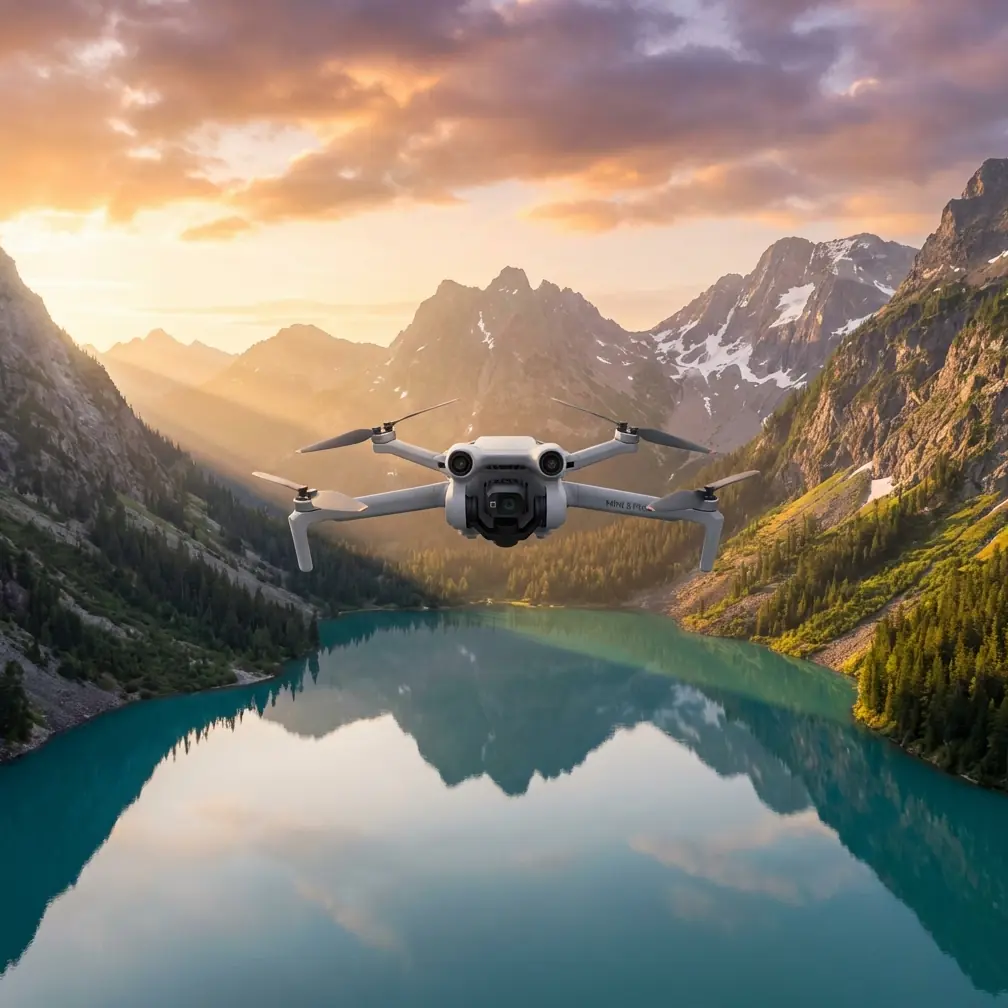
I took the Mini 5 Pro into a vineyard that does not forgive sloppy flying.
The site rolls across broken terrain, with tight rows, abrupt elevation changes, reflective irrigation lines, and tree edges that create messy light from one pass to the next. On paper, it sounds like a routine mapping and visual inspection job. In reality, this is the kind of environment where bad camera defaults and overconfidence ruin a survey long before battery level becomes the issue.
That is the part many operators miss.
A recent photography note making the rounds claimed that 90% of people never open the hidden settings in their phone’s native camera, and that the disappointing results they see are often not a talent problem but a parameter problem. That idea translates directly to drone work. I would argue it matters even more in a vineyard survey, because once you are relying on aerial imagery to assess canopy variability, row condition, drainage patterns, or access paths on a slope, “good enough” footage quickly becomes operationally useless.
The Mini 5 Pro, in this context, is not just a small aircraft with a good sensor stack. It is a tool that rewards setup discipline.
The real problem in vineyard surveying is not always the drone
When growers or site managers say their aerial images look flat, hazy, yellowish, or soft, they often assume the limitation is the platform. Sometimes it is. More often, the aircraft is fine and the capture workflow is not.
That same source described familiar image failures: photos that look gray and lifeless, skin tones that turn dark or yellow, and frames that miss focus. Ignore the portrait reference and the pattern still fits drone operations almost perfectly. In vineyard work, the equivalents are easy to spot:
- foliage that looks dull rather than differentiated
- soil and leaf color that shift enough to confuse visual comparison
- soft frames that weaken inspection confidence
- uneven exposure between flight segments
- footage that looks cinematic at a glance but carries poor analytical value
On the Mini 5 Pro, these issues usually start with camera settings that are left on broad consumer defaults when the mission actually requires consistency.
That is why I treat this aircraft less like a “smart camera in the sky” and more like a field instrument with creative headroom.
A steep vineyard teaches you fast
On this specific flight, we were surveying blocks laid across a slope with alternating pockets of shadow and harsh sun. One side of the property dropped into a scrub-lined gully. The other side rose toward a windbreak with irregular tree height. If you have flown vineyards like this, you already know what happens: exposure swings become visible row by row, the aircraft’s route feels narrower than it looked from the ground, and even small autofocus hesitations become obvious once you review footage on a larger screen.
Halfway through a contour-following pass, a pheasant burst out from between the rows and cut low across the flight path before dropping toward the gully edge. It was over in a second. What mattered was not drama. What mattered was that the Mini 5 Pro’s sensing and obstacle avoidance behavior stayed composed instead of forcing a clumsy correction into the nearest trellis line.
That operational significance is easy to underestimate. In vineyard terrain, obstacle avoidance is not just about preventing a headline incident. It helps preserve survey continuity. A sudden evasive wobble can break framing, alter overlap quality, or create a section of footage that no longer matches the rest of the dataset. When the aircraft can navigate an unexpected intrusion while maintaining stable path control, the value shows up later in cleaner review and fewer reshoots.
Hidden settings matter more than pilot ego
The phone-camera article got one thing exactly right: many users are not failing because they lack instinct. They are failing because the system was never configured properly. With the Mini 5 Pro, that usually means four things before takeoff:
1. Locking down image behavior
If the drone is allowed to reinterpret the scene too aggressively from one turn to the next, you lose consistency. For vineyard monitoring, consistency is often more useful than a flashy image. If one block appears warmer simply because auto settings drifted as the drone rotated toward the sun, the footage can mislead the viewer before analysis even begins.
This is where D-Log earns its place. Not because every survey needs a dramatic grade, but because it gives more room to manage highlight-heavy scenes with alternating shade and sun. In sloped vineyards, bright sky spill and reflective leaves can push standard capture into clipped, brittle-looking footage. D-Log gives the operator a better starting point when the site’s contrast is unruly.
2. Managing focus intentionally
The original reference mentioned blurry frames and missed focus. That problem is not confined to phones. Aerial inspection footage can look sharp on the controller and disappoint later. In vineyards, where repeating geometry can confuse the eye, focus discipline matters. Before each block, I verify focal behavior against a defined point in the rows rather than trusting a quick glance at the live feed.
Operationally, that means fewer “almost usable” sequences. Those are the most expensive kind, because they consume time twice: once in flight, once in failed review.
3. Correcting the “gray image” trap
The source described photos that come out gray and textureless. Again, that maps cleanly to drone imaging. Vineyards are full of subtle tonal cues: leaf density, soil moisture expression on access paths, exposed patches around posts, signs of stress along drainage lines. If your capture settings flatten everything into a low-energy image, you lose one of the drone’s biggest advantages.
The Mini 5 Pro can produce attractive footage quickly, but for survey work the goal is not simply “pretty.” The goal is readable contrast without destroying natural detail.
4. Avoiding false confidence from smart automation
Automatic features help, but they also tempt pilots to stop thinking. Complex terrain punishes that habit. Subject tracking, ActiveTrack, QuickShots, and Hyperlapse all have their place. I use them. But on a vineyard survey, they are supporting tools, not substitutes for mission planning.
Where the Mini 5 Pro actually helps in vineyard terrain
There is a reason smaller aircraft are attractive in this kind of work. Access can be awkward. Launch spots are rarely ideal. Terrain changes compress the margin for error. A compact drone that still offers capable sensing and stable imaging reduces friction at every stage of the job.
With the Mini 5 Pro, three strengths stand out in vineyard operations.
Obstacle avoidance is not just a safety feature
The phrase gets used too loosely, so let’s pin it down.
In vineyards with irregular topography, obstacle avoidance does three practical things:
- It reduces the risk of lateral drift into posts, wires, or row-edge vegetation during low-altitude work.
- It protects image continuity when the aircraft encounters surprise movement or spatial compression.
- It gives the pilot more attention to spend on framing, overlap, and data usefulness rather than pure collision anxiety.
That pheasant incident made this very clear. Wildlife is part of real fieldwork. Birds flush. Rabbits break cover. Farm dogs appear where they were not a minute earlier. A sensor suite that reads the environment well enough to help the aircraft stay composed is not a luxury. It is part of producing dependable output in uncontrolled outdoor conditions.
ActiveTrack and subject tracking are useful beyond obvious “follow me” content
A lot of operators hear “subject tracking” and think influencer footage. That misses the agricultural value.
In a vineyard, tracking tools can help maintain smooth visual attention on moving utility vehicles, tractors, or workers performing row-level tasks, provided the operation is conducted safely and with proper planning. That matters for workflow review, training footage, and documenting how equipment moves through constrained terrain. You are not using tracking because it looks clever. You are using it because repeatable framing reveals process details that shaky manual pursuit often hides.
The Mini 5 Pro’s tracking capability also helps when you want to document a route through a steep parcel without constantly overcorrecting as the terrain shifts beneath the aircraft. The result is footage that communicates operational realities more clearly to farm managers, consultants, or remote stakeholders.
QuickShots and Hyperlapse are not fluff when used correctly
I would not build a technical survey around them. But dismissing them outright is shortsighted.
QuickShots can create fast location context at the start of a report: the relation between vineyard blocks, access roads, windbreaks, drainage channels, and adjacent terrain. Hyperlapse can show cloud movement, shadow progression, or work activity over time. Those are communication assets, especially when a grower needs to explain site conditions to an investor, agronomist, insurer, or operations team spread across multiple properties.
The key is to treat these modes as reporting layers, not as the survey itself.
Camera setup decides whether the Mini 5 Pro is documenting or merely flying
This loops back to the central lesson from the camera reference: people often blame themselves when the real issue is hidden settings left untouched.
That source claimed 90% of users never activate the settings that change their results. The exact percentage is less interesting to me than the underlying truth. Most disappointing imagery is born before the shutter moment. In drone work, that means preflight configuration, exposure discipline, focus checks, and deciding whether the mission is meant for analysis, communication, or both.
For vineyards in complex terrain, I recommend thinking in layers:
- Survey layer: stable, repeatable, readable passes
- Inspection layer: closer visual review of stress points, erosion, trellis condition, or access trouble spots
- Communication layer: brief cinematic context using QuickShots or Hyperlapse
- Archive layer: color-managed footage, ideally with D-Log when the scene’s contrast justifies it
The Mini 5 Pro can handle all four, but only if the operator stops treating default settings as neutral. They are not neutral. They are generic.
Why this matters for vineyard managers, not just drone pilots
The better question is not “Can the Mini 5 Pro fly here?”
It can.
The better question is whether it can return imagery that helps someone make a decision. On steep vineyard sites, decisions often revolve around water movement, road access, canopy uniformity, row damage, labor planning, and seasonal documentation. Every one of those benefits from footage that is sharp, consistent, and spatially trustworthy.
A muddy-looking image that hides texture, or a soft clip that looked acceptable on the controller, weakens the whole value chain. It creates doubt where the drone should be adding clarity.
That is why experienced field operators obsess over details that casual users skip. Hidden camera settings. Focus verification. Exposure consistency. Flight lines that respect terrain. Smart use of obstacle avoidance rather than blind faith in it. The Mini 5 Pro is powerful in this environment, but only if flown as part of a method.
My takeaway after this field session
The aircraft did what a good field drone should do. It stayed agile in confined terrain, handled abrupt environmental complexity without drama, and produced footage that held up in review because the camera was treated as a controllable system rather than a magic box.
That last point is the one worth carrying forward.
The internet is full of arguments about which drone has the best specs. On a working vineyard, specs become secondary very quickly if the operator leaves image behavior on broad defaults and hopes the aircraft will sort everything out on its own. It will not. And it should not have to.
The surprising lesson from a phone-camera discussion published on 2026-04-22 is that the same human mistake appears everywhere: people assume disappointing images mean they lack skill, when the real problem is that the tool was never properly configured. In aerial surveying, that misunderstanding wastes far more than a bad social photo. It wastes site time, flight windows, and confidence in the data.
If you are planning Mini 5 Pro work in vineyards with slopes, broken edges, and mixed light, start with the settings. Then trust the aircraft’s obstacle avoidance, tracking, and imaging strengths for what they are: force multipliers, not replacements for field judgment.
If you want to compare workflows for vineyard inspection and reporting, you can message Chris Park directly here.
Ready for your own Mini 5 Pro? Contact our team for expert consultation.