How I’d Survey Urban Vineyards With the Mini 5 Pro
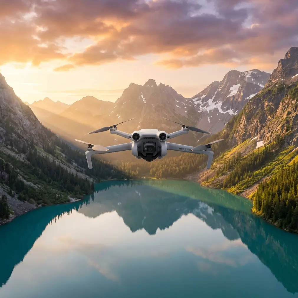
How I’d Survey Urban Vineyards With the Mini 5 Pro
META: A practical Mini 5 Pro tutorial for surveying vineyards in urban environments, covering flight setup, obstacle avoidance, ActiveTrack, D-Log capture, and safer data collection around tight city-edge rows.
Surveying vineyards inside or near urban areas is a different discipline from flying over open farmland. The vines may look orderly from the ground, but once you get airborne, the real constraints show up fast: utility lines at the edge of a block, narrow access roads, reflective roofs, parked vehicles, trees planted as wind buffers, and neighbors much closer than you would prefer. That mix creates a job that demands precision more than raw size or speed.
That is exactly where the Mini 5 Pro concept makes sense.
If I think back to older vineyard flights I’ve done in tight edge-of-town plots, the hardest part was rarely getting the drone in the air. It was getting repeatable, usable footage and visual records without wasting time repositioning after every small obstacle or interruption. You would line up a clean pass over a row, notice a pole or branch entering the corridor, pull off the line, restart, and end up with fragmented coverage. The aircraft might be capable enough, but the workflow was clumsy.
A Mini 5 Pro-style platform changes that job because it fits the physical reality of urban vineyard work: small launch spaces, short survey windows, and a need to move carefully around obstructions while still collecting footage you can compare from pass to pass. If your goal is not cinema for its own sake but practical inspection of canopy consistency, row condition, irrigation clues, access routes, and edge-of-property hazards, that matters far more than headline specs alone.
Why urban vineyard surveying is harder than it looks
Urban vineyards create a strange combination of agricultural and suburban flying conditions. One minute you are following a tidy block of vines; the next you are dealing with a street border, backyard trees, decorative lighting, or a retaining wall. The terrain may not be dramatic, yet the obstacle density is high.
This is why obstacle avoidance is not a luxury feature here. It is operational insurance.
In open rural blocks, you can often keep wider margins and smoother arcs. In an urban setting, you may need to fly slower, lower, and closer to defined paths to document the exact condition of specific rows. A drone with reliable obstacle sensing gives you more confidence to maintain that deliberate line instead of constantly overcorrecting. That translates into cleaner visual records and fewer broken passes.
The same applies to subject tracking. Most people hear “ActiveTrack” and think of cyclists, cars, or solo creators filming themselves. In vineyard work, I think about it differently. Tracking can help maintain consistent framing when you are documenting a utility vehicle moving down a service lane, a worker performing a repeat inspection route, or a ground reference point moving through a constrained corridor. Used carefully, it reduces the workload on the pilot and helps preserve composition when the environment is already demanding enough.
That matters in city-adjacent vineyards because your attention is already split between navigation, safety, airspace awareness, and the survey objective. Any feature that lowers manual correction without compromising control earns its place.
The Mini 5 Pro workflow I would use
I would not approach an urban vineyard survey as one long flight. That is usually where mistakes begin. Instead, I would break the mission into four short tasks.
1. Perimeter read first, rows second
Start with a higher, slower perimeter orbit or box pattern to understand the site as it exists that day, not as you remember it. Urban-edge vineyards change in small but important ways: delivery vans parked near access roads, temporary fencing, maintenance equipment, or fresh trimming piles near row ends.
This first pass is where obstacle avoidance pays off immediately. You are building a live hazard map while also checking whether your intended low-level routes are still realistic. I would not chase detail yet. I would look for pinch points.
Operationally, this saves time because it prevents bad route choices before they happen. A three-minute setup pass can spare you three interrupted low-altitude attempts later.
2. Run the rows in repeatable lanes
Once the perimeter is understood, I’d move into row-by-row capture. The goal is consistency. Fly parallel to the canopy lines and keep altitude, speed, and camera angle as steady as possible.
This is where a compact drone platform becomes useful in a very practical way. In urban vineyards, launch and recovery spots are often awkward. Sometimes you are taking off from a gravel strip, a narrow service road, or a corner near parked equipment. A smaller aircraft is simply easier to deploy cleanly and reposition between blocks without turning setup into a production.
For the row runs themselves, I would use a moderate forward speed and avoid dramatic yaw inputs. You are not trying to make a promo reel. You are trying to build comparable footage that lets you notice irregular growth, missing vine sections, signs of stress, trellis issues, and edge encroachment from nearby structures or vegetation.
If the Mini 5 Pro includes refined ActiveTrack behavior, I would use it selectively for vehicle-follow or guided alignment tasks, not as a substitute for pilot judgment. In vineyards, rows can create repeating patterns that look simple but become disorienting fast on-screen. Tracking is helpful when it serves consistency; it is a liability when it encourages complacency.
3. Capture inspection clips in D-Log when light is difficult
Urban vineyards often sit near buildings, walls, and paved surfaces that create uneven light. One side of a row may be clean and bright while the next section is hit by shadow from trees or nearby structures. Standard color profiles can be fine for quick review, but if the goal is serious post-flight analysis, D-Log is worth using.
The operational significance is straightforward: D-Log helps retain more usable tonal information across high-contrast scenes. That is useful when you need to inspect canopy density, soil variation, or subtle differences between rows that might otherwise get crushed in shadow or clipped in bright highlights.
I would not shoot everything in D-Log by default if the end user wants immediate, no-edit deliverables. But for flights where you know comparison and review matter, especially under mixed lighting, it gives you more room to work afterward.
That is one of those details newer pilots underestimate. Image profile is not just a filmmaker’s choice. In survey-style documentation, it can determine whether the footage remains analytically useful once you are back at the desk.
4. Finish with short specialty passes
This is where QuickShots and Hyperlapse can actually earn a place, though not for the reason most people expect.
QuickShots are often treated like social media shortcuts, but in a vineyard context they can create quick contextual references of the block within its surroundings. A brief reveal or pullback can help show how a particular row section sits relative to roads, walls, neighboring lots, or drainage lines.
Hyperlapse is even more interesting if used carefully. A controlled time-compressed view of worker movement, traffic around access points, or changing light across a block can provide operational context that still images miss. I would not make it the core of the survey, but I would absolutely consider it as a supplementary record when site activity affects how and when the vineyard can be serviced.
That is the broader point: features associated with creativity can still be useful in technical work when they answer a real field question.
My preferred flight logic in a tight urban block
When I’m working a site like this, I follow a simple rule: low complexity in the air, high discipline on the ground.
That means I plan the route before takeoff, define no-fly directions relative to the nearest roads or residences, and decide in advance which rows matter most if battery or conditions tighten. I do not improvise the whole mission from the live view.
A good Mini 5 Pro survey session in an urban vineyard might look like this:
- one reconnaissance perimeter pass
- two to four structured row passes
- one oblique inspection segment for canopy edges
- one contextual clip for layout reference
That sounds basic because it should be. Vineyard surveying gets messy when pilots try to collect every possible angle in one go. Better to come home with a coherent set of repeatable visuals than a memory card full of disconnected clips.
If you’re planning a site-specific workflow and want a second opinion, I’d share your route sketch here: message me directly on WhatsApp.
How obstacle avoidance changes the job on real flights
Let’s get specific. In an urban vineyard, obstacle avoidance has two main benefits.
First, it reduces the mental load during close-structure flying. If you are navigating near a row that borders trees, netting supports, or utility features, your cognitive bandwidth is already under pressure. Reliable sensing gives you a margin that helps maintain smoother lines and steadier footage.
Second, it makes repeat passes more realistic. Repeatability is everything in comparative observation. If you fly one row at one height and angle today, you want a realistic chance of doing something very similar next week. Features that stabilize movement and reduce abrupt corrections make that more achievable.
Notice what I am not saying: obstacle avoidance does not replace site assessment. Branches, wires, and fine structures can still be problematic. But in the kind of constrained environment vineyards near urban infrastructure often present, it improves the odds of collecting usable data without turning every pass into a manual rescue exercise.
Why ActiveTrack can be surprisingly useful in vineyard work
ActiveTrack is easy to dismiss as a content creator feature until you use it with a more disciplined purpose.
Imagine you are documenting how a small utility cart moves through service lanes beside the vines, or you want consistent lateral framing of a worker performing visual checks along a row edge. Manual flight can do that, of course, but it also introduces micro-corrections that make review harder. A stable tracking mode can reduce those variations.
The key is restraint. In a vineyard full of repeating geometry, similar textures, and intermittent obstructions, you need to treat tracking as an assistive tool rather than an autopilot promise. Use it when the path is predictable and the environment is already assessed. Drop back to full manual control when complexity increases.
That balance is what makes the feature genuinely useful instead of gimmicky.
What I would actually deliver after the flight
For an urban vineyard survey, I would organize outputs into three layers:
- Wide context images showing the full block and its surrounding constraints.
- Repeatable row-level clips or stills for canopy and structure review.
- Targeted detail captures of anomalies such as gaps, leaning trellis sections, pooling areas, or edge interference from nearby vegetation and built structures.
If D-Log footage was captured, I would normalize it lightly for review while keeping a graded master that preserves detail. If QuickShots or Hyperlapse clips were created, I would label them as contextual rather than primary inspection records.
That distinction matters because the value of a survey is not in how dynamic it looks. It is in how clearly it supports decisions.
The real advantage of a Mini 5 Pro for this kind of work
For urban vineyard operators, the ideal drone is not the one that looks most impressive on paper. It is the one that reduces friction in the field.
A Mini 5 Pro-type aircraft is compelling because it aligns with how these jobs actually unfold: tight launch areas, multiple short repositionings, careful row-following, frequent obstacle checks, and mixed lighting that benefits from flexible capture options like D-Log. Add capable obstacle avoidance and practical tracking tools such as ActiveTrack, and the drone becomes less of a flying camera and more of a field instrument.
That is the difference I care about most.
Years ago, the frustrating part of vineyard survey work was not the lack of image quality. It was the number of tiny interruptions that broke consistency. Urban obstacles. Awkward angles. Incomplete passes. Too much pilot attention spent on preserving the flight instead of observing the site.
A well-equipped Mini 5 Pro changes that equation. It lets you spend less energy fighting the environment and more energy reading it.
And for vineyard surveying, that is what better technology is supposed to do.
Ready for your own Mini 5 Pro? Contact our team for expert consultation.