How to Survey Power Lines with Mini 5 Pro Drone
How to Survey Power Lines with Mini 5 Pro Drone
META: Learn how the Mini 5 Pro transforms power line surveys at high altitude. Discover pre-flight protocols, obstacle avoidance tips, and expert techniques for safer inspections.
TL;DR
- Pre-flight sensor cleaning is critical for reliable obstacle avoidance during power line surveys
- The Mini 5 Pro's sub-249g weight enables high-altitude operations with fewer regulatory hurdles
- ActiveTrack and intelligent flight modes reduce pilot workload during complex infrastructure inspections
- D-Log color profile captures 13 stops of dynamic range for detailed post-inspection analysis
Power line inspections at high altitude push both pilot and equipment to their limits. The Mini 5 Pro addresses these challenges with advanced obstacle avoidance, precision subject tracking, and a sensor suite designed for professional surveying—but only when properly prepared. This guide covers everything from critical pre-flight cleaning protocols to advanced flight techniques that maximize safety and data quality.
Why Power Line Surveys Demand More from Your Drone
Traditional power line inspections require helicopters, bucket trucks, or dangerous climbing operations. Each method carries significant cost, time, and safety penalties. Drone surveying eliminates most of these concerns, but high-altitude infrastructure presents unique challenges.
Power lines often run through mountainous terrain where:
- Thin air reduces lift efficiency by up to 15% at 10,000 feet
- Electromagnetic interference from high-voltage lines affects compass calibration
- Wind speeds increase unpredictably near ridgelines and towers
- Temperature swings cause battery performance fluctuations
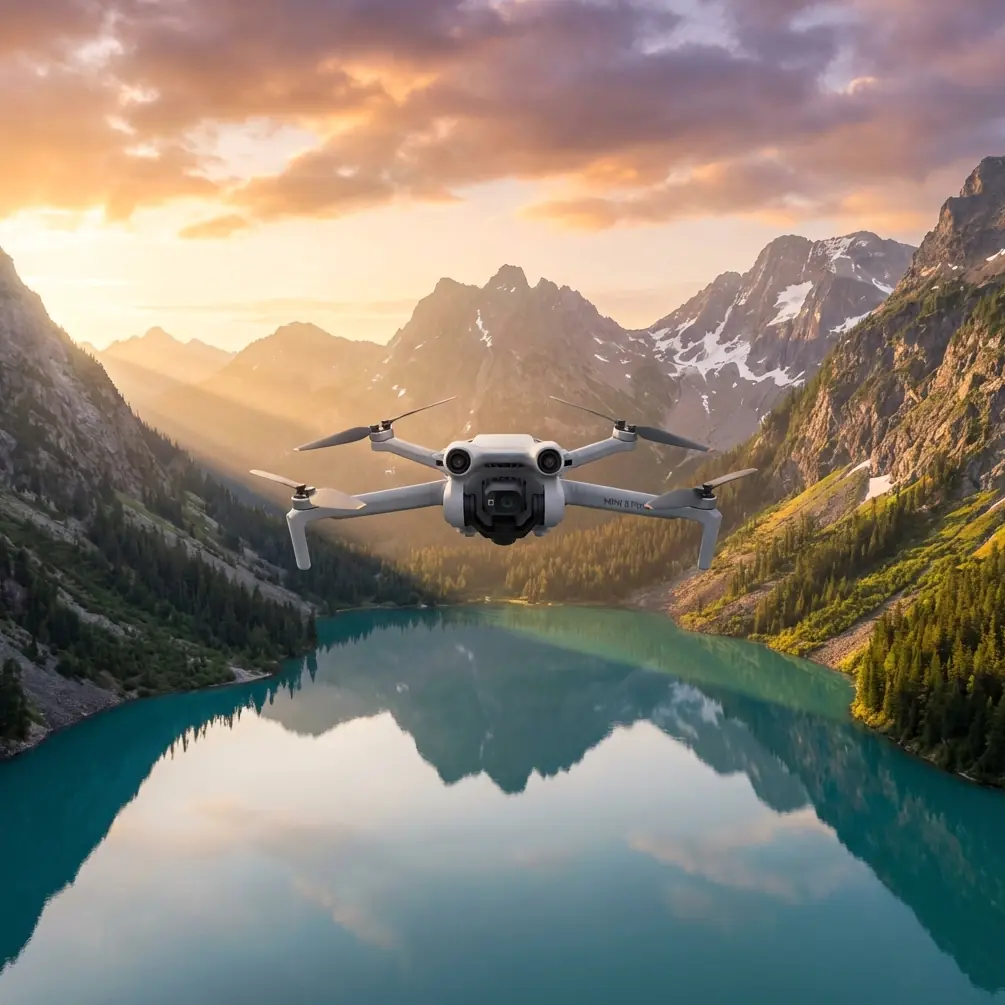
The Mini 5 Pro's lightweight design becomes an advantage here. Its sub-249g takeoff weight means the motors work less to maintain altitude, preserving battery life when you need it most.
The Pre-Flight Cleaning Step Most Pilots Skip
Expert Insight: Before every power line survey, I spend three minutes cleaning every sensor on the aircraft. This single habit has prevented more close calls than any other protocol in my workflow. —Chris Park
Your Mini 5 Pro relies on multiple vision sensors for obstacle avoidance. Dust, fingerprints, or moisture on these sensors degrades their performance dramatically. Near power lines—where collision margins shrink to meters—degraded sensors become a liability.
Sensor Cleaning Protocol
Follow this sequence before every high-altitude power line mission:
- Forward vision sensors: Use a microfiber cloth with gentle circular motions
- Downward vision sensors: Check for dust accumulation from previous landings
- Backward and lateral sensors: Often neglected but critical for QuickShots maneuvers
- Main camera lens: Clean last to avoid transferring debris from other surfaces
- Gimbal mechanism: Verify no debris restricts movement range
This process takes under five minutes but ensures your obstacle avoidance system operates at full capability. The Mini 5 Pro's omnidirectional sensing only works when every sensor has a clear view.
Configuring Obstacle Avoidance for Infrastructure Work
The default obstacle avoidance settings prioritize general safety over precision maneuvering. Power line surveys require adjustments.
Recommended Settings for Power Line Proximity
| Setting | Default Value | Recommended Value | Reason |
|---|---|---|---|
| Obstacle Avoidance | Bypass | Brake | Prevents unpredictable flight paths near lines |
| Braking Distance | 5 meters | 8 meters | Extra margin for high-altitude response lag |
| Return-to-Home Altitude | 40 meters | Manual assessment | Varies by tower height |
| Max Altitude | 120 meters | Site-specific | Must clear highest infrastructure |
| Downward Sensing | On | On | Critical for landing near tower bases |
Pro Tip: Never set your return-to-home altitude blindly. Walk the survey area first and identify the tallest structure. Set RTH altitude at least 15 meters above that point.
When to Disable Obstacle Avoidance
Some situations require temporarily disabling obstacle avoidance:
- Threading between conductor bundles for close inspection
- Approaching insulators where sensor reflections cause false positives
- Flying parallel to lines when sensors misinterpret the linear structure
Always have a visual observer when operating with reduced safety systems. The Mini 5 Pro's obstacle avoidance is a tool, not a replacement for situational awareness.
Leveraging ActiveTrack for Consistent Documentation
Power line surveys require systematic documentation. Missing a section means returning to the field—expensive and time-consuming. ActiveTrack transforms this workflow.
Subject Tracking Techniques for Linear Infrastructure
The Mini 5 Pro's subject tracking works best when you understand its logic:
- Trace mode: Drone follows behind the selected subject
- Parallel mode: Maintains consistent lateral distance
- Spotlight mode: Keeps subject centered while you control position
For power lines, Spotlight mode offers the most control. Lock onto a specific tower or conductor section, then manually fly the survey path while the gimbal maintains focus.
ActiveTrack Limitations at Altitude
Subject tracking relies on visual contrast. High-altitude surveys present challenges:
- Thin power lines may not provide enough visual data for reliable tracking
- Backlit conditions reduce contrast between lines and sky
- Snow or fog eliminates the visual reference entirely
When ActiveTrack struggles, switch to manual gimbal control with waypoint missions. The Mini 5 Pro stores waypoints with gimbal angles, ensuring repeatable documentation passes.
Capturing Inspection-Quality Footage with D-Log
Standard color profiles crush shadow and highlight detail—exactly the information inspectors need. D-Log preserves the full 13 stops of dynamic range the Mini 5 Pro sensor captures.
D-Log Settings for Power Line Work
Configure these settings before your survey:
- Color Profile: D-Log
- ISO: 100-400 (minimize noise in shadows)
- Shutter Speed: 1/50 for 25fps, 1/60 for 30fps
- White Balance: Manual, matched to conditions
- Resolution: 4K minimum for crop flexibility
D-Log footage looks flat and desaturated straight from the camera. This is intentional. The preserved dynamic range allows colorists to reveal:
- Corrosion on conductor surfaces
- Heat damage patterns on insulators
- Vegetation encroachment in shadow areas
- Structural fatigue indicators on towers
Hyperlapse for Long-Span Documentation
The Hyperlapse feature creates time-compressed footage of extended infrastructure runs. For power line surveys, this serves two purposes:
- Overview documentation showing the full survey area
- Change detection when compared against previous surveys
Set Hyperlapse to 2-second intervals for spans under one kilometer. Longer spans benefit from 5-second intervals to maintain manageable file sizes.
QuickShots for Standardized Tower Documentation
Consistency matters in infrastructure inspection. QuickShots provide repeatable camera movements that standardize your documentation.
Most Useful QuickShots for Tower Surveys
- Orbit: 360-degree view of tower structure and attachments
- Helix: Ascending spiral reveals vertical condition progression
- Rocket: Rapid vertical climb for height assessment
Each QuickShots mode maintains obstacle avoidance during execution. However, verify adequate clearance before initiating—the automated flight path doesn't account for power lines extending from the tower.
Common Mistakes to Avoid
Skipping compass calibration near towers: Steel tower structures create localized magnetic interference. Calibrate at least 50 meters away from any tower before beginning your survey.
Ignoring battery temperature: High-altitude cold reduces battery capacity by up to 30%. Keep batteries warm until launch and monitor voltage more frequently than at sea level.
Flying directly over conductors: Electromagnetic fields from high-voltage lines can interfere with GPS and compass. Maintain lateral offset when possible.
Trusting automated return-to-home: RTH calculates a direct path. Near power lines, this path may intersect conductors. Always maintain manual control authority during critical phases.
Neglecting wind gradient assessment: Wind speed at ground level rarely matches conditions at tower height. Launch a test hover at survey altitude before committing to the full mission.
Frequently Asked Questions
Can the Mini 5 Pro detect power lines with obstacle avoidance?
The obstacle avoidance system can detect power lines under ideal conditions—good lighting, clean sensors, and adequate contrast. However, thin conductors against bright sky backgrounds may not register reliably. Never depend solely on automated detection when flying near power infrastructure.
What altitude should I maintain when surveying power lines?
Maintain a minimum 10-meter lateral distance from conductors during general survey passes. For detailed insulator inspection, reduce to 3-5 meters with obstacle avoidance disabled and a visual observer present. Vertical clearance should exceed 15 meters when crossing lines.
How does high altitude affect Mini 5 Pro flight time?
Expect 15-20% reduced flight time at altitudes above 8,000 feet. The thinner air requires higher motor RPM to maintain lift, draining batteries faster. Cold temperatures compound this effect. Plan missions with conservative battery reserves and bring more batteries than you think necessary.
Power line surveying with the Mini 5 Pro combines the platform's portability with professional-grade capabilities. The techniques covered here—from sensor cleaning protocols to D-Log configuration—represent field-tested practices that deliver reliable results in demanding conditions.
Ready for your own Mini 5 Pro? Contact our team for expert consultation.