Mini 5 Pro: Master Mountain Field Surveying
Mini 5 Pro: Master Mountain Field Surveying
META: Learn how the Mini 5 Pro transforms mountain field surveying with obstacle avoidance and precision mapping. Expert tutorial from professional photographer Jessica Brown.
TL;DR
- Pre-flight sensor cleaning is critical for reliable obstacle avoidance in dusty mountain environments
- The Mini 5 Pro's sub-250g weight eliminates permit requirements for most mountain survey zones
- D-Log color profile captures terrain data with 13 stops of dynamic range for accurate post-processing
- ActiveTrack and Subject tracking enable hands-free surveying of irregular field boundaries
Mountain field surveying presents unique challenges that ground-based methods simply cannot address efficiently. The Mini 5 Pro solves these problems with a combination of lightweight portability, advanced obstacle avoidance, and professional-grade imaging capabilities that transform how photographers and surveyors document agricultural terrain at elevation.
This tutorial walks you through my complete workflow for surveying mountain fields—from essential pre-flight preparation to post-processing techniques that deliver client-ready results.
Why Pre-Flight Cleaning Determines Survey Success
Before discussing flight techniques, let's address the step most operators skip: cleaning your obstacle avoidance sensors.
Mountain environments expose your Mini 5 Pro to fine dust, pollen, and debris that accumulate on the vision sensors located on all six sides of the aircraft. When these sensors are compromised, the drone's ability to detect and avoid obstacles—trees, power lines, rock outcroppings—degrades significantly.
My Pre-Flight Sensor Cleaning Protocol
I developed this routine after nearly losing a drone to an undetected fence wire during a survey in the Colorado Rockies:
- Inspect all six sensor windows using a headlamp at an angle to reveal smudges
- Use a microfiber lens cloth dampened with distilled water—never alcohol-based cleaners
- Check the downward vision sensors twice, as these accumulate the most debris during landing
- Verify sensor status in the DJI Fly app before each flight session
- Carry compressed air for removing loose particles in the field
Expert Insight: Dirty sensors don't always trigger warnings. I've seen obstacle avoidance fail silently when sensors were only 30% obscured by dust film. Clean sensors before every survey day, not just when you notice problems.
This cleaning ritual takes four minutes and has prevented countless potential crashes during my mountain survey work.
Understanding the Mini 5 Pro's Survey Capabilities
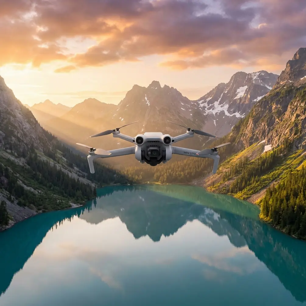
The Mini 5 Pro packs surveying features into a 248-gram airframe that fits in a jacket pocket. This weight classification matters enormously for mountain work.
Key Specifications for Field Surveying
| Feature | Specification | Survey Application |
|---|---|---|
| Sensor Size | 1/1.3-inch CMOS | Captures fine terrain detail |
| Video Resolution | 4K/60fps HDR | Smooth boundary documentation |
| Photo Resolution | 48MP | High-detail orthomosaic source |
| Max Flight Time | 34 minutes | Covers 15-20 acre fields per battery |
| Obstacle Avoidance | Tri-directional sensing | Safe navigation near tree lines |
| Wind Resistance | Level 5 (29-38 km/h) | Stable in mountain gusts |
| Transmission Range | 12 km (FCC) | Maintains signal in valleys |
The Sub-250g Advantage in Mountain Zones
Many mountain regions fall under protected airspace or require special permits for commercial drone operations. The Mini 5 Pro's sub-250g classification often exempts operators from these requirements, allowing you to:
- Survey fields in national forest buffer zones
- Operate without Part 107 waivers in many jurisdictions
- Carry the complete kit during hiking approaches to remote fields
- Deploy quickly without extensive pre-authorization paperwork
Configuring Camera Settings for Terrain Documentation
Proper camera configuration separates amateur aerial snapshots from professional survey data. The Mini 5 Pro's D-Log color profile is your most powerful tool for mountain field work.
Why D-Log Matters for Surveying
Mountain fields present extreme dynamic range challenges. You're often capturing:
- Shadowed valleys with minimal light
- Sun-bleached ridgelines at maximum brightness
- Mixed vegetation requiring color accuracy
- Water features with reflective highlights
D-Log preserves 13 stops of dynamic range, giving you flexibility to recover shadow detail and highlight information during post-processing. This matters when clients need accurate vegetation health assessments or drainage pattern analysis.
My Standard Survey Camera Settings
For consistent results across varying mountain conditions, I use these baseline settings:
- Color Profile: D-Log M
- Resolution: 4K/30fps for video sweeps, 48MP for stills
- ISO: 100-400 (never auto)
- Shutter Speed: 1/focal length x2 minimum
- White Balance: 5600K fixed (never auto)
- Aperture: f/2.8-f/4 for maximum sharpness
Pro Tip: Lock your white balance to a fixed Kelvin value. Auto white balance shifts between frames, creating inconsistent data that complicates orthomosaic stitching and makes vegetation analysis unreliable.
Mastering ActiveTrack for Boundary Documentation
The Mini 5 Pro's Subject tracking and ActiveTrack capabilities transform how I document irregular field boundaries—common in mountain agriculture where terrain dictates property lines.
ActiveTrack Workflow for Perimeter Surveys
Rather than manually flying the entire boundary, I use ActiveTrack to follow my ground assistant as they walk the perimeter:
- Position the drone at 40-60 meters altitude for optimal tracking angle
- Select your ground subject using the touchscreen interface
- Choose Trace mode to follow behind the subject
- Set tracking sensitivity to medium for smooth, cinematic movement
- Monitor obstacle warnings continuously during the track
This technique produces continuous boundary footage without the jerky movements of manual stick control. The resulting video clearly documents fence lines, drainage ditches, and vegetation transitions.
When Subject Tracking Fails
ActiveTrack struggles in specific mountain conditions:
- Dense tree canopy blocks the downward vision sensors
- Snow-covered ground reduces subject contrast
- Steep terrain angles exceed the gimbal's tracking range
- Multiple similar subjects confuse the tracking algorithm
In these situations, switch to manual flight with Hyperlapse mode for time-compressed boundary documentation.
Leveraging QuickShots for Contextual Footage
While QuickShots might seem like consumer features, they serve legitimate survey purposes when documenting field context and surrounding terrain.
Survey-Appropriate QuickShots Modes
Dronie: Captures the field's relationship to surrounding mountains and access roads. Start from field center, set distance to maximum, and you'll document the complete geographic context in 15 seconds.
Circle: Documents a specific feature—a spring, erosion point, or structure—from all angles. Essential for irrigation infrastructure assessment.
Helix: Combines altitude gain with orbital movement. Ideal for showing how a field sits within the broader watershed.
QuickShots Settings for Professional Results
- Always shoot in D-Log for consistency with other footage
- Set speed to slow for smoother, more professional movement
- Verify obstacle clearance before initiating any automated movement
- Use 4K resolution even for contextual shots
Building Efficient Survey Flight Patterns
Mountain fields rarely conform to simple rectangular shapes. Developing efficient flight patterns saves battery life and ensures complete coverage.
The Overlapping Grid Method
For fields requiring orthomosaic processing:
- Establish field boundaries using GPS waypoints
- Calculate flight lines with 70% front overlap and 65% side overlap
- Set consistent altitude at 80-120 meters AGL depending on detail requirements
- Fly perpendicular to slopes when possible to maintain consistent ground sampling distance
- Capture nadir (straight-down) images at 2-second intervals
Hyperlapse for Progress Documentation
When clients need time-series documentation of seasonal changes or construction progress, Hyperlapse mode creates compelling visual records:
- Free mode: Manual flight path with automatic interval capture
- Circle mode: Orbital documentation of a central feature
- Course Lock mode: Straight-line passes across the field
Set interval to 2 seconds and speed to 10x for professional-quality results that compress hours of change into seconds of footage.
Common Mistakes to Avoid
Ignoring wind patterns at different altitudes: Mountain valleys create complex wind layers. Conditions at launch altitude often differ dramatically from survey altitude. Always test at your working height before committing to long flight patterns.
Trusting obstacle avoidance completely: The Mini 5 Pro's tri-directional sensing has blind spots. Thin wires, bare branches, and guy cables often escape detection. Maintain visual line of sight and manual override readiness.
Using auto exposure during surveys: Automatic exposure shifts between frames create inconsistent data. Clouds passing over the sun will cause exposure jumps that ruin orthomosaic processing.
Neglecting battery temperature: Mountain environments often mean cold batteries. Performance degrades significantly below 15°C. Keep spare batteries warm in an inside pocket until needed.
Flying without a ground reference: Mountain terrain makes altitude estimation difficult. Always verify your actual height AGL using the app display, not visual estimation.
Frequently Asked Questions
How many acres can I survey on a single Mini 5 Pro battery?
With proper flight planning and the 70/65 overlap method, expect to cover 15-20 acres per battery at 100 meters altitude. Steeper terrain, higher winds, or lower altitudes reduce this significantly. I carry four batteries minimum for any mountain survey day.
Can the Mini 5 Pro handle typical mountain wind conditions?
The Mini 5 Pro maintains stable flight in winds up to Level 5 (29-38 km/h). Most mountain survey days fall within this range during morning hours. Schedule flights before 10 AM when thermal activity increases wind unpredictability. The app provides real-time wind warnings—respect them.
What's the minimum equipment kit for mountain field surveys?
My essential mountain survey kit includes: Mini 5 Pro with four batteries, charging hub with portable power station, ND filter set (ND8, ND16, ND32), microfiber cleaning supplies, tablet with sun shade for better screen visibility, backup smartphone with DJI Fly installed, and high-visibility landing pad. Total kit weight stays under 3 kg for hiking approaches.
Mountain field surveying demands equipment that balances capability with portability. The Mini 5 Pro delivers professional-grade imaging, reliable obstacle avoidance, and the lightweight design that makes remote field access practical. Combined with proper pre-flight preparation and the techniques outlined in this tutorial, you'll capture survey data that meets professional standards while navigating the unique challenges of elevated terrain.
Ready for your own Mini 5 Pro? Contact our team for expert consultation.