Mini 5 Pro Field Report: Mountain Site Survey Lessons
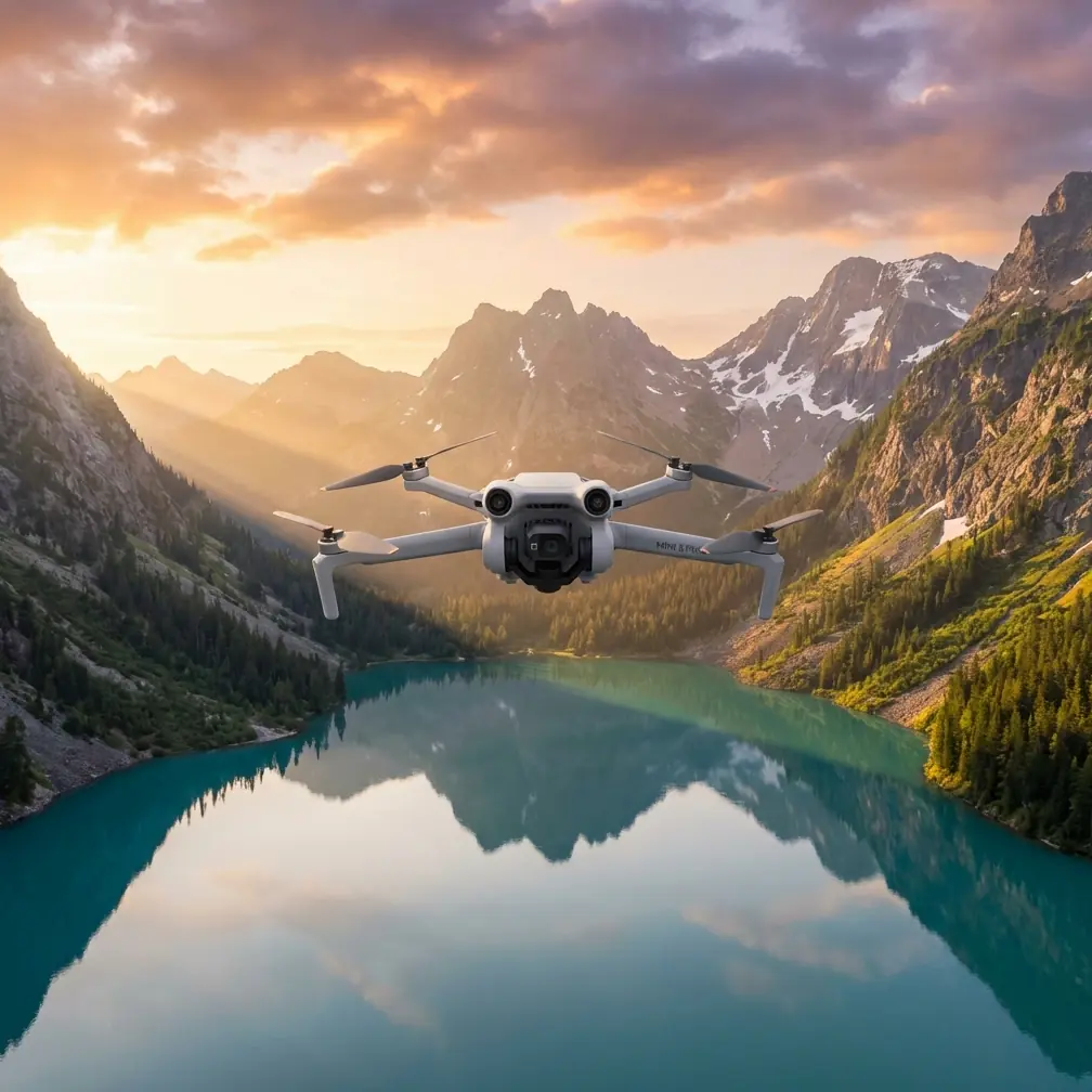
Mini 5 Pro Field Report: Mountain Site Survey Lessons from Remote Corridor Inspection
META: A field-based Mini 5 Pro guide for mountain construction surveying, drawing practical lessons from remote 205 km utility corridor drone inspection, including wind, altitude, battery, obstacle avoidance, and flight planning.
I’ve spent enough time around rugged job sites to know that the drone rarely fails first. The plan does.
That’s especially true in mountain construction surveying, where launch points are uneven, weather shifts without warning, and line-of-sight can disappear behind a ridge faster than a pilot expects. When people ask whether the Mini 5 Pro is suitable for this kind of work, my answer is yes—with one condition: you have to operate it like a field tool, not like a weekend camera.
A useful way to frame that discussion comes from a real inspection scenario in the utility sector. One reference case involved a 500 kV transmission corridor stretching 205 kilometers, with 25 kilometers passing through sparsely populated no-man’s-land. The documented challenges were exactly the kind mountain crews understand immediately: volatile weather, poor road access, difficult terrain, and a heavy burden on manual inspection teams. The point wasn’t just that drones could fly there. The point was that drones changed what “practical inspection” meant when the ground route became the bottleneck.
That matters for Mini 5 Pro users in construction surveying because mountain sites create a smaller version of the same problem. You may not be inspecting 205 kilometers of line, but you are often dealing with fragmented access, inconsistent communications, elevation swings, and pressure to collect usable visual data quickly. The airframe is only part of the equation. The operating method is everything.
What remote corridor inspection teaches a Mini 5 Pro operator
In the utility reference, the inspection team did not simply show up and improvise. They prepared around three very specific constraints:
- relay communications layout
- wind resistance testing
- route design for high-altitude mountain areas
Those details are easy to skim past, but operationally they are the real story.
For a mountain construction survey, relay communications translates into a simple truth: signal reliability should be treated as a survey variable, not an afterthought. On paper, a compact aircraft can cover a lot of terrain. In practice, cliffs, concrete cores, steel framing, and tree lines interrupt both control and video feed. If your site includes multiple terraces or a cut into the hillside, you should plan your standing positions just as carefully as your waypoints. Before the first mapping pass, walk the ridge, identify visual dead zones, and decide where you may need to reposition rather than trying to “push through” from one launch point.
Wind testing is just as relevant. The utility case explicitly highlighted anti-wind preparation because mountainous terrain creates erratic air behavior: rotor wash rebounds from slopes, valley funnels amplify gusts, and calm conditions at takeoff often mean very little once the aircraft clears the ridge. A Mini 5 Pro pilot surveying retaining walls, haul roads, drainage channels, or slope stabilization work should assume that the cleanest-looking section of sky may still hide turbulence.
Then there’s high-altitude route design. The reference system included a platform rated for operation up to 4,000 meters above sea level, with a working temperature range of -10°C to 40°C and wind resistance up to level 6. The Mini 5 Pro is a different class of aircraft, of course, but the lesson carries over: mountain work changes aircraft behavior even before the wind gets dramatic. Climb performance, braking feel, and battery discharge all shift as altitude and temperature change. If your survey route was planned like a flat-ground real estate flight, you’re already behind.
Why hovering still matters on a construction site
One of the strongest operational details in the source material is the emphasis on multirotor hovering for short-range detailed inspection. That’s not just a utility maintenance principle. It’s exactly why a compact aircraft like the Mini 5 Pro can be so effective on mountain projects.
When I’m documenting a cut slope or checking progress on drainage installation, there are moments where movement is less valuable than stillness. Hovering lets you evaluate rockfall netting alignment, rebar placement, erosion paths, or edge protection details without introducing blur from constant repositioning. It also helps when your visual reference points are messy—loose aggregate, temporary barriers, excavator tracks, and partial structures all compete in the frame. A stable hover gives you time to read the scene.
This is where features like obstacle avoidance and ActiveTrack need to be used with judgment. People tend to treat them as all-purpose intelligence. They’re not. On mountain sites, obstacle avoidance is most useful as a secondary protective layer when you’re working near uneven terrain, scaffolding, utility poles, or temporary fencing. But if the slope rises sharply behind your subject, automated behavior can become less intuitive than expected. Terrain isn’t a vertical wall; it’s an advancing surface. That distinction matters.
ActiveTrack can help if you’re following a haul truck route, documenting movement along an access road, or capturing progress from a safe lateral angle. But I wouldn’t use tracking mode in a cluttered excavation zone without first flying the line manually. Machines pause unexpectedly. Workers change direction. Dust can obscure contrast. The Mini 5 Pro is at its best when automation reduces workload, not when it replaces site awareness.
The battery mistake mountain crews make most often
Here’s the field tip I wish more new pilots heard early: stop thinking about battery as total flight time and start thinking about it as reserve for terrain recovery.
On mountain sites, the return leg is often more demanding than the outbound leg. Maybe you descended into a cut and now need extra power to climb out. Maybe wind picked up on the exposed side of the ridge. Maybe you drifted farther laterally than planned while framing a retaining structure. On flat ground, these errors are survivable. In mountains, they stack quickly.
The source material included endurance figures for a larger six-rotor platform: 50 minutes with no load, 40 minutes with 500 grams, and 30 minutes with 3 kilograms. Even though the Mini 5 Pro is not carrying industrial payloads in that class, the principle is directly transferable: mission duration is never just “how long the battery lasts.” It’s how long the battery lasts under the actual aerodynamic and operational load of the task.
My own field habit is simple. I assign every battery a role before takeoff:
- first battery for broad orientation and route testing
- second battery for the must-have survey captures
- third battery for detail work or contingency
That sequencing prevents a common mistake: spending the freshest battery experimenting with angles and then trying to complete the critical passes on a declining pack as wind increases. It also helps with thermal management. In cooler mountain conditions, I keep spare batteries insulated until use rather than leaving them exposed in the truck bed or on damp concrete. Cold-soaked packs can look healthy at launch and then drop faster than expected under climb load.
Another habit: never start the most distant or lowest-elevation segment at the point where you’re already asking yourself whether one battery is “probably enough.” That phrase has ended more productive survey mornings than any technical fault I can think of.
Route design for mountains: think in layers, not loops
A lot of drone guides recommend neat circular or rectangular patterns. Mountain sites don’t behave that way. A better approach for Mini 5 Pro surveying is layered route planning.
Start with a high safety recon pass. This is where subject tracking, QuickShots, or even a short Hyperlapse segment can be useful—not as gimmicks, but as fast visual summaries. A brief elevated orbit can reveal stockpile placement, equipment circulation paths, runoff channels, and blind corners in a way a ground walkthrough misses. Hyperlapse can also help project managers visualize changing weather shadows or moving equipment patterns over time.
Then move to the working layer: the altitude and angle where measurements, progress photos, and inspection visuals become useful. This is where consistency beats creativity. Match your height across repeated flights. Reuse reference points. Keep camera angle changes intentional.
Finally, fly the detail layer. This is where the Mini 5 Pro earns its place. Tight structural context shots, embankment edges, culvert entries, trench transitions, or temporary retaining details all benefit from a smaller platform that can be positioned precisely without the operational burden of a heavier inspection aircraft.
That layered method mirrors the logic in the source document, which separated short-range detailed multirotor work from long-range fixed-wing coverage. For construction readers, the takeaway is not that you need two aircraft for every site. It’s that you should separate reconnaissance from detail capture instead of forcing one flight style to do both poorly.
Imaging choices that help the office, not just the pilot
If your survey flights feed into progress reporting, design review, or stakeholder updates, image flexibility matters. I lean toward D-Log when the scene has harsh contrast—bright concrete, dark cut faces, reflective puddles, deep vegetation shadows. It preserves more grading room later, which is valuable when the engineering team needs to inspect details hidden by midday light.
But there’s a caveat. D-Log is only useful if your workflow supports it. If your site manager needs quick same-day visuals and nobody is color-correcting footage, standard profiles may be more practical. The wrong “pro” setting can slow a job down.
QuickShots have their place too, though not in the way social media suggests. A short, repeatable reveal shot from the same location each week can serve as a visual progress benchmark. Consistency is the value, not flair.
If you need help translating that kind of flight workflow into a practical site checklist, I’d point you to this direct field support channel rather than guessing your way through a mountain deployment.
Night and low-visibility lessons from utility inspection
The reference material also described night inspection using thermal imaging to identify abnormal heat patterns along infrastructure. For mountain construction readers, that’s a reminder that inspection value often comes from sensing method, not just flying skill.
The Mini 5 Pro won’t replace dedicated industrial thermal platforms for advanced diagnostics, but the underlying logic still applies: choose your capture timing based on what the site is trying to reveal. Early morning can expose drainage paths and moisture contrast better than noon. Late afternoon can make earthwork contours more legible than flat overhead light. Fog, cold, and shaded slopes all change what is visible.
Good mountain surveying is rarely about sending the drone up at the first convenient moment. It’s about sending it up when the surface tells the truth.
Where Mini 5 Pro fits best on mountain construction jobs
For me, the Mini 5 Pro makes the most sense in mountain surveying when the assignment involves three things:
- frequent repositioning between tight access points
- repeated visual documentation over weeks or months
- detail capture in areas where larger aircraft are inefficient
It is not a substitute for every industrial platform. The utility reference showed why heavier aircraft with defined payload capacity, autonomous takeoff, and specialized endurance still matter in remote infrastructure work. But that same reference also showed something else: the mission should drive the platform choice.
A mountain construction site often doesn’t need a heavy inspection rig to be productive. It needs a compact, reliable aircraft that can launch quickly, hover accurately, navigate uneven terrain with care, and gather clean data before weather closes the window.
That’s where disciplined Mini 5 Pro operation wins.
Not because the drone is magical. Because the pilot respects the mountain, plans the batteries like they matter, and flies each route with the same seriousness that remote corridor inspectors brought to a 205-kilometer line through difficult country.
Ready for your own Mini 5 Pro? Contact our team for expert consultation.