Mini 5 Pro for Low-Light Vineyard Work: What an Aerial
Mini 5 Pro for Low-Light Vineyard Work: What an Aerial Imaging Standard Reveals About Real Field Use
META: A technical review of Mini 5 Pro suitability for low-light vineyard operations, using aerial survey standards to assess wind tolerance, navigation frequency, control range, takeoff flexibility, and obstacle awareness in real-world conditions.
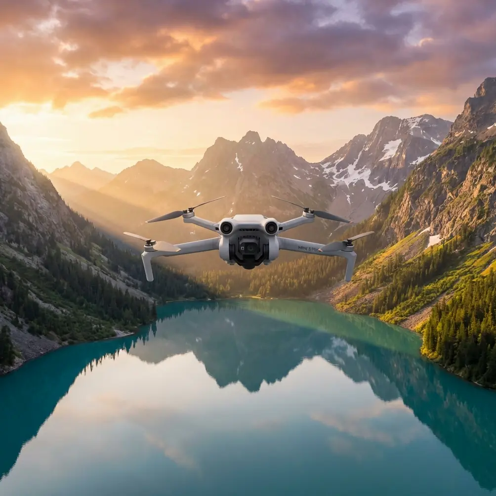
I approach the Mini 5 Pro from a photographer’s angle, but vineyard work forces you to think like an operator, not just an image-maker. Low light changes everything. Rows compress visually. Terrain flattens. Moisture hangs in the air. Trellis wire, posts, netting, and uneven access points become harder to read from the ground and from the aircraft. If the mission is to support vineyard spraying decisions, especially in narrow weather windows around dawn or dusk, the useful question is not whether the drone looks impressive on paper. It is whether its core flight behavior matches the kind of practical expectations that professional aerial imaging standards have demanded for years.
That is where the reference material becomes surprisingly valuable.
The Chinese low-altitude digital aerial photography standard cited here is not about marketing claims or lifestyle filming. It describes what an aerial imaging platform should be able to do when the work has consequences: stable navigation, controlled takeoff and landing outside airport infrastructure, dependable monitoring links, and safe operation in wind. Even though the Mini 5 Pro is a compact platform rather than a heavy survey aircraft, those benchmarks give us a disciplined way to judge whether it makes sense for vineyard operations in low light.
Why low-light vineyard flights are harder than they look
Spraying vineyards is rarely just about putting liquid in the air. In civilian agricultural use, the drone often supports pre-spray inspection, canopy documentation, terrain awareness, route planning, and post-application visual checks. In low light, image capture can actually become more informative for certain decisions because shadows reveal canopy structure and row geometry differently than harsh midday sun. The tradeoff is that obstacle perception and pilot orientation become less forgiving.
This is where features like obstacle avoidance, ActiveTrack, and subject tracking need a reality check. In open promotional language, those sound like convenience tools. In a vineyard at first light, they are closer to risk management aids. A drone threading past row ends, utility poles, and marginal tree cover must detect objects soon enough to prevent abrupt last-second braking or, worse, sideward contact during course correction. If the Mini 5 Pro’s sensing package is genuinely mature, it is not just helping with cinematic confidence. It is reducing interruptions in data collection and lowering the chance of damaged equipment in a place where ground access is often awkward.
I had one wildlife moment that made this painfully clear. During a low-light pass along the edge of a vineyard bordered by scrub and shallow drainage, a roe deer broke from cover and crossed near the row end just as the aircraft was moving laterally to frame a transition between canopy vigor zones. The drone’s sensors reacted before I had fully processed the movement on screen, giving me enough margin to hold position and re-route. That kind of encounter is not dramatic in the action-film sense. It is operationally significant. Vineyards are living landscapes, not controlled sets, and a drone working there needs environmental awareness that extends beyond vines and poles.
The standard’s wind requirement matters more than people think
One of the most concrete details in the reference text is the wind capability benchmark. It states that unmanned aerial photography systems should be able to fly safely in Level 4 wind conditions. That may sound abstract until you translate it into field reality. Vineyard blocks are rarely uniform wind environments. The top of a slope, the lee side of a hedgerow, and the open lane at the edge of a parcel can all behave differently within the same flight.
For low-light work, wind tolerance is even more important because operators often choose dawn or late-day periods for softer light, cooler crop conditions, and calmer spray-related planning windows. But “calmer” does not mean calm. Air can still move unpredictably along rows, especially where temperature shifts create drainage flows over uneven ground.
So when evaluating the Mini 5 Pro, I would place wind composure near the top of the list. Not because anyone wants to push a small aircraft to its limit, but because a drone that remains predictable below that threshold produces cleaner, more repeatable imaging. It holds line better over row centers. It maintains framing consistency for before-and-after comparisons. It also reduces battery waste caused by constant correction. Those are not glamorous benefits, yet they are exactly what determine whether a low-light vineyard flight yields actionable visuals or just pretty footage.
Navigation frequency and positioning are not trivial specs
Another reference point stands out: GPS output frequency should be no less than 4 Hz. On paper, that is just a number. In practice, it tells you something about the expected rhythm of position updates during aerial imaging work. For vineyard mapping, inspection, and spray-planning support, frequent positional updates help the aircraft maintain smoother path discipline and better timestamped image correlation.
The same standard also mentions the option of dual-antenna GPS navigation with automatic heading correction and the use of advanced positioning methods to compute actual exposure point coordinates. That sounds highly technical, because it is. But the operational meaning is straightforward: if you want aerial images to mean something beyond visual impression, the aircraft’s idea of where it was and how it was oriented must be trustworthy.
For a Mini 5 Pro user in vineyards, this matters in two ways.
First, repeatability. If you are documenting the same block over several mornings to compare moisture patterns, canopy gaps, or areas affected by drift concerns, stable navigation is what lets you rebuild similar flight paths rather than improvising from memory.
Second, interpretability. Low-light images can be gorgeous, but beauty is not the goal in agricultural operations. You need to know which row, which edge, which transition zone. Better positioning makes the imagery easier to tie back to field decisions.
The standard also requires the autopilot to store at least 1,000 waypoints and exposure points. That figure is a reminder that serious aerial work is route-driven. In a vineyard context, waypoint capacity and route reliability shape whether a compact platform can cover multiple blocks systematically rather than one ad hoc orbit at a time. If the Mini 5 Pro offers dependable route planning and waypoint behavior, that is far more relevant to spraying support than flashy one-tap modes.
Monitoring radius and link stability define confidence in the field
The source states that an unmanned aerial photography system should include a data transmission radio and ground monitoring station, with a monitoring radius greater than 5 km. No responsible vineyard operator should read that as permission to stretch flights to the edge of visibility or regulation. The real takeaway is different: field systems are expected to maintain robust situational awareness links across meaningful operational distance.
For the Mini 5 Pro, a strong control and video link is not about maximum range boasting. It is about preserving image judgment and obstacle awareness when the aircraft moves behind trellis geometry, rises over a contour, or skims a row edge in low-contrast light. A stable downlink helps the pilot identify missed coverage, confirm row alignment, and spot subtle canopy differences before leaving the site.
This becomes especially useful when vineyards are fragmented into parcels with awkward access. You may launch from one service lane and inspect several adjacent zones without repeatedly repositioning on foot. The standard’s more-than-5-kilometer monitoring benchmark highlights the broader principle: aerial work should not fall apart the moment terrain or vegetation begins to interfere with line quality.
Airport independence is a practical agricultural advantage
One of the most grounded details in the standard is the requirement that both ultralight aircraft systems and unmanned aircraft systems should be capable of takeoff and landing without relying on an airport. That may seem obvious today, but it points to a serious operational value. Agricultural imaging often happens in places with no formal launch infrastructure at all.
That fits vineyard work perfectly. Access roads can be muddy. Headlands can be narrow. Morning dew can make surface conditions awkward. A compact aircraft that can deploy from a modest safe clearing, a firm path margin, or a prepared small landing zone has genuine value. You are not buying convenience for convenience’s sake. You are preserving the ability to fly when the crop, weather, and light align.
For the Mini 5 Pro, this is one of the strongest format advantages. A small aircraft is easier to launch in constrained civilian agricultural settings, easier to recover before wind shifts, and easier to move between blocks during short low-light windows. If you are inspecting rows before spraying or documenting edge areas where tractor access is inefficient, portability and flexible takeoff matter every bit as much as camera quality.
Camera modes are useful only when they support decision-making
The context around the Mini 5 Pro includes terms like D-Log, Hyperlapse, QuickShots, and ActiveTrack. For vineyard operations, these are not all equal.
D-Log is the one I would treat seriously. In low light, dynamic range discipline matters. Vineyard scenes often include bright sky openings, dark row corridors, reflective moisture, and shaded embankments in the same frame. A flatter capture profile can preserve detail for later review, especially if you are comparing canopy tone and boundary conditions rather than producing finished social clips.
ActiveTrack and subject tracking can also be useful, but not for the reasons hobby users usually imagine. In a vineyard, their value lies in helping maintain stable framing on moving utility vehicles, workers performing non-sensitive routine field tasks, or predefined visual targets during documentation workflows. The point is consistency, not spectacle.
QuickShots and Hyperlapse are lower-priority for operational spraying support. They may have a place in stakeholder reporting, seasonal documentation, or farm communications, but they are secondary to path discipline, obstacle sensing, and accurate location data. A vineyard manager deciding whether to revisit a block after a low-light inspection will learn more from a repeatable, geospatially coherent pass than from a stylish automated reveal.
A Mini 5 Pro technical verdict through the lens of the standard
If I judge the Mini 5 Pro against the values embedded in the reference standard rather than consumer hype, five factors define its usefulness for low-light vineyard work:
Predictable flight in wind below the Level 4 benchmark
This determines whether row-following remains clean enough for repeatable inspection.Frequent and stable navigation updates, with reliable heading behavior
The standard’s 4 Hz baseline and dual-antenna logic underline how much positional trust matters.A strong monitoring and control link
The greater-than-5-kilometer monitoring expectation speaks to link resilience, not reckless distance.Airport-independent deployment
Essential for fragmented vineyard terrain and short early-morning operating windows.Obstacle awareness that works in ambiguous, living environments
Not just walls and trees, but wires, row ends, slope transitions, and occasional wildlife.
That last point keeps bringing me back to the roe deer incident. Marketing language often reduces obstacle avoidance to a neat safety icon on a feature list. Real field use is messier. The value of the sensors was not merely that they stopped the drone. The value was that they preserved the mission. I could continue the survey, maintain trust in the aircraft’s situational awareness, and avoid turning a routine agricultural flight into a recovery exercise.
Where this leaves vineyard operators
If your interest in the Mini 5 Pro is tied to spraying vineyards in low light, the smartest way to assess it is to ignore the usual consumer checklist and borrow the mindset of aerial survey standards. Ask whether it can hold itself together in modest wind. Ask whether its navigation and orientation are good enough to revisit the same rows with confidence. Ask whether the monitoring link remains clear when topography and vegetation complicate the path. Ask whether the aircraft can launch quickly from real farm conditions. Then ask whether the sensing system can protect both the drone and the workflow when the environment does something unexpected.
That is a much stricter standard than “does it shoot nice footage.” It is also the right one.
If you want to discuss vineyard-specific setup choices or compare flight planning approaches for low-light inspection work, you can reach us directly through this field support chat. For operators balancing portability with reliable agricultural imaging, those details matter more than any headline spec.
The Mini 5 Pro, viewed through this lens, is most compelling when it behaves less like a toy camera in the sky and more like a disciplined small-platform imaging tool. The reference standard may come from formal aerial photography practice, but its lessons transfer cleanly to modern vineyard operations. Low light rewards precision. Vineyards punish sloppiness. A drone that respects those truths earns its place.
Ready for your own Mini 5 Pro? Contact our team for expert consultation.