Mini 5 Pro for High-Altitude Vineyard Scouting
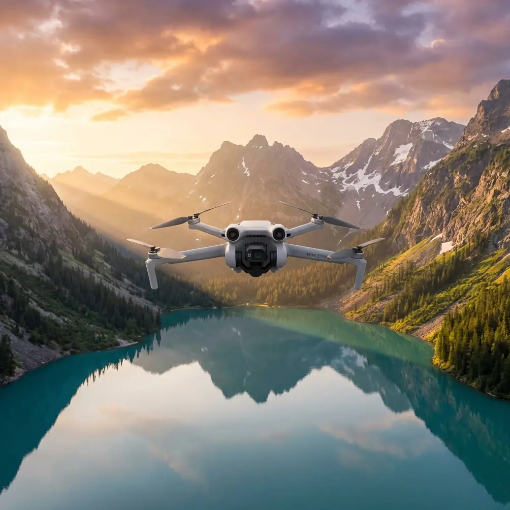
Mini 5 Pro for High-Altitude Vineyard Scouting: What Actually Matters in the Field
META: A practical expert tutorial on using Mini 5 Pro for high-altitude vineyard scouting, with flight planning, antenna positioning, control-point logic, and imaging tips tied to aerial survey standards.
High-altitude vineyard scouting looks easy from the ground. Launch a compact drone, fly a few rows, review the footage, done.
That assumption usually lasts until the first mountain gust hits the slope, the signal bars drop as the aircraft slips behind a terrace line, or the imagery comes back beautiful but useless for comparing one block against another. Vineyards at elevation punish casual workflow. Terrain changes fast. Row orientation creates repetitive texture. Light reflects unevenly across leaves, soil, and support wires. A small drone can absolutely handle this work, but only if the operator respects both the landscape and the logic behind aerial imaging.
That is where the Mini 5 Pro becomes interesting.
For vineyard managers, agronomists, and technical scouts working in steep or elevated growing regions, the appeal is not just portability. It is the ability to get frequent visual intelligence without dragging heavier platforms into narrow mountain roads or tiny access points. But a compact aircraft only becomes a real scouting tool when the pilot understands three things: how to structure the flight, how to maintain link quality, and how to capture images that can be compared over time rather than admired once and forgotten.
Why high-altitude vineyard scouting is different
A vineyard on flat land lets you work with relatively forgiving assumptions. Height above takeoff point stays predictable. Return path visibility is usually open. The geometry of the field is simple.
On mountain vineyards, none of that is stable.
The aircraft may be physically close to you while being radio-obstructed by a ridge shoulder or terrace wall. A short horizontal movement can create a large relative change in altitude above the canopy. If you are trying to inspect vigor differences, drainage patterns, row gaps, or irrigation stress, inconsistent image geometry becomes a real problem.
That is why even a scouting mission benefits from borrowing discipline from photogrammetry standards.
One useful reference comes from the Chinese low-altitude digital aerial photogrammetry field specification, CH/Z 3004—2010. It includes control-point and baseline span guidance for mapping scales such as 1:500, 1:1000, and 1:2000. At first glance, that seems far removed from a compact vineyard drone mission. It is not. The deeper point is operational: image collection quality depends on geometry, spacing, and control logic, not just camera quality.
The standard also shows that baseline span values are not arbitrary. In the extracted table, you can see progression values such as 0.14, 0.15, 0.17, 0.18, 0.20, up to 0.29, and later entries climbing beyond 1.0 to 1.13. You do not need to memorize the table to benefit from it. What matters is the principle: as mapping conditions and scale demands change, the relationship between control and image acquisition must be adjusted deliberately. For a vineyard scout, that translates into a simple field rule: do not improvise overlap, route spacing, or reference locations if you want repeatable observations.
What the Mini 5 Pro is really good at here
The Mini 5 Pro format suits mountain vineyard work because it lowers friction. You can hike it to a ridge access road, move between blocks quickly, and relaunch from multiple safe points without turning the day into a logistics exercise.
Its practical value in this scenario comes from a stack of flight and imaging functions working together:
- obstacle avoidance helps around trellis lines, poles, trees, and uneven terrace edges
- ActiveTrack and subject tracking can help when following a utility cart, worker path, or inspection route for visual documentation
- QuickShots and Hyperlapse are useful for progress records and client reporting, though not as primary data capture methods
- D-Log gives more latitude when bright mountain sky and shaded vine rows appear in the same frame
Those features matter, but none of them replaces planning. In a high-altitude vineyard, the best Mini 5 Pro operator is rarely the one flying the most creatively. It is usually the one who collects the cleanest, most comparable set of visuals with the fewest avoidable interruptions.
Start with row direction, not with the drone
Before takeoff, stand still and read the vineyard.
Look at row alignment. Check where the slope breaks. Identify any terraces, netting, utility lines, tall trees, and road cuts. Then note the sun angle. In mountain vineyards, side-lighting can exaggerate texture in one block and flatten it in the next. That can make healthy and stressed areas look more similar than they really are.
If your goal is scouting rather than cinematic output, your first pass should usually favor consistency over drama.
A good working sequence is:
- Wide orientation pass at safe altitude to understand the terrain.
- Systematic row-parallel pass for comparable imagery.
- Cross-row pass if you need to verify drainage channels, erosion, or canopy uniformity from another angle.
- Targeted low pass only after you know where the problem areas are.
This is where the survey standard mindset becomes useful again. The reference to 1:2000 and 1:500 mapping scales is a reminder that image purpose changes flight design. If you want broad block-to-block comparison, your geometry can be looser. If you want to diagnose specific weak sections in a steep vineyard, your spacing and consistency need to tighten.
Flight height over sloping terrain: the hidden trap
A common mistake in elevated vineyards is launching from a road or turnout and flying “at 60 meters” as if that value means the same thing everywhere. It does not.
On a slope, the aircraft may be much closer to the vines upslope than downslope, even when the controller shows a stable altitude relative to takeoff. That changes image scale, shadow behavior, and obstacle margin. It also affects obstacle avoidance performance because the scene geometry is constantly shifting.
For scouting missions, I prefer to think in terms of canopy-relative consistency, not just takeoff-relative altitude. If the terrain rises aggressively, break the mission into segments and reposition the pilot rather than trying to force one long flight. The Mini 5 Pro’s portability makes this strategy practical.
That repositioning habit also helps with signal quality, which is often the weakest link in mountain vineyards.
Antenna positioning advice for maximum range
This part gets ignored too often, especially by operators who assume modern transmission systems will solve everything.
In vineyards at altitude, your biggest signal enemy is not always distance. It is partial obstruction. Terrace walls, slope shoulders, tree lines, and even your own body position can weaken the link. Maximum usable range comes from preserving a clean path between controller antennas and aircraft, not from hoping the system can brute-force through terrain.
A few field rules make a noticeable difference:
1. Face the aircraft with the controller held correctly
Do not point the antenna tips directly at the drone if your controller uses broadside radiation characteristics. In most compact drone controller designs, the stronger signal pattern projects outward from the faces or sides of the antenna orientation, not straight off the ends. Keep the controller aligned so the antennas present their effective side toward the aircraft.
2. Raise your own position before extending the flight
If you can step two meters higher onto a safe turnout or terrace edge with clear visibility, that often improves the link more than flying a hundred meters closer to the target area while standing lower. Height at the pilot location is a signal tool.
3. Avoid turning your torso away during inspection
Operators often rotate to talk, check a tablet, or watch the vineyard below while the drone continues outbound. Your body can become part of the obstruction. Keep the controller facing the aircraft when link margin is thin.
4. Do not let the drone drop behind the ridge line
A short descent behind a slope shoulder can collapse signal quality quickly. In vineyards, this often happens when the pilot tries to “peek” into the next terrace. Climb first, move second.
5. Reposition instead of forcing the link
The Mini 5 Pro is compact enough that walking to a better pilot station is usually smarter than testing the limits of transmission through broken terrain.
If you need help with a mountain-vineyard flight layout or controller setup, you can message our drone team directly here.
Building repeatable scouting flights
Scouting is most valuable when today’s flight can be compared with next week’s.
That means using repeatable route logic. A vineyard manager does not just want to know that one clip looked “off.” They want confidence that changes in canopy density, color, runoff marks, or row gaps are genuine field conditions rather than a byproduct of different camera angle or altitude.
The CH/Z 3004—2010 reference matters here because it reinforces the concept of structured control. Even if you are not creating a formal map, you should still create your own lightweight control framework.
Practical options include:
- choose a fixed takeoff point for each block whenever possible
- use visible reference objects like road junctions, end posts, or irrigation manifolds
- fly the same row direction on each revisit
- keep similar camera pitch for baseline scouting passes
- capture one consistent “overview frame” at the start of every mission
This is the operational significance of those mapping-scale references. A 1:500-style mindset demands tighter visual discipline than a casual overview. For detailed vineyard diagnostics, that rigor pays off.
When to use obstacle avoidance, and when not to trust it blindly
Obstacle avoidance is valuable in vineyards, especially around support structures and irregular terrain, but mountain agriculture creates edge cases.
Thin wires, netting, and narrow branch structures may not always be interpreted the way a pilot expects. Vine rows also create repetitive patterns that can lead operators into false confidence. The system helps; it does not absolve.
Use obstacle avoidance as a buffer, not as your primary flight strategy. In practice:
- keep more margin near trellis ends and corner posts
- slow down near mixed vegetation and support structures
- avoid low backward flight unless the path is fully known
- treat automated tracking around rows with caution
ActiveTrack can still be useful when documenting a worker route, small vehicle movement, or walking inspection line, but I would not let any tracking mode replace a clean manual survey pass in tight vineyard terrain.
D-Log for mountain light and why it matters
Vineyards at elevation often present brutal contrast. Bright sky. Dark shadows between rows. Reflective leaves. Pale dust roads. If you shoot in a standard contrast-heavy profile, you may lose subtle canopy detail in either the highlights or the shadows.
D-Log gives you more room to preserve those details. That matters if your job is to inspect foliage consistency, identify dry patches, or compare one block’s vigor against another. You are not only making a nicer image. You are keeping more usable visual information.
For routine scouting, I like this approach:
- use D-Log when the light is harsh or mixed
- keep white balance fixed during a structured scouting run
- avoid changing exposure strategy halfway through one block
- reserve QuickShots and Hyperlapse for reporting or presentation, not primary inspection capture
QuickShots are great for stakeholder updates. Hyperlapse can show access-road traffic, fog movement, or work progression. But if the mission is agronomic interpretation, your core footage should be stable, repeatable, and easy to compare.
A practical high-altitude vineyard workflow with Mini 5 Pro
Here is the tutorial version I would actually use in the field:
Pre-flight
- check wind on the ridge and in the block below; they may differ
- identify one safe launch area with clear sky exposure
- inspect for wires, netting, and trees near terrace edges
- decide your first pass based on row direction and sun angle
Signal setup
- hold the controller with proper antenna orientation
- keep the aircraft in unobstructed line of sight
- if the terrain masks the route, move your pilot position before continuing
First pass
- fly a conservative overview route
- record one wide establishing shot for future comparison
- note any zones with irregular canopy color or missing vigor
Second pass
- run row-parallel lines with consistent speed and camera angle
- maintain similar canopy-relative height as much as terrain allows
- avoid aggressive descent into lower terraces without checking link path
Targeted inspection
- use slow manual flight around suspect zones
- switch to closer views only after broad context is established
- use obstacle avoidance, but keep enough clearance to avoid relying on it
Post-flight
- sort imagery by block and route direction
- compare with prior missions using the same reference frames
- note where flight geometry changed, since that may affect interpretation
The real value of a small drone in a big landscape
The Mini 5 Pro is not interesting because it is small. It is interesting because it makes disciplined scouting easier to repeat. That is what vineyards need.
High-altitude blocks reward operators who borrow a little from survey logic, respect radio geometry, and treat every sortie as part of a longer visual record. The reference standard discussed above was written for formal aerial photogrammetry, not for casual drone vineyard checks. Yet its core lesson applies perfectly: image usefulness depends on structure.
Use the automation features where they genuinely reduce workload. Keep D-Log in your toolkit for difficult mountain light. Let obstacle avoidance add margin, not complacency. And never underestimate antenna positioning. In steep vineyard terrain, a better pilot stance and cleaner controller orientation can matter more than another minute of battery life.
That is the difference between flying a drone over a vineyard and actually scouting one.
Ready for your own Mini 5 Pro? Contact our team for expert consultation.