Mini 5 Pro Best Practices for Scouting High
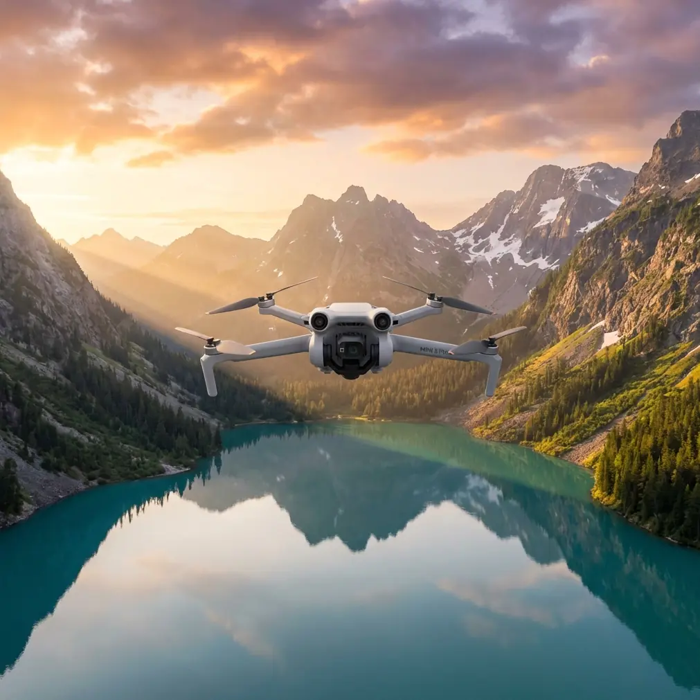
Mini 5 Pro Best Practices for Scouting High-Altitude Vineyards
META: A practical, expert guide to using Mini 5 Pro for high-altitude vineyard scouting, with workflow lessons drawn from proven UAV mapping results on complex heritage sites.
High-altitude vineyards are beautiful until you have to survey them properly.
Steep access roads, fragmented plots, retaining walls, mixed elevations, unstable light, and the constant nuisance of signal noise around metal infrastructure all make the job harder than it looks from the tasting room. If you are using the Mini 5 Pro to scout vineyard blocks for planning, imaging, visual condition checks, or terrain awareness, the challenge is not simply getting airborne. The real task is turning a small drone flight into usable decision material.
That is where a good workflow matters more than raw flight time.
I approach this as both a photographer and a field operator. When I scout mountain vineyards, I am not chasing cinematic fluff. I want clean overhead references, readable slope transitions, façade-level detail on terraces and buildings, and a repeatable method that lets me leave the site with material I can actually use. The most useful lesson comes from an unlikely place: a documented drone mapping case involving heritage structures, where aerial surveying cut costs by at least an order of magnitude compared with ground-only methods, and where conventional total-station work could have stretched to 150 man-days.
That result matters for vineyard scouting because the terrain problems are similar. Heritage compounds and high-altitude vineyards both force teams to deal with irregular geometry, elevation change, access limitations, and the need to document structures and land surfaces together. A drone does not just make the work faster. It changes what is realistic to capture in a day.
The real problem in vineyard scouting
When people say they are “scouting” a vineyard, they often mean several jobs at once:
- checking row alignment and terrain breaks
- reviewing access roads and drainage paths
- documenting retaining walls, utility structures, and buildings
- collecting images for owners, consultants, and farm managers
- building a visual baseline before seasonal changes
On a high-altitude site, walking every section with conventional tools can consume days. In the reference mapping case, a total-station approach alone could have demanded up to 150 man-days. Even when the comparison is not one-to-one, that number is a useful benchmark. It reminds us how quickly ground-based documentation time explodes once slopes, walls, and separated structures enter the picture.
For a vineyard operator or consultant, the practical takeaway is simple: if you rely only on boots-on-the-ground inspection, your coverage narrows. You inspect less, revisit less often, and tend to miss relationships between blocks, access corridors, and terrain transitions.
A compact platform like the Mini 5 Pro gives you a different kind of reach. Not industrial survey reach, obviously. But enough to build an efficient scouting layer that supports agronomy, planning, visual records, and stakeholder communication.
Why the heritage mapping case is relevant to Mini 5 Pro users
The reference case is not about vineyards, and it is not about a sub-250 g drone. That is exactly why it is useful.
In that case, the aerial workflow using Datugram3D reduced image post-processing time by half, and a job that previously took 75 days with 8 total stations could be completed in 30 days under the new method. It also produced outputs directly usable in CAD, including 2D façade elevations with orthographic imagery, 2D roof plans, CAD topographic maps, and multiple 2D cross-sections.
Those details are operationally significant for Mini 5 Pro scouting in two ways.
First, they show that the value of aerial work is not just flying faster than walking. The value is in producing layered outputs: top-down views, sectional understanding, and structure-specific documentation. For vineyards, that translates into a better scouting package. You are not limited to pretty aerials. You can capture overhead context, oblique views of terracing, and repeated visual references for buildings, roads, and drainage features.
Second, they prove that the bottleneck often shifts from field capture to data handling. If post-processing is chaotic, the flight advantage disappears. The heritage case specifically notes that post-processing time was cut in half. For Mini 5 Pro users, that means your field plan should be built around what you need at the desk later. Capture with the final use in mind.
A practical problem-solution workflow for high-altitude vineyards
Problem 1: Terrain hides risk from the ground
On steep vineyards, a path that looks minor on foot may be the key erosion channel for the whole block. A retaining wall that seems straight from below may reveal bulging or runoff damage from above. Access roads often show crown failure, edge collapse, or drainage scarring only when viewed obliquely.
Solution: Build your flight around three image layers
With the Mini 5 Pro, I recommend a simple three-layer scouting sequence:
High overview pass
Fly a safe, conservative overview to map block boundaries, road links, buildings, and exposure changes.Mid-altitude oblique pass
Use angled views to read terraces, wall faces, switchbacks, and slope breaks.Low-detail inspection pass
Focus on specific trouble spots such as washouts, building roofs, culverts, stair access, and retaining structures.
This mirrors the logic behind outputs like 2D roof plans, façade documentation, and cross-sections from the reference case. You may not be generating formal CAD deliverables from every Mini 5 Pro session, but the same layered capture philosophy dramatically improves the usefulness of your scouting data.
Problem 2: Electromagnetic interference on mountain sites
High-altitude vineyards can be surprisingly noisy from a signal perspective. Power lines, repeater equipment, metal roofs, irrigation control systems, and even parked utility vehicles can create localized electromagnetic interference. The drone may still fly, but you may see unstable signal behavior, delayed live view response, or inconsistent control confidence at exactly the wrong moment.
Solution: Antenna discipline and launch discipline
This is where most pilots overcomplicate things. Start with the basics.
- Launch away from metal roofs, parked equipment, and utility cabinets.
- Face the controller antennas toward the aircraft’s actual flight line, not where you think it “should” be.
- If signal quality dips, do not immediately climb blindly. Pause, reorient your body, and adjust antenna angle first.
- Avoid standing directly beside wire fencing or steel structures during the entire flight.
In practice, antenna adjustment can solve what many pilots misread as a drone problem. I have had vineyard flights where the link became noticeably cleaner simply by stepping several meters away from a corrugated shed and tilting the controller orientation to maintain a more direct path to the aircraft.
That sounds trivial. It is not. A clean signal preserves confidence when you are framing narrow terraces or tracking the edge of a steep row block. Good scouting depends on composure, and composure starts with a reliable link.
Problem 3: Fast flights produce weak records
A lot of vineyard drone work fails because the pilot gets seduced by speed. They race through the site, collect a handful of dramatic clips, and return with footage that looks attractive but answers almost no operational questions.
Solution: Use automation selectively, not lazily
The Mini 5 Pro’s likely strengths in subject tracking, obstacle avoidance, QuickShots, Hyperlapse, D-Log, and ActiveTrack are useful here, but only if applied with restraint.
- Obstacle avoidance matters when terraced vineyards create deceptive depth around walls, poles, and trees. It is not a license to fly carelessly. It is a safety layer for complex geometry.
- ActiveTrack or subject tracking can help when documenting a vehicle route through a vineyard road network, giving managers a realistic sense of access conditions.
- QuickShots are best reserved for orientation clips that show the relationship between ridge, block, and building cluster.
- Hyperlapse can be valuable for showing fog movement, shifting light, or worksite access rhythms across the day.
- D-Log gives more flexibility when the contrast range is harsh, which often happens at altitude where bright sky and dark terraces coexist in the same frame.
The point is not to use every feature. The point is to come home with material that can be reviewed weeks later and still answer useful questions.
Problem 4: Buildings and terrain need to be read together
Vineyard scouting often ignores built structures until they become urgent. Pump houses, storage sheds, retaining stair systems, worker paths, and roof drainage can all influence operational decisions. In the mapping reference, one of the standout capabilities was the ability to generate per-building outputs, including 2D façade plans with orthographic imagery and roof plans, while also creating area-level CAD topographic mapping and multiple 2D cross-sections.
That combination is a smart model for vineyard documentation.
Solution: Treat structures as part of the land system
When flying the Mini 5 Pro, do not isolate scenic rows from the built environment. Include:
- roof runoff paths relative to slope direction
- retaining wall faces below structures
- stair and path connections between terrace levels
- drainage entry and exit points near buildings
- access width around service areas
This is where your photography instincts should support your operational thinking. Frame each structure so it can be understood in relation to the slope. A roof image without runoff context is just a roof. A wall image without terrace context is just texture.
Problem 5: Data becomes unusable after the flight
A scouting mission is only successful if the vineyard manager, consultant, or owner can review the material without needing you to narrate every frame from memory. The heritage reference is valuable here because it emphasizes direct output into CAD-compatible formats and practical deliverables, not just raw images.
Solution: Organize the mission like a deliverable, not a flight
I recommend sorting each vineyard session into folders like this:
- Block overviews
- Access roads
- Drainage concerns
- Retaining walls
- Buildings and roofs
- Seasonal beauty or communications assets
If you need help building a repeatable field-to-delivery workflow, you can message a drone workflow specialist here.
The more disciplined your structure, the easier it becomes to compare flights over time. That is especially useful in vineyards where seasonal growth can hide the same terrain issue in one month and expose it in another.
A Mini 5 Pro mindset for high-altitude scouting
The biggest misunderstanding about compact drones is that they are only for casual capture. In reality, a small platform becomes powerful when paired with a disciplined mission design.
The heritage mapping case offers a hard-edged reminder of what aerial methods can change. Compared with conventional ground surveying, aerial work delivered at least an order-of-magnitude cost savings. Post-processing time was cut by half. A workflow involving 8 total stations that once required 75 days could be completed in 30. And the outputs were not vague visualizations; they included roof plans, façade documentation, topographic mapping, and cross-sections.
You are not trying to turn the Mini 5 Pro into a heavy survey platform. That misses the point. The lesson is that aerial capture becomes valuable when it expands coverage, compresses field time, and produces reviewable outputs that support real decisions.
For high-altitude vineyards, that means:
- faster terrain understanding without exhaustive walking
- better visibility on roads, walls, roofs, and slopes
- repeatable visual baselines across the season
- stronger communication between field teams and off-site decision makers
Use obstacle avoidance as insurance, not bravado. Use ActiveTrack when movement itself tells the story. Use D-Log when mountain contrast is punishing. Use antenna adjustment and careful launch positioning whenever electromagnetic interference creeps in. And most of all, fly with the final review in mind.
That is how the Mini 5 Pro stops being a scenic gadget and starts becoming a reliable scouting tool for serious vineyard work.
Ready for your own Mini 5 Pro? Contact our team for expert consultation.