Mini 5 Pro Scouting Tips for Vineyard Altitude Work
Mini 5 Pro Scouting Tips for Vineyard Altitude Work
META: Master high-altitude vineyard scouting with Mini 5 Pro. Expert tips on obstacle avoidance, subject tracking, and D-Log settings for precision viticulture aerial surveys.
TL;DR
- Pre-flight sensor cleaning is critical for reliable obstacle avoidance at vineyard elevations above 1,500 meters
- ActiveTrack 5.0 maintains lock on vine rows even through complex canopy patterns and terrain variations
- D-Log color profile captures 13+ stops of dynamic range essential for identifying subtle vine stress indicators
- Hyperlapse modes create compelling seasonal progression documentation for vineyard management teams
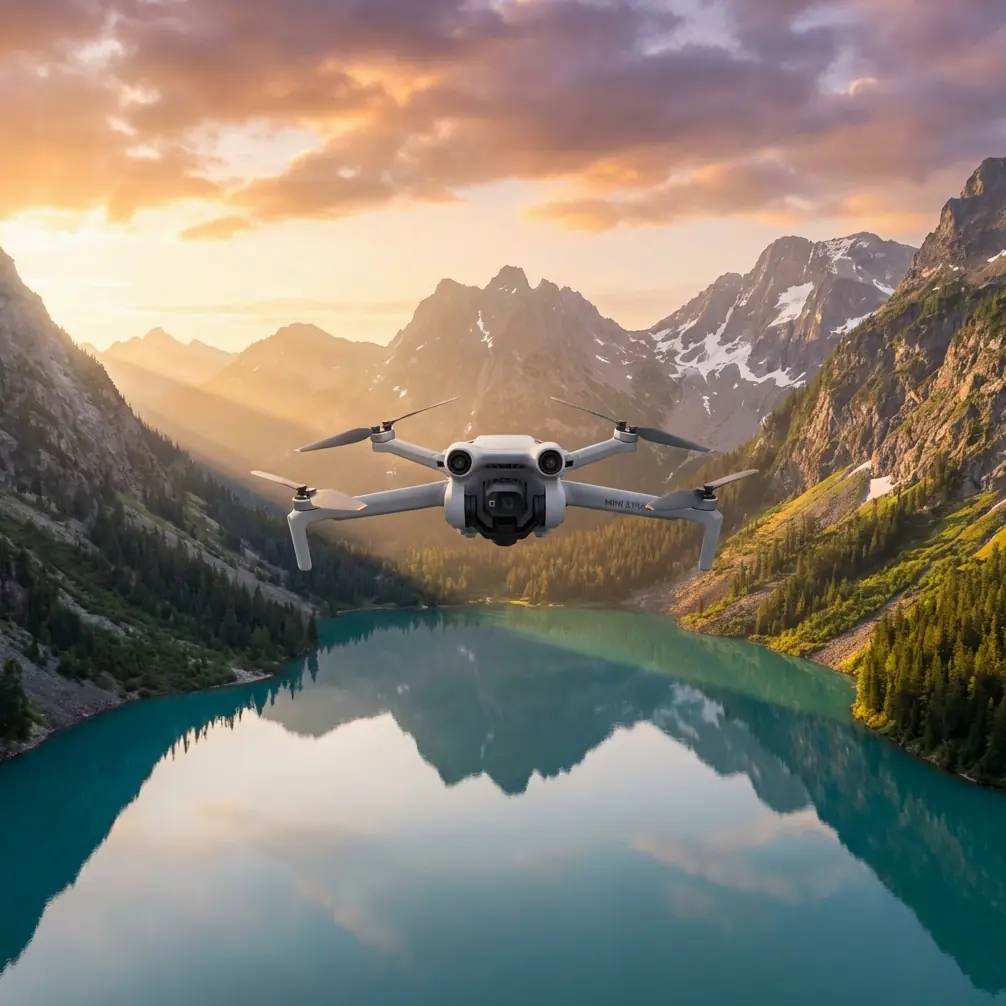
High-altitude vineyard scouting presents unique challenges that ground-based assessment simply cannot address. The Mini 5 Pro weighs under 249 grams while packing professional-grade imaging capabilities that transform how viticulturists monitor crop health, irrigation patterns, and pest pressure across steep terrain. This technical review breaks down exactly how to configure and deploy this drone for maximum vineyard intelligence gathering.
Pre-Flight Preparation: The Cleaning Step That Saves Your Survey
Before any vineyard flight, I perform a ritual that many pilots skip—and regret. The Mini 5 Pro's omnidirectional obstacle sensing system relies on clean sensor surfaces to function properly. Vineyard environments are notoriously dusty, especially during harvest season when tractors kick up fine particulate matter that settles on everything.
Here's my pre-flight cleaning protocol:
- Wipe all six obstacle avoidance sensors with a microfiber cloth dampened with lens cleaning solution
- Inspect the downward vision sensors for pollen, dust, or moisture accumulation
- Check the forward-facing sensors for insect residue from previous flights
- Clean the main camera lens and gimbal housing to prevent image artifacts
- Verify sensor calibration in the DJI Fly app before each session
This three-minute investment prevents the terrifying moment when obstacle avoidance fails to detect a trellis wire or utility line. At high altitude, where air density decreases and the drone works harder, you need every safety system performing optimally.
Expert Insight: Vineyard dust contains silica particles that can scratch sensor surfaces if wiped dry. Always use a dampened cloth first, then follow with a dry microfiber. I've seen pilots permanently damage their obstacle avoidance sensors by aggressive dry wiping.
Understanding High-Altitude Performance Characteristics
Flying the Mini 5 Pro above 1,200 meters elevation changes everything about how the drone behaves. The thinner air reduces lift efficiency, which directly impacts:
| Performance Factor | Sea Level | 1,500m Altitude | 2,000m Altitude |
|---|---|---|---|
| Max Flight Time | 34 minutes | 28 minutes | 24 minutes |
| Hover Stability | Excellent | Good | Moderate |
| Motor Temperature | Normal | Elevated | Monitor closely |
| GPS Lock Speed | 8-12 seconds | 12-18 seconds | 15-25 seconds |
| Obstacle Avoidance Range | 12 meters | 10 meters | 8 meters |
The reduced obstacle avoidance range at altitude is particularly critical for vineyard work. Trellis systems, bird netting, and irrigation infrastructure create a complex three-dimensional environment. Plan your flight paths with wider margins than you would at lower elevations.
Configuring Flight Parameters for Thin Air
Access the advanced settings in DJI Fly and make these adjustments:
- Set maximum altitude to 120 meters AGL (above ground level) to comply with regulations while maintaining visual line of sight
- Enable APAS 5.0 (Advanced Pilot Assistance System) in "Bypass" mode rather than "Brake" for smoother navigation around obstacles
- Reduce maximum speed to 80% of normal to compensate for decreased motor efficiency
- Enable Return-to-Home altitude at least 30 meters above the highest point in your survey area
Subject Tracking for Systematic Vine Row Coverage
The Mini 5 Pro's ActiveTrack 5.0 system excels at following linear features—exactly what vineyard rows provide. Rather than manually flying each row, I use subject tracking to maintain consistent altitude and lateral positioning while I focus on monitoring the camera feed for anomalies.
Setting Up ActiveTrack for Vineyard Surveys
- Position the drone at the start of a vine row at your desired survey altitude (typically 15-25 meters)
- Frame the row so it extends toward the horizon in your camera view
- Draw a selection box around the row's leading edge on your controller screen
- Select "Trace" mode to follow the linear feature
- Set tracking speed to 3-4 m/s for adequate image overlap
The system maintains lock even when:
- Canopy density varies between vine blocks
- Terrain elevation changes create perspective shifts
- Shadow patterns from adjacent rows create visual complexity
- Wind gusts cause minor positional corrections
Pro Tip: For the most reliable tracking, survey during mid-morning or mid-afternoon when shadows are angled rather than directly overhead. The contrast between sunlit canopy and shadowed ground helps ActiveTrack maintain its lock on row geometry.
Imaging Configuration for Viticulture Analysis
Vineyard scouting demands specific camera settings that differ significantly from recreational photography. The goal is capturing data, not pretty pictures—though the Mini 5 Pro delivers both when configured correctly.
D-Log Profile for Maximum Data Capture
The D-Log M color profile is non-negotiable for serious vineyard work. This flat color profile preserves:
- 13.4 stops of dynamic range to capture detail in both shadowed understory and bright canopy
- Full color information for post-processing into NDVI-approximation imagery
- Subtle tonal variations that reveal early-stage chlorosis, nutrient deficiencies, and water stress
Configure these settings for D-Log vineyard surveys:
- ISO: 100-200 (never higher to minimize noise in shadow recovery)
- Shutter Speed: 1/500 minimum to freeze motion during tracking shots
- Aperture: f/2.8-f/4 for adequate depth of field across uneven terrain
- White Balance: Manual at 5600K for consistent color across survey sessions
QuickShots for Stakeholder Communication
While systematic survey data serves technical analysis, vineyard owners and investors often need compelling visual content. The Mini 5 Pro's QuickShots modes create professional-quality footage with single-button simplicity:
- Dronie: Reveals vineyard scale by pulling back and up from a focal point
- Circle: Orbits a specific block to show canopy uniformity
- Helix: Combines orbital motion with altitude gain for dramatic reveals
- Rocket: Vertical ascent showcasing row geometry from above
These automated sequences free you to monitor obstacle avoidance performance rather than manually executing complex maneuvers near trellis infrastructure.
Hyperlapse Documentation for Seasonal Tracking
Vineyard management decisions depend on understanding change over time. The Mini 5 Pro's Hyperlapse modes create time-compressed footage that communicates seasonal progression more effectively than static images.
Recommended Hyperlapse Configurations
| Mode | Best Application | Duration Setting | Interval |
|---|---|---|---|
| Free | Custom flight paths through blocks | 10-15 seconds output | 2 seconds |
| Circle | Individual vine or block focus | 8-12 seconds output | 2 seconds |
| Course Lock | Straight-line row surveys | 15-20 seconds output | 3 seconds |
| Waypoint | Repeatable multi-point routes | 20-30 seconds output | 2 seconds |
For altitude vineyard work, Course Lock mode proves most valuable. It maintains consistent heading while you manually adjust altitude to follow terrain contours, creating smooth footage that reveals subtle elevation changes affecting drainage and sun exposure.
Common Mistakes to Avoid
Ignoring wind speed at altitude: Wind velocity increases approximately 20% per 300 meters of elevation gain. A manageable 15 km/h breeze at the valley floor becomes 18+ km/h at vineyard elevation, pushing the Mini 5 Pro toward its stability limits.
Flying during temperature inversions: Morning inversions trap cold air in valleys while hilltop vineyards warm rapidly. This temperature differential creates unpredictable turbulence at the inversion boundary—exactly where many vineyard flights occur.
Neglecting battery temperature: Cold mountain mornings reduce battery capacity by 15-25%. Keep batteries in an insulated bag until immediately before flight, and never launch with battery temperature below 15°C.
Over-relying on obstacle avoidance: The system cannot detect thin wires, transparent bird netting, or guy-wires supporting trellis end posts. Maintain visual awareness regardless of sensor status.
Shooting JPEG instead of RAW: Vineyard analysis requires post-processing flexibility. The Mini 5 Pro's 48MP RAW files contain vastly more recoverable data than compressed JPEGs, especially in D-Log profile.
Frequently Asked Questions
How does the Mini 5 Pro's obstacle avoidance perform around vineyard trellis systems?
The omnidirectional sensing system reliably detects solid trellis posts and thick support wires at distances of 8-12 meters depending on altitude and lighting conditions. However, thin bird netting, monofilament support lines, and wires under 5mm diameter may not trigger avoidance responses. Always maintain manual override readiness when flying near infrastructure, and reduce speed to 3 m/s or less in complex environments.
What's the optimal flight altitude for detecting vine stress indicators?
Survey altitude depends on your analysis goals. For general canopy assessment, fly at 20-25 meters AGL to capture block-level patterns. For individual vine analysis, descend to 8-12 meters where the 48MP sensor resolves leaf-level detail. For NDVI-style analysis using D-Log footage, maintain 15-18 meters to balance resolution with coverage efficiency. Always verify your altitude provides adequate obstacle clearance for the terrain.
Can the Mini 5 Pro handle full-day vineyard survey sessions?
With proper battery management, yes. Carry minimum six batteries for a full survey day, rotating through them to allow cooling between flights. At high altitude, expect 24-28 minutes of actual flight time per battery rather than the rated 34 minutes. Plan survey blocks that can be completed within single battery cycles, and always land with minimum 20% remaining to account for return-to-home requirements and unexpected wind conditions.
The Mini 5 Pro transforms vineyard scouting from labor-intensive ground walking into efficient aerial intelligence gathering. Its combination of professional imaging capabilities, reliable obstacle avoidance, and sub-249 gram weight class makes it the ideal tool for viticulturists working challenging high-altitude terrain. Master the pre-flight preparation, configure your settings for thin-air performance, and leverage the automated tracking features to capture actionable data that drives better vineyard management decisions.
Ready for your own Mini 5 Pro? Contact our team for expert consultation.