Mini 5 Pro for Mountain Venues: A Field Case Study
Mini 5 Pro for Mountain Venues: A Field Case Study from a Photographer’s Workflow
META: A practical case study on using the Mini 5 Pro to map mountain venues, with insights on obstacle avoidance, ActiveTrack, D-Log, QuickShots, and Hyperlapse in real terrain.
Mountain venues look effortless in finished photos. They never are.
By the time a couple, event planner, or resort manager sees the final gallery, the hard part has already happened: scouting access roads, checking ridgelines, reading wind movement, figuring out where sunrise actually lands, and building a visual map that makes the property understandable from the ground and the air. For a photographer, that mapping stage often decides whether the final shoot feels organized or chaotic.
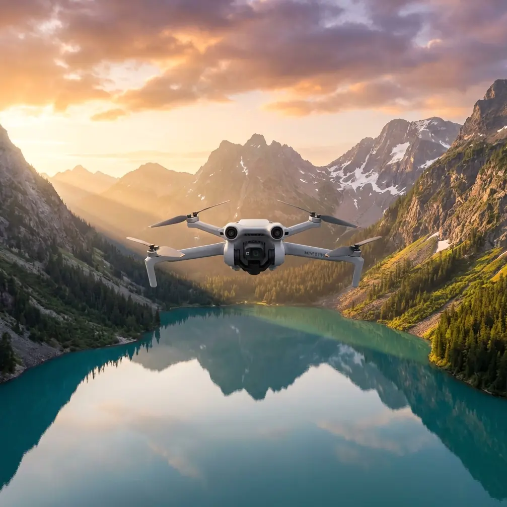
This is where the Mini 5 Pro becomes more than a small camera drone. In a mountain venue workflow, it acts like a compact aerial notebook: fast to deploy, discreet around guests and wildlife, and capable of collecting both cinematic reference footage and practical terrain intelligence in the same session.
I’ve been thinking about this through the lens of a specific assignment style: venue mapping in elevated terrain, where the property is beautiful but operationally awkward. Steep access roads. Tree lines that interrupt sightlines. Ceremony spaces tucked near drop-offs. Reception decks with changing light every twenty minutes. In that setting, the Mini 5 Pro’s value is not just image quality. It’s the combination of obstacle avoidance, subject tracking, QuickShots, Hyperlapse, and D-Log flexibility, all working together to reduce uncertainty before the main production day.
The assignment: mapping a mountain venue before event season
Let’s frame this as a real case study.
A photographer is hired to create pre-season visuals for a mountain venue that hosts weddings, retreats, and private events. The goal is not simply to produce a highlight reel. The venue needs a usable aerial understanding of the property:
- how the ceremony lawn relates to the parking area
- how guests move from cabins to the main lodge
- where sunset portraits work best
- which routes are visually clean and which ones reveal service roads or utility structures
- how the venue sits against the surrounding mountain backdrop
This kind of mission rewards speed and repeatability. You are not flying for spectacle alone. You are creating a visual reference system that the venue team can use for planning, marketing, and shot design.
That is where a lightweight platform matters. On mountain jobs, I often move between several launch points in one morning. A larger aircraft can deliver excellent results, but a smaller drone changes the tempo of the day. You stop less. You hesitate less. You capture more transitional moments because getting airborne doesn’t feel like a production in itself.
Why the Mini 5 Pro format makes sense in terrain that changes by the minute
Mountain venues force you to work in short windows. Mist clears and returns. Sun breaks through one ridge while another stays in shadow. Guests or staff may briefly occupy a path you intended to document. A drone that can be launched quickly has practical value far beyond convenience.
For a photographer, the Mini 5 Pro format is especially useful because it supports two jobs at once. First, it can create polished assets for client delivery. Second, it can gather scouting footage that improves every later shoot on the property. That second role is easy to underestimate.
If I’m standing on a deck above a valley and trying to explain to a venue owner why one ceremony angle works better than another, a top-down or rising reveal from the drone solves that conversation in seconds. If I need to understand whether the bridal path disappears under tree cover at 5 p.m., a short tracking flight gives me an answer that ground scouting might miss.
That’s the deeper appeal of this class of drone. It doesn’t only decorate a shoot. It shortens decision cycles.
Obstacle avoidance matters more in mountain venues than in open landscapes
“Obstacle avoidance” can sound like a specification line until you fly around an actual mountain property.
These venues are rarely open fields. They are layered environments. You might have tall pines along a ceremony platform, decorative string lights near a reception terrace, railing lines, lodge roofs, narrow clearings, and sudden slope changes that distort your depth perception. Add shifting wind and uneven signal reflections off terrain, and the airspace becomes less forgiving than it looks from the ground.
This is where obstacle sensing has operational significance. It is not a substitute for pilot judgment, but it adds a margin that becomes very meaningful in complex spaces. For venue mapping, that means more confidence during low, slow establishing passes near tree edges or while repositioning around structures to understand guest flow.
One of the most memorable moments on a mountain venue scout came during an early morning run near a ridge trail that connected the overlook to a lower photo spot. A small group of deer emerged from brush just below the tree line while the drone was repositioning laterally. The key benefit wasn’t “the drone avoided wildlife” in some dramatic sense. The benefit was that the aircraft’s sensing and controlled responsiveness gave me time to adjust calmly, hold a safe standoff, and reframe without forcing a rushed manual correction through branches and uneven terrain. That’s the real-world value: smoother choices under pressure.
In mountain settings, there is often very little room for ugly corrections.
ActiveTrack and subject tracking are not just for athletes or influencers
A lot of pilots hear “ActiveTrack” or “subject tracking” and immediately think of biking, running, or social clips. For venue work, the feature can be much more practical.
Imagine a venue coordinator walking the guest path from shuttle drop-off to the ceremony lawn. Or a couple doing a rehearsal walk at sunset. Or a planner moving between tent placement zones while discussing layout. Being able to track that movement from above helps produce footage that explains scale and flow. It turns a property from a collection of static pretty spots into a place people can mentally navigate.
That matters when mapping mountain venues because elevation can be deceptive. A path that looks direct on foot may appear disjointed in photos. A tracked overhead or trailing sequence can show how spaces actually connect. Done carefully, this becomes useful for both storytelling and operations.
The operational significance is straightforward: subject tracking reduces the pilot workload during repetitive movement shots, allowing more attention to framing, terrain awareness, and route interpretation. In an environment with altitude shifts and visual clutter, that is a real advantage.
I would still treat every tracking move with caution in mountain conditions. But when used deliberately, ActiveTrack becomes one of the strongest tools for creating venue orientation footage that clients instantly understand.
QuickShots help build a visual map faster than manual repetition
For venue teams, consistency often matters more than artistic improvisation.
This is where QuickShots earn their place. A repeatable orbit, reveal, or pull-away can document each major area of a property in a uniform visual language. Instead of manually flying every pass from scratch, you can capture a structured set of shots that make the final edit easier to compare and organize.
That’s useful in at least two ways.
First, it speeds up production on days when weather windows are tight. In mountain regions, ten usable minutes of light can disappear quickly. QuickShots help secure the essentials before conditions shift.
Second, it creates a reference archive. If the venue adds a deck, changes landscaping, expands parking, or reworks a ceremony site, you can recreate similar aerial moves later and compare the property over time. For venues that evolve seasonally, that consistency becomes valuable documentation.
This is one of those features that can seem consumer-friendly on paper but becomes quietly professional in the field. A clean automated reveal of the lodge and surrounding ridge line may not be glamorous to talk about, but it can save time and produce material the client uses for months.
Hyperlapse is particularly strong in mountain hospitality storytelling
Mountain venues are defined by environmental change. Fog climbing across a slope. Evening light moving over a valley. Clouds breaking over a ridge behind the ceremony site. Hyperlapse translates those shifts into something instantly legible.
For a venue operator, that kind of sequence does more than look cinematic. It communicates atmosphere. It shows why the location feels different at 7 a.m. than it does at golden hour. It helps prospective clients understand the rhythm of the place.
From a mapping perspective, Hyperlapse also helps reveal how light behaves across the property. If one part of the lawn loses sunlight an hour before the reception deck does, that affects scheduling, décor decisions, and portrait planning. A well-placed time-compressed aerial sequence can show that pattern clearly.
I’ve found this especially useful when a venue sits between tree cover on one side and open valley exposure on the other. Ground scouting gives you fragments. Hyperlapse gives you the behavior of the whole scene.
D-Log gives photographers more room when the mountain light turns difficult
Mountain light is rarely gentle for long.
You might have bright cloud breaks over a pale sky and deep shadows under pines in the same frame. You may be filming a lodge roof in direct sun while a ceremony space below sits in cool shade. In those conditions, D-Log matters because it gives more grading latitude than a standard baked-in look.
For photographers crossing into hybrid photo-video work, that flexibility is easy to appreciate. A flatter profile can preserve more highlight and shadow information, which becomes useful when matching drone footage to ground cameras or building a more natural final look. That does not mean every venue operator wants a heavy grade. It means the capture has more room for refinement later.
Operationally, this is significant because mountain venues often don’t offer second chances. Weather, traffic, staff availability, and event schedules may make a reshoot impractical. Capturing footage with stronger post-production flexibility is a hedge against those constraints.
If you are documenting a property that may use the footage across website headers, social edits, planning decks, and seasonal promos, that extra flexibility has real value.
The real workflow advantage: one drone, multiple outputs
What makes the Mini 5 Pro compelling in this scenario is not any single feature. It is the way the features stack.
A typical mountain venue session might produce:
- top-down reference clips for route planning
- tracking footage of guest or coordinator movement using ActiveTrack
- QuickShots of each major venue zone for a structured edit
- Hyperlapse sequences showing weather and light transitions
- D-Log footage for polished final grading
- scouting passes used later to plan portrait sessions and ceremony coverage
That combination turns one field visit into a multi-layered asset collection exercise.
For a photographer like Jessica Brown, that matters. Clients often think they are hiring someone to capture what the venue looks like. In reality, the most useful work often shows how the venue works. Aerial mapping bridges that gap. It reveals circulation, spacing, terrain relationships, and timing in ways still images alone rarely can.
A note on communication and client confidence
One underrated benefit of bringing this kind of workflow to a venue project is how much easier it makes client conversations.
When you can show a manager exactly how the western ridge shades the cocktail area or how the path from cabins to the overlook reads from above, planning gets more precise. Questions become visual, not hypothetical.
If a venue team needs help thinking through an aerial mapping setup for a mountain property, I’d point them toward a direct planning conversation rather than generic advice. A simple way to start is through this WhatsApp contact for flight workflow questions.
That kind of discussion usually saves time because every mountain venue has its own constraints: local wind, tree density, access issues, event patterns, wildlife activity, and visual priorities.
Final take
The Mini 5 Pro makes sense for mountain venue mapping because it solves a very specific problem: how to gather useful, polished aerial information in a place that is visually stunning but operationally tricky.
Obstacle avoidance helps when trees, rails, and slope changes compress your margins. ActiveTrack turns paths and transitions into understandable movement. QuickShots build a repeatable visual structure. Hyperlapse reveals environmental behavior. D-Log protects image flexibility when the light becomes uneven and harsh.
Those are not abstract feature wins. They directly shape how a venue is documented, how efficiently a shoot runs, and how confidently a client can plan.
For mountain properties, that is the difference between pretty footage and genuinely useful aerial work.
Ready for your own Mini 5 Pro? Contact our team for expert consultation.