Mapping Windy Venues With Mini 5 Pro: A Practical Field
Mapping Windy Venues With Mini 5 Pro: A Practical Field Method That Protects Data Quality
META: Learn how to map windy venues with the Mini 5 Pro using safe flight planning, antenna positioning, obstacle avoidance, ActiveTrack awareness, and disciplined capture settings.
Wind changes everything in venue mapping.
Not because the Mini 5 Pro suddenly becomes unusable, but because wind exposes every weak decision in your workflow: rushed launch points, sloppy overlap planning, bad antenna orientation, overreliance on automation, and poor judgment around signal noise. If your goal is a clean, usable map of a venue rather than a cinematic flight, the margin for error gets tighter fast.
This guide is built around a specific scenario: mapping venues in windy conditions with the Mini 5 Pro, while also dealing with electromagnetic interference and the very real need to maintain a stable link through proper antenna adjustment. That combination matters more than many pilots admit. Wind affects aircraft attitude, speed consistency, and battery draw. Interference affects command reliability, video downlink confidence, and your willingness to keep a mission going when you should probably reset.
If you want survey-friendly imagery instead of a folder full of compromised frames, you need a method.
Start with the venue, not the drone
A windy venue is rarely just “windy.” It usually has its own layered problems.
Stadium lighting, steel roofing, temporary event structures, broadcast gear, perimeter fencing, parked service vehicles, Wi‑Fi saturation, and dense pedestrian infrastructure all contribute to a messy radio environment. Even open venues can create turbulence through grandstands, tree lines, and neighboring buildings. The Mini 5 Pro may be compact, but compact aircraft are often the first to reveal how ugly the local air really is.
Before takeoff, define the mission type. Are you creating a stitched overview for planning and documentation? A progress map for event operations? A preproduction scout for security or logistics? The answer determines altitude, grid shape, and how much you can rely on intelligent flight tools.
This is where many pilots drift off course. They treat mapping as a casual capture session and let features like QuickShots or Hyperlapse shape their flying. Those are useful creative modes, but they are not substitutes for disciplined, repeatable image acquisition. For mapping venues, consistency beats flair every time.
The real problem in wind: angle, drag, and uneven coverage
In calm air, a small drone can hold a tidy line with little effort. In wind, the Mini 5 Pro must pitch and roll more aggressively to stay on course. That creates three operational consequences.
First, groundspeed can vary sharply depending on direction of travel. One leg of your pattern may crawl into the wind while the return leg moves much faster than expected. If you do not account for that, image spacing becomes inconsistent.
Second, the aircraft’s body angle changes more often. Even with a stabilized gimbal, stronger corrections can reduce capture consistency, especially on the edges of a venue where turbulence spills off structures.
Third, battery consumption rises. A venue that looked easy on a planning screen can turn into two or three conservative sorties instead of one ambitious flight.
So the first discipline is simple: shorten your expectations. Fly smaller blocks. Keep your passes tighter. Build overlap margin beyond what you would use on a calm day. If you were comfortable with a certain frontlap and sidelap in benign conditions, windy venue work rewards extra redundancy. You are buying insurance against drift, yaw corrections, and occasional frames that are technically sharp but operationally weak for stitching.
Choose your launch position for signal health, not convenience
Pilots love the closest flat patch of ground. That is not always the right launch site.
For windy venue mapping, the launch position needs to support two things at once: clean wind departure and clean signal geometry. The EMI issue often shows up before the weather does. If you set up beside metal barricades, utility boxes, generator trucks, or temporary communications equipment, you may begin the mission already compensating for an avoidable problem.
Move away from concentrated electrical infrastructure when possible. Give yourself a launch point with a clear line of sight above low obstructions and away from reflective clutter. That matters because signal reliability is not only about raw transmission power. It is also about orientation, multipath reflection, and how well your controller antennas are aligned with the aircraft’s position during the mission.
This is where antenna adjustment becomes operationally significant rather than theoretical. When the aircraft is mapping a venue perimeter, its relative position to you changes constantly. If you leave the controller in one lazy posture, you may notice intermittent downlink instability precisely when the drone reaches the far edge of the site or dips near structures.
The correction is not dramatic. It is disciplined.
Keep the broadside of the antennas facing the drone’s general direction rather than pointing the antenna tips directly at it. Re-adjust as the aircraft moves across the grid. If you are flying long lateral legs, your body position and controller angle should evolve with the mission. That one habit can make the difference between a smooth mapping run and a flight interrupted by signal hesitation in a noisy venue.
If you want to compare your site plan with an experienced pilot before launch, send it here: field mission check-in
Recognize electromagnetic interference before it becomes a flight decision
EMI is dangerous partly because it is easy to rationalize.
A pilot sees brief signal warnings, a little breakup in the feed, maybe a temporary dip in confidence, and decides to keep going because the drone is still flying. But venue mapping is not only about whether the aircraft stays airborne. It is about whether every pass remains trustworthy enough to finish the mission without gaps, misalignment, or emergency improvisation.
Warning signs include recurring signal instability in one sector of the venue, inconsistent control feel near infrastructure, or downlink behavior that does not match actual distance. If the aircraft is only moderately far away but the link behaves like it is at the edge of range, assume the environment is part of the problem.
The best response is usually not to push through. Reposition.
Sometimes moving your pilot station even 20 to 30 meters changes the radio picture enough to restore confidence. Sometimes raising your standing position, stepping out from beside a vehicle, or changing the angle of the controller to maintain cleaner antenna alignment solves what looked like a much bigger issue. That is why antenna adjustment is not a minor tip in windy venue work. In a compact aircraft mission, signal quality and aircraft workload already run close together. Wind adds aerodynamic stress; EMI adds communication stress. Stack the two, and small mistakes stop being small.
Use obstacle avoidance intelligently, not blindly
Obstacle avoidance is one of the Mini 5 Pro features that sounds universally beneficial until venue work gets complicated.
Yes, obstacle sensing can help protect the aircraft near light poles, signage, stands, and tree lines. In a windy environment, that extra awareness matters because the drone may drift more than expected during deceleration or lateral transitions. A compact aircraft operating around venue edges benefits from every layer of spatial awareness it can get.
But obstacle avoidance can also alter flight behavior in ways that disrupt mapping consistency. If the system slows or reroutes unexpectedly because it interprets a path as constrained, your image spacing and line discipline can suffer. That is not a reason to disable it casually. It is a reason to understand where automation supports the mission and where it begins to steer the mission.
For manual mapping-style passes, predictability matters. If you are near cluttered structures, obstacle avoidance may be the right safety net. If you are working broad, clear overhead lanes, stable manual control and a conservative path may produce cleaner results. The point is not to worship or reject the feature. The point is to know whether it is serving the map.
The same logic applies to ActiveTrack and subject tracking. These tools are excellent when the job is following motion. They are not your primary mapping solution. In a windy venue, tracking algorithms can be impressive, but they are designed to follow subjects, not protect image geometry for stitching. Use them for supplemental documentation, not the core grid.
Camera settings that favor mapping over mood
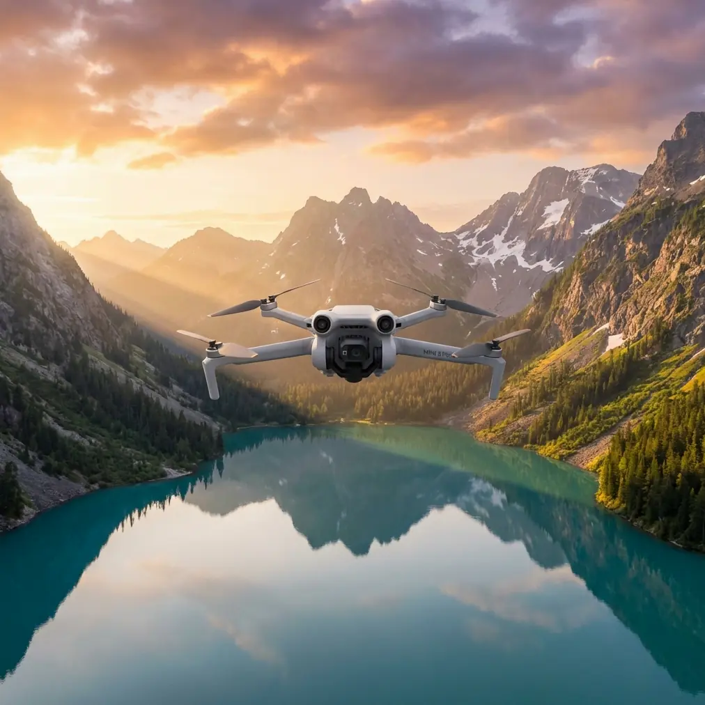
The Mini 5 Pro attracts a lot of attention for image quality features like D-Log. That matters, but not always in the way creators think.
For venue mapping, your first objective is consistent, usable imagery. D-Log can be valuable when you need wider grading flexibility for secondary deliverables, such as promotional overviews or inspection-style clips alongside the map. But flat profiles are not automatically better for the mapping portion of the mission. Your stitching workflow benefits most from stable exposure, good sharpness, and minimal inconsistency between frames.
If the light is changing quickly because wind is pushing clouds through, lock your exposure decisions as much as conditions allow. Avoid letting the drone chase brightness from pass to pass. Sudden exposure shifts can make a venue mosaic harder to normalize later.
That also means not confusing cinematic tools with mapping tools. Hyperlapse is useful for showing event setup progress over time. QuickShots are useful for grabbing a fast establishing clip after the operational mission is done. Neither should distract from the main capture sequence when battery, wind, and signal quality are already competing for attention.
Finish the map first. Then use creative modes if the site and battery reserve justify it.
Fly the wind pattern, don’t deny it
There is a smarter way to map in wind than pretending every leg is equal.
Run a short diagnostic leg before committing the full pattern. Watch how the Mini 5 Pro behaves on crosswind and headwind segments. Look at groundspeed, aircraft attitude, and how much correction is needed near venue edges. That one preview pass tells you where the mission is likely to degrade.
Then shape the mapping run around what the air is actually doing.
If one side of the venue has rotor wash from a grandstand or building line, do not leave it for the end of a depleted battery. Handle the messiest sector earlier while your energy reserve and concentration are strongest. If the tailwind leg is running too fast for your preferred capture interval, reduce speed or tighten your mission geometry. If one corner repeatedly produces signal noise and gust turbulence together, consider splitting the venue into separate blocks with a better pilot position for the second segment.
This is what experienced field work looks like. Not dramatic stick inputs. Not blind trust in smart modes. Just constant micro-adjustment based on the interaction between aircraft, air, and site.
Build in redundancy where failure is expensive
Venue mapping often happens on limited access schedules. You may have a narrow window before people arrive, before vehicles move in, or before the weather worsens. That pressure tempts pilots to cut corners. Resist it.
If the venue matters, redundancy matters. Capture a confirming perimeter orbit after the main mapping passes. Take a handful of extra high-overlap frames over problematic zones such as reflective roofs, uniform parking surfaces, or corners affected by gusts. Those extra images cost very little in time compared with the cost of discovering a gap later.
This is also where the Mini 5 Pro’s compact form works in your favor. A smaller aircraft can be deployed quickly and repositioned with less friction than a heavy platform. But the tradeoff is that wind tolerance must be managed actively. The advantage is agility, not invincibility.
A practical Mini 5 Pro workflow for windy venue jobs
Here is the field method I recommend.
Arrive early enough to observe the venue before powering on. Identify metal-heavy zones, likely interference sources, and turbulent edges. Choose a launch point based on line of sight and radio cleanliness, not walking convenience. Calibrate your own expectations for wind, battery reserve, and number of sorties.
Launch and fly a short test line. Watch signal behavior while adjusting antenna orientation deliberately as the drone moves. If the link improves with your repositioning, you have confirmed that pilot geometry is part of the equation. If it does not, relocate before the real mission begins.
Fly the mapping sequence in manageable sections. Keep movements smooth. Protect overlap. Avoid letting creative modes intrude on the mapping objective. Use obstacle avoidance where structural density justifies it, but do not let automation secretly rewrite a mission that depends on predictable paths.
Capture supplemental footage only after your mapping data is secure. That is the right time for QuickShots, a Hyperlapse clip, or a D-Log pass intended for presentation content.
Then review on site. Not later. On site. Make sure the windy corners, interference-prone sectors, and structurally complex edges are all covered while the aircraft and batteries are still available.
Why this matters
A venue map is only useful if it is reliable.
The Mini 5 Pro can absolutely produce strong results in demanding conditions, but windy venue work is where casual flying habits get exposed. Obstacle avoidance helps, but only when it supports predictable flight. ActiveTrack and subject tracking are powerful, but they are not the backbone of mapping. D-Log has value, but image consistency matters more than creative latitude during the primary capture. And when electromagnetic interference enters the picture, antenna adjustment is not a footnote. It becomes part of flight discipline.
That is the real takeaway. Good venue mapping with the Mini 5 Pro is less about squeezing heroics out of a small drone and more about reducing preventable errors. Read the site. Respect the wind. Manage the radio link actively. Fly for the map, not for the highlight reel.
Do that, and even a difficult venue starts to look organized from above.
Ready for your own Mini 5 Pro? Contact our team for expert consultation.