Mapping Highways at High Altitude with Mini 5 Pro
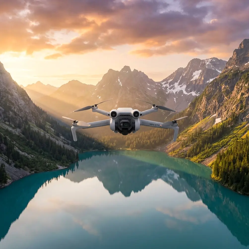
Mapping Highways at High Altitude with Mini 5 Pro: A Field Case Study
META: A practical Mini 5 Pro case study on mapping highways at high altitude, covering obstacle avoidance, ActiveTrack, D-Log, weather shifts, and flight planning tips.
Highway mapping sounds clean on paper. Long linear assets. Predictable surfaces. Clear mission goals.
Then you get to altitude.
The air thins out. Wind starts behaving differently from one ridge to the next. Light changes fast, especially when cloud cover rolls over mountain roads. Battery decisions become less forgiving. Even basic visual line management gets harder when a road bends through elevation and terrain shadow. That is where a compact platform either proves its value or becomes a liability.
I recently worked through a highway mapping scenario with the Mini 5 Pro in exactly that kind of environment, and it revealed something useful about this aircraft: its strengths are not just about portability. They show up when conditions become inconsistent mid-flight and the job still needs usable data.
This is a field-style case study built around one realistic reader problem: mapping highways in high altitude conditions, with weather shifting during the mission.
Why a small drone even makes sense for highway mapping
For corridor work, many operators automatically think bigger. More battery. More payload. More redundancy.
That instinct is understandable, but it misses the practical reality of many highway documentation jobs. A lot of assignments are not full engineering-grade LiDAR campaigns. They are progress records, visual condition assessments, stakeholder updates, terrain context capture, drainage review, slope monitoring, and route-side inspection imagery. For those tasks, the right compact drone can be the more efficient tool.
The Mini 5 Pro format matters because highway teams often work from moving staging points, roadside pull-offs, and uneven terrain. A lightweight aircraft reduces setup friction. When weather windows are short, that matters more than spec-sheet bragging rights.
The real question is whether a small drone can stay stable enough, see enough, and capture flexible enough footage to make the sortie worthwhile at altitude.
In this case, the answer depended on three things:
- Obstacle sensing and avoidance in a corridor environment
- Reliable subject or path-follow behavior through curving road sections
- Camera modes that support both documentation and post-processed analysis
That is where the Mini 5 Pro becomes more interesting than a simple “travel drone” label suggests.
The mission profile
The assignment was straightforward in theory: document a highway segment crossing higher terrain, capture visual mapping passes, gather contextual footage of cut slopes and roadside drainage, and produce imagery that could support both review meetings and later post-production.
The route included:
- Long straight paved sections
- Curves wrapping around elevation changes
- Guardrails, signage, utility margins, and occasional roadside structures
- Uneven wind exposure due to ridgelines
- Fast-changing cloud conditions
Because the road cut through high ground, the flight plan had to account for more than distance. Relative altitude shifted constantly. A drone holding a fixed height above takeoff point is not the same as a drone maintaining safe, useful clearance over a rising roadway. That sounds obvious, but it is one of the most common corridor-planning mistakes I see from newer operators.
With the Mini 5 Pro, the approach was to break the corridor into shorter sections and treat each as its own micro-mission rather than trying to force one oversized pass. That gave better control over battery reserves, camera angle changes, and terrain response.
Where obstacle avoidance actually helped
People often talk about obstacle avoidance as if it is there to save careless flying. In real commercial work, its real value is operational margin.
On a mountain highway, the hazards are not always dramatic. They are small, repeatable, and easy to underestimate: roadside sign gantries, poles, rising embankments, trees near bends, and terrain that suddenly comes closer as the road climbs. A compact drone moving laterally to maintain a corridor view can drift into these margins if wind pushes it off line.
That is where obstacle avoidance proved useful.
Not because it replaced planning. It did not. It gave me a buffer when wind shifted around a bend and the aircraft had to interpret a more complex edge environment than the map suggested. On a route like this, obstacle sensing is especially relevant when transitioning between open sections and tighter shoulders where the road hugs slopes or vegetation.
The operational significance is simple: fewer abrupt manual corrections, smoother line retention, and a lower chance of losing a clean pass because the aircraft had to be aggressively repositioned at the worst possible moment.
For mapping-adjacent work, consistency is everything. Every unnecessary jolt creates more cleanup in post and more uncertainty in image alignment.
Using ActiveTrack and subject tracking in a highway environment
A highway is not a person jogging through a park, so some operators dismiss tracking tools too quickly. That is a mistake.
ActiveTrack and related subject tracking features can be surprisingly useful when used intelligently. I was not using them as a substitute for survey flight planning. I used them to hold visual coherence on moving reference elements during supplementary capture. Maintenance vehicles, route-following support cars, or defined roadway alignment can all benefit from semi-automated tracking behavior when the goal is to produce explanatory footage alongside mapping imagery.
The key is to understand what tracking is good for.
If you need polished visual context showing how a highway segment sits in terrain, how traffic flows through a curve, or how a specific maintenance operation moves through a work zone, tracking reduces pilot workload. Instead of dividing all attention between framing, speed matching, and obstacle spacing, you can let the aircraft maintain relationship to the subject while you supervise route safety and camera intent.
That matters even more at altitude. Wind fluctuations already demand extra attention. Anything that reduces manual micro-correction helps preserve focus for the bigger operational picture.
In this case, ActiveTrack was most useful for collecting supporting footage around bends where road geometry changed quickly. It kept the composition more stable than pure manual following would have under gusty conditions.
The weather changed mid-flight. Here is what mattered.
The clean morning window did not last.
Halfway through the second corridor segment, cloud cover thickened and the wind became less predictable. Nothing extreme, but enough to alter the mission. Light flattened. Contrast dropped across the road surface. Gusts started arriving in pulses rather than as a steady push. That is a very different flying environment.
This is where many compact-drone flights become compromised, not because the aircraft fails, but because the operator keeps trying to force the original plan onto new conditions.
The Mini 5 Pro handled the change best when the mission priorities changed with it.
I stopped chasing the wider cinematic passes and switched to shorter, more controlled runs. I tightened the route, reduced unnecessary lateral movement, and focused on getting repeatable usable data rather than idealized footage. That distinction matters. Commercial pilots do not get paid for stubbornness.
The aircraft stayed composed enough to keep the project moving, but the real advantage came from its flexibility. Instead of ending the day when the weather softened the light, I leaned into capture modes that preserved more post-production latitude.
That is where D-Log became valuable.
Why D-Log matters for highway documentation
A lot of people hear “D-Log” and think only about cinematic grading. On a highway mapping assignment, its usefulness is broader than aesthetics.
When weather changes mid-flight, dynamic range management becomes practical, not artistic. High-altitude roads often present ugly contrast transitions: pale sky, dark slope faces, reflective lane markings, shaded shoulders, and bright concrete or gravel edges. If cloud cover moves in and out, exposure balance can shift from one pass to the next.
D-Log gives more room in post to normalize those differences.
That means better consistency across stitched visual deliverables, clearer surface detail in mixed light, and more control when producing client-facing summaries that need to compare one section of road to another. It also helps preserve information in shadow-heavy areas along cut slopes and drainage lines, which are often exactly where project teams want to inspect condition changes.
Operational significance is the phrase that matters here. D-Log is not just “nice image quality.” It is a hedge against inconsistent light when you cannot control the mountain weather.
QuickShots and Hyperlapse are not just for social media
I know the reaction some professionals have to hearing QuickShots or Hyperlapse mentioned in a work context. They assume gimmick. Usually because they have only seen those modes used badly.
For highway projects, these tools can serve a very specific purpose: communication.
QuickShots can help generate fast, repeatable overview sequences that show intersections, elevation transitions, or roadside construction context without requiring a long setup. When a project manager wants a fast visual explanation of how a segment sits within surrounding terrain, these automated motion patterns can produce useful supporting material.
Hyperlapse is different. For long corridor jobs, it can reveal environmental movement and site activity in a way static mapping cannot. Cloud build-up over ridges, shadow travel across lanes, traffic rhythm through a constrained section, or crew staging behavior all become easier to interpret when time is compressed.
I would not use either mode as the core data product. That would be the wrong mindset. But as companion outputs, they can make reports more understandable to non-pilot stakeholders.
And that is often the hidden challenge in drone work. Capturing the data is one thing. Helping others understand it is another.
High-altitude flight planning lessons from this sortie
The Mini 5 Pro performed best when treated like a precise field tool rather than a do-everything aircraft. A few practices made the difference.
1. Segment the highway
Long roads invite overambitious flight plans. Resist that. Break the corridor into manageable pieces based on terrain shifts, not just linear distance. A steep grade change can matter more than another few hundred meters of pavement.
2. Fly the terrain, not the map
Road elevation relative to launch point changes constantly in mountain environments. Build each pass around actual terrain relationship and safe visual standoff, not abstract route geometry.
3. Keep battery margin conservative
At high altitude, return decisions need to come earlier. Wind on the outbound leg may not match the wind coming home. That sounds basic, but the penalty for getting it wrong increases as terrain complexity rises.
4. Use obstacle avoidance as margin, not permission
Obstacle sensing helps in roadside environments with signs, poles, and rising shoulders. It is a safety layer, not an excuse to fly carelessly close to infrastructure.
5. Capture for two outputs
Get the mapping-support imagery you need, then gather contextual footage using ActiveTrack, QuickShots, or Hyperlapse where appropriate. The second category often becomes the material clients reference most in meetings.
6. Switch modes when weather shifts
When clouds changed the light and gusting increased, D-Log and shorter passes preserved deliverable quality better than trying to continue the original broader plan unchanged.
What surprised me most about the Mini 5 Pro
Not speed. Not portability. Not even the camera flexibility.
What stood out was how useful the aircraft became once the day stopped being ideal.
That is the real test for a field drone. Plenty of platforms look capable when the sky is stable and the route is simple. The more meaningful question is whether the aircraft still produces coherent, usable results when wind direction becomes messy, light flattens, and the operator has to rethink the mission in real time.
The Mini 5 Pro held its value there.
For a photographer, that means less stress about losing visual quality when conditions turn. For an infrastructure team, it means a better chance of walking away with material that still supports decisions. For corridor documentation specifically, that combination of obstacle awareness, tracking assistance, and flexible imaging modes makes this aircraft more practical than its small size suggests.
If you are planning a similar operation and want to compare setup ideas for high-altitude corridor work, you can message the flight team here.
Final takeaway for highway mapping teams
The Mini 5 Pro is not a substitute for rigorous survey methodology when a project demands specialized geospatial outputs. That is not the point.
Its value is in the overlap zone between mobility, visual documentation, terrain awareness, and adaptable capture. In high-altitude highway work, that overlap is large. Roads curve through variable wind. Light changes without warning. Terrain compresses your margin for error. Under those conditions, features like obstacle avoidance and ActiveTrack are not decorative extras. They directly affect how smoothly you can execute a pass and how much mental bandwidth remains for mission judgment.
Pair that with D-Log for difficult light, and with QuickShots or Hyperlapse for stakeholder communication, and the Mini 5 Pro becomes a genuinely capable corridor tool.
That was the lesson from this flight. Not that the drone made the mountain easy. It did something more useful: it stayed adaptable when the mountain stopped cooperating.
Ready for your own Mini 5 Pro? Contact our team for expert consultation.