Mini 5 Pro in Coastal Mapping: A Field Report on Why Bionic
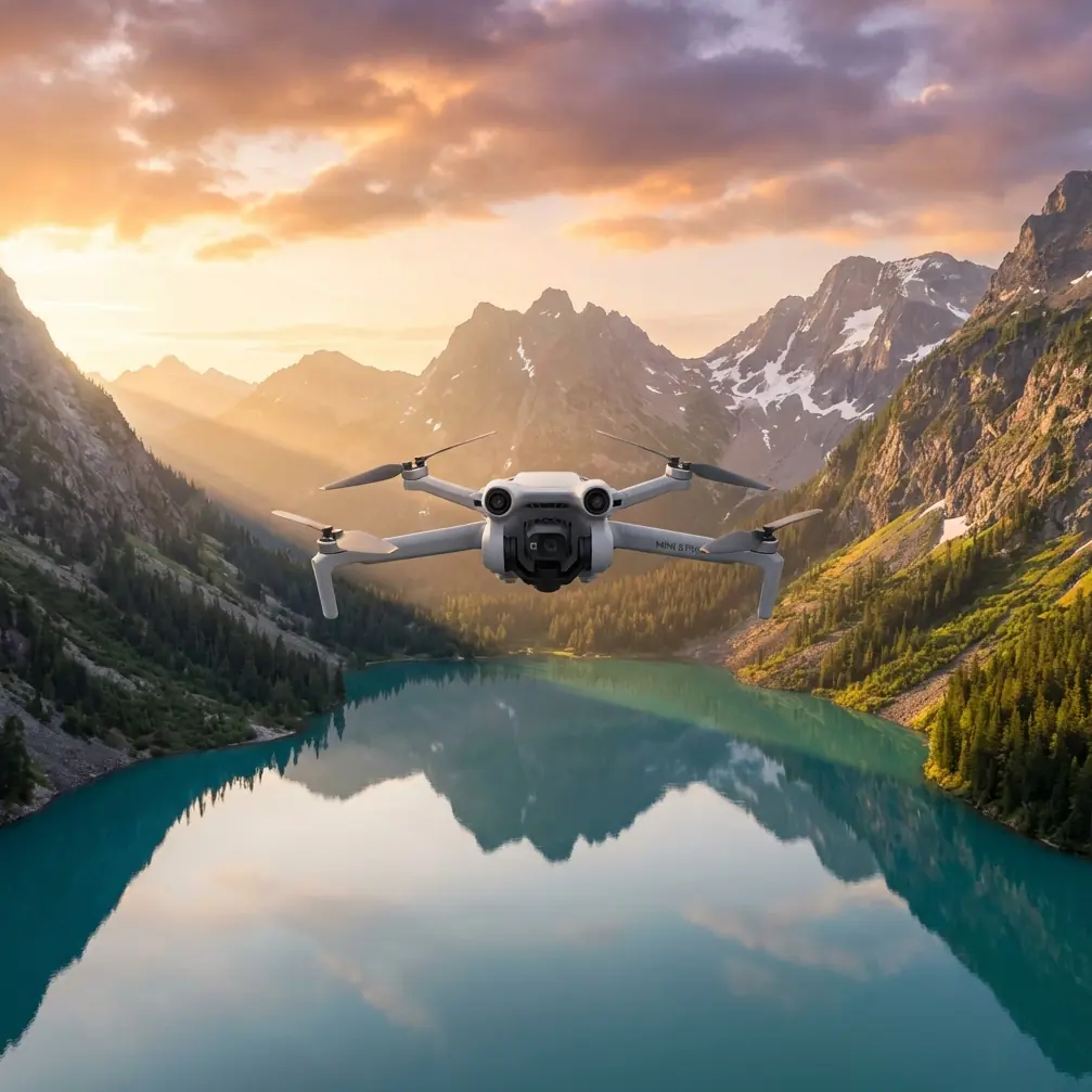
Mini 5 Pro in Coastal Mapping: A Field Report on Why Bionic Design Logic Matters
META: Field report on using Mini 5 Pro for coastal mapping, with practical altitude guidance, obstacle awareness, and why bionic drone design principles matter in wind, spray, and uneven terrain.
Coastlines expose every weakness in a small drone.
They compress wind shifts, glare, moisture, cliffs, sand drift, and moving subjects into one flight envelope. A platform that feels stable over a park can suddenly look indecisive over a rocky shore. That is why any serious discussion about the Mini 5 Pro for coastal mapping should start somewhere deeper than resolution or flight modes. It should start with environmental adaptability.
A useful reference point comes from the broader direction of drone design itself. One industry source from 2019 described bionic drones as aircraft shaped by the external forms and structural logic of birds, bats, or flying insects. The key idea was not visual novelty. It was performance. By optimizing outer shape and internal structure through biomimicry, drone developers aim to improve flight behavior and strengthen environmental adaptability. The article framed that as an important future direction for drone research.
That matters more to a Mini 5 Pro operator on the coast than it may seem at first glance.
I am not suggesting the Mini 5 Pro is literally a bird-shaped aircraft. The value of that reference is conceptual. When you are mapping a coastline, the drone that succeeds is the one whose design priorities align with what nature has already solved: stable movement in changing air, efficient use of energy, and quick correction when the environment turns uneven. Coastal work is where those priorities stop being theoretical.
Why coastlines reward adaptable aircraft
As a photographer, I learned this the hard way before I learned it methodically.
A beach is not one surface. It is several micro-environments stitched together. Open water pushes steady wind in one direction, dunes break it unpredictably, cliffs create turbulence, and structures along the shore add mechanical disturbance. Even before you think about image overlap for mapping, the aircraft has to hold a clean path.
This is where the bionic design principle from the source becomes operationally useful. The source emphasized two things: optimization of external form and optimization of internal structure. In practical drone terms, those are not abstract engineering phrases. External form influences how the aircraft cuts through disturbed air. Internal structural optimization affects rigidity, weight balance, and responsiveness. For coastal mapping, both shape the drone’s ability to maintain line discipline on survey passes.
If the Mini 5 Pro inherits more of that design logic, the payoff is simple: fewer deviations from the planned track, less energy wasted on correction, and more consistent capture geometry. Those three things directly affect map quality.
A lot of pilots talk about image quality first. Along the coast, flight quality is image quality.
The Mini 5 Pro through a coastal mapping lens
The Mini 5 Pro conversation often gets pulled toward creator features such as QuickShots, Hyperlapse, D-Log, and ActiveTrack. Those are useful, but for mapping they only matter if the platform remains predictable in hostile light and unstable air.
Obstacle avoidance is a good example. On paper, some people treat it as a convenience feature. Along the coast, it becomes a workflow stabilizer. Sea stacks, poles, cliff edges, marina structures, and low vegetation all complicate return paths and side transitions. A mapping mission does not always happen over an empty strip of beach. You may be surveying a mixed shoreline with revetments, boardwalks, moorings, or elevated terrain. Obstacle awareness helps reduce abrupt operator inputs during these transitions, which protects frame consistency and lowers the risk of route disruption.
Subject tracking seems less relevant to mapping at first, but there is a second use case. In shoreline documentation projects, it is common to supplement orthographic passes with contextual motion footage of moving waterlines, sediment displacement, or vessel interactions near developed waterfronts. ActiveTrack-style automation can help maintain framing of a reference subject while you gather supporting visual material. That is not the map itself, but it often becomes part of the project record for planners, coastal managers, or construction teams.
D-Log matters too, though not for the reason hobby pilots usually cite. Along the coast, reflective contrast can be brutal. Bright surf, dark rock, wet sand, and haze often coexist in one frame. A flatter profile can preserve more flexibility when you need to produce supporting visual deliverables alongside the mapping set. It will not fix poor flight execution, but it does give you more room to balance a difficult scene in post.
Optimal flight altitude for coastal mapping
Here is the practical insight I return to most often: for many coastal mapping jobs with a compact drone, the most dependable working altitude is usually around 60 to 80 meters above ground level, adjusted for terrain relief and local rules.
That band is not magic. It is a compromise.
Fly too low and you magnify every gust, every small cliff-induced rotor, and every path irregularity. You also increase the number of flight lines required to cover the same shoreline section, which means more turns, more battery transitions, and more chances for inconsistency. Fly too high and you may lose the ground detail needed to distinguish edge conditions such as erosion cuts, wrack lines, drainage marks, or small infrastructure features.
For open beaches with gentle relief, 70 meters is often a strong starting point. It usually gives enough coverage efficiency without pushing so high that fine shoreline detail starts to feel generalized. Around cliffs or structures, I often step higher only if the wind profile remains acceptable and the mission needs wider context. In broken terrain, the smarter move is not simply climbing. It is adjusting your route so the aircraft maintains a more consistent relative height over the surface.
Operationally, this ties back to the reference source’s emphasis on environmental adaptability. A drone that handles disturbed air more gracefully gives you more confidence to stay in the altitude band that best serves map accuracy rather than the band that merely feels survivable.
What the shoreline teaches about design
The 2019 source called bionic drones an important direction for future research because they improve performance by borrowing from natural flyers and enhancing adaptability to the environment. That sentence lands differently when you are standing on a shoreline at sunrise with a short weather window.
Birds and bats do not just fly. They absorb variation. They react continuously to invisible changes in air. That is exactly what small drones must do on the coast, even if the mechanism is entirely different.
For Mini 5 Pro users, this matters in two ways.
First, it changes what you should value in the aircraft. Marketing checklists rarely capture how much mission quality depends on tiny corrections made every second. The coast rewards aircraft that are composed rather than merely fast.
Second, it changes how you fly. If environmental adaptability is the design goal, your mission planning should support it rather than fight it. That means smoother turns, cleaner line spacing, moderate altitude, and realistic wind thresholds. It also means avoiding the temptation to push low cinematic passes when the actual task is survey-grade consistency.
Field method: how I would approach a coastal mapping run
If I were taking the Mini 5 Pro to document a coastal section, I would break the session into three layers.
1. Recon pass
A short visual pass first, not the mapping run.
I use this to read wave run-up, identify gull activity, check for masts or poles near the route, and see how the wind behaves near cliffs or built structures. This is where obstacle avoidance earns its keep. You are not trying to prove skill. You are trying to reduce surprises before the grid begins.
2. Primary mapping altitude
For the main capture, I would start near 70 meters over the dominant surface if the shoreline is open and the wind is manageable. If the coast includes elevation changes, I would segment the mission rather than force one altitude across everything.
This is also where disciplined overlap and straight-line behavior matter more than dramatic framing. The cleaner the geometry, the less pain later in stitching and interpretation.
3. Supplemental visual layer
After the map set is secured, then I would capture contextual footage.
This is where QuickShots or Hyperlapse can be genuinely useful, not as decoration but as documentation. A hyperlapse showing tidal movement, cloud shadow drift, or shoreline traffic can help stakeholders understand temporal context that still maps cannot show. Likewise, D-Log footage can preserve difficult highlight and shadow information for environmental reporting visuals.
That order is critical. Map first. Visual storytelling second.
Mini 5 Pro features only matter when tied to the mission
A lot of articles on compact drones drift into feature recitation. That is not how field operators think.
Obstacle avoidance matters because shorelines are visually open but structurally deceptive.
ActiveTrack matters because supporting footage sometimes needs repeatable framing of moving reference elements.
QuickShots matter if they save time gathering context after core data capture is complete.
Hyperlapse matters when coastal change over short periods is part of the story.
D-Log matters because the coastline can contain punishing dynamic range in a single sweep.
The drone is not there to entertain the pilot. It is there to hold up under coastal variability and come back with usable material.
One overlooked risk: false confidence from calm takeoff zones
The most misleading coastal flights begin from protected ground.
A launch area behind dunes, beside a vehicle, or near a building can feel calm enough to invite an aggressive low-altitude plan. Fifty meters out, the air can be entirely different. This is another reason the reference emphasis on environmental adaptability is so relevant. The better the aircraft’s underlying flight behavior, the more margin you have when the environment changes between launch and mission area.
Still, margin is not immunity. A small drone on the coast should be flown with humility. The smartest operators are rarely the most dramatic. They are the ones who bring back complete, consistent data.
The bigger takeaway from bionic research
That 2019 report may have been talking broadly about the future of drone development, but it points toward a real evaluation framework for the Mini 5 Pro today.
Do not ask only what the drone can capture. Ask how well it adapts.
The source specifically noted that bionic drones improve flight performance by optimizing both shape and internal structure, with the goal of stronger environmental adaptability. That dual focus is exactly what coastal mapping exposes. A shoreline is a test of design integrity. If a drone’s form, balance, and control behavior work together efficiently, the operator feels it in cleaner passes, steadier framing, and fewer corrective interventions.
For anyone planning shoreline work with the Mini 5 Pro, that is the lens I would use. Not hype. Not spec-sheet theater. Adaptability.
If you are comparing mission setups or want a second opinion on a coastal mapping workflow, you can message the flight planning desk here and discuss the site conditions before you go.
Final field note
The coast does not reward drones that are merely portable. It rewards drones that stay composed when air, light, and terrain stop cooperating.
That is why the bionic design thread is worth taking seriously. The source’s central claim was straightforward: drones inspired by birds, bats, and flying insects pursue better flight performance and stronger environmental adaptability, and that direction matters for the future of UAV development. In coastal mapping, that future-facing idea becomes a present-tense requirement.
For the Mini 5 Pro, the practical reading is clear. Choose flight plans that respect the environment. Use a moderate survey altitude, with 60 to 80 meters as the working zone for many shoreline jobs. Treat obstacle avoidance and tracking features as mission tools, not gimmicks. Secure the map set before chasing creative footage. And judge the aircraft by how calmly it handles a difficult edge-of-landscape environment.
That is what real shoreline work asks of a compact drone.
Ready for your own Mini 5 Pro? Contact our team for expert consultation.