Mini 5 Pro in Urban Vineyard Inspection: What Civil
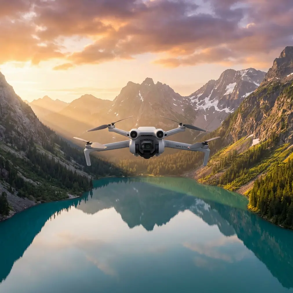
Mini 5 Pro in Urban Vineyard Inspection: What Civil Airworthiness Milestones Tell Us About Flying Smarter
META: A field-based Mini 5 Pro case study for urban vineyard inspection, with practical notes on obstacle avoidance, ActiveTrack, D-Log workflow, and handling electromagnetic interference through antenna adjustment.
I spend a lot of time around cameras, but vineyards teach you quickly that image quality is only half the job. The other half is getting the aircraft through a cluttered environment without wasting battery, missing rows, or fighting signal issues caused by the city pressing in around the vines.
That is why one recent certification story caught my attention, even though it sits far above the weight class of a Mini 5 Pro. In China, Yufeng Future announced on January 4 that its subsidiary Zhongshan Fukun Aviation Technology secured a type certificate for the E40H civil unmanned aircraft system. The certificate, issued by the South Central Regional Administration of the Civil Aviation Administration of China, carries the number TC0105A-ZN. The bigger headline is what that certificate represents: the E40H is described as the world’s first medium-sized compound-wing, hybrid-powered unmanned aircraft to meet the regulator’s airworthiness requirements.
If you fly a compact camera drone in real civilian work, that matters more than it first appears.
Not because a vineyard manager in an urban edge district is about to replace a small drone with a medium compound-wing hybrid aircraft. They are not the same tool. What matters is the direction of travel. Formal airworthiness progress in the broader UAV sector signals a market that is being pulled away from hobby logic and toward operational reliability, documented safety, and mission-specific aircraft selection. For a Mini 5 Pro pilot inspecting vines near roads, power lines, residences, and reflective structures, that shift changes how we should think about every flight.
Why a certification story matters to a Mini 5 Pro operator
The E40H’s type certificate does two things symbolically.
First, it shows regulators are increasingly willing to validate advanced unmanned designs when they can prove design safety and technical maturity. The report also notes that only 19 civil unmanned aircraft models from 10 Chinese companies have received type certificates so far, and that the E40H is the first medium-sized compound-wing and hybrid-powered model among them. That is not a casual milestone. It means the bar is high, and airworthiness recognition is still rare enough to mean something.
Second, it sharpens the distinction between aircraft categories. In practice, this helps operators stop expecting one drone to do everything. For urban vineyard inspection, that is healthy. A Mini 5 Pro should not be judged by endurance and corridor coverage standards meant for larger industrial platforms. It should be judged by the quality of close visual inspection, the precision of low-altitude route work, the ease of repeatable image capture, and the ability to maneuver safely in spaces where a larger aircraft would be awkward or excessive.
In other words, the E40H story helps define the Mini 5 Pro’s sweet spot by contrast.
The vineyard scenario: compact drone, dense obstacles, inconsistent signal
The site I am thinking of is not a romantic hillside estate with endless clean rows. It is an urban vineyard. There are buildings off one boundary, traffic on another, utility infrastructure nearby, and enough metallic clutter to create occasional electromagnetic noise. The vines themselves sit in orderly rows, but the airspace around them feels fragmented.
This is where the Mini 5 Pro earns its keep.
For this kind of mission, I care less about spectacle and more about three things:
- whether the drone can hold a stable path between rows
- whether it can avoid branches, trellis wires, poles, and edge obstacles without overreacting
- whether I can recover a solid signal quickly when interference starts to nibble at the link
That is where the usual feature checklist becomes operational rather than promotional.
Obstacle avoidance is not just about not crashing
Urban vineyard work turns obstacle avoidance into a productivity feature.
Between vine rows, there are repeating structures that can trick less disciplined pilots into relaxing at exactly the wrong time. Trellis lines, support posts, irrigation hardware, and unexpected overhangs all compress the margin for error. Add nearby fences, parked vehicles, and utility lines at the vineyard perimeter, and a small inspection flight can become a stop-start exercise if the aircraft is not reading its surroundings well.
With the Mini 5 Pro, obstacle avoidance matters because it lets you maintain a smoother visual inspection pass at a useful speed while preserving enough attention for the actual crop indicators: canopy density, missing growth, uneven coloration, irrigation anomalies, and access condition around the rows.
The trick is to treat obstacle sensing as a support layer, not as permission to fly carelessly. In vineyards, thin wires and irregular branch geometry still demand conservative line choice. I usually offset slightly above and to the side of the row when I want a clean angled look into the canopy, then slow down before tighter turns at the headlands. If I need a lower reveal shot for context, I will run that separately rather than force one pass to do two jobs.
That separation of tasks is a photographer’s habit, but it also makes inspection footage cleaner.
ActiveTrack and subject tracking are useful, but only when the subject is defined correctly
People often hear “subject tracking” and think athlete, cyclist, vehicle. In vineyard work, I use tracking differently.
Sometimes the subject is not a person at all. It may be a maintenance utility cart moving slowly along the perimeter, a worker checking irrigation, or simply a repeating corridor line that helps maintain spatial consistency in the footage. ActiveTrack can be useful for creating stable context clips that show how a problem area sits within the broader block layout.
But I do not rely on tracking when the route itself is the inspection priority. Rows are full of repetitive visual cues, and urban backgrounds can confuse framing if there are passing vehicles or pedestrians beyond the vineyard boundary. In those moments, manual route control usually produces better data.
Where tracking does help is in transitional shots between inspection zones. If I want to document how a worker accesses a difficult edge section near a wall or service lane, subject tracking can preserve smooth movement while I watch for environmental hazards.
The broader point is simple: automation should reduce workload, not shift your attention away from the mission.
QuickShots and Hyperlapse have a place in inspection, if you use them honestly
I know these modes are often treated as creative extras. In vineyard inspection, they can be surprisingly practical.
A short automated orbit or pull-back can create a quick orientation record for each block, especially when the site is surrounded by urban references like roads, rooftops, and walls. That context becomes valuable later when you are comparing conditions across visits. QuickShots are not the inspection itself, but they can anchor the inspection.
Hyperlapse is even more misunderstood. I am not using it to make the vineyard look cinematic. I use time-compressed motion to reveal pattern. For example, a rising hyperlapse from one corner of the property can show how shadows from adjacent buildings move across the rows at a particular time of day. In an urban vineyard, that is not cosmetic information. It can affect vine vigor, drying conditions after irrigation, and the timing of visual checks for stress.
Again, this is where small drones make sense. You can collect these contextual clips without dedicating a larger aircraft and crew to a relatively contained site.
D-Log matters because vineyards punish bad color decisions
Vineyards are all about subtle differences in green. That makes flat color workflows far more valuable than many casual users realize.
When I shoot in D-Log, I am not trying to turn an agricultural inspection into a film project. I am trying to preserve tonal separation in leaves, soil, trunk texture, and reflective surfaces so that later review does not flatten everything into one generic green mass. In urban sites, mixed lighting makes this even more important. You may have hard reflections from nearby glass, shadow spill from buildings, and bright open sky at the row ends.
A flatter profile gives me more room to normalize those extremes. That, in turn, makes visual comparisons between rows more credible. If one section is showing reduced canopy density or a shift in color, I want to be confident I am seeing plant condition, not compression from a harsh baked-in profile.
For a photographer, this is obvious. For an inspection team, it should be just as obvious.
The real-world headache: electromagnetic interference and antenna adjustment
Here is the part people skip until they need it.
Urban vineyard flights can suffer from electromagnetic interference. Not dramatic loss-of-control panic, just the more common and frustrating kind: image breakup, reduced transmission stability, or a warning that appears right when you are lined up for your cleanest pass.
In one site, the trouble zone was near a boundary where utility hardware and dense surrounding structures created a noticeably weaker link. The wrong response is to push through because the drone is “only a little farther out.” The right response is to treat signal quality as a live flight variable.
What helped most was simple antenna adjustment. I changed position slightly and reoriented the controller antennas to improve alignment with the aircraft instead of letting nearby structures sit directly in the signal path. I also raised the flight path just enough on the next pass to reduce shielding from the edge obstacles. That combination stabilized the link without forcing a full relocation of the launch point.
This is operationally significant because it preserves continuity. In inspection work, an interrupted pass is not just an annoyance. It can ruin comparability between rows or make a later review less useful because the footage no longer follows the same pattern.
The lesson is uncomplicated: in an urban vineyard, RF awareness belongs in the same mental category as wind and obstacle spacing. You do not need to dramatize interference, but you do need to respect it.
If you are building your own field workflow around a compact drone, I’ve found it helps to share flight challenges with an experienced setup team through this direct WhatsApp channel, especially when signal environment and route design are both part of the problem.
Why the broader UAV market is moving toward specialization
This is where the E40H certification story loops back in.
When a regulator certifies a medium-sized compound-wing, hybrid-powered civil platform under a formal type certificate, it is not merely approving one aircraft. It is reinforcing a future where drone operations are sorted by mission fit, safety evidence, and platform class. The fact that only 19 civil models from 10 companies have reached that level underlines how selective that process remains.
For small-drone operators, that is good news.
It means a Mini 5 Pro does not need to pretend to be a long-range logistics aircraft, a heavy industrial mapper, or an emergency response platform. It can be exactly what many urban agricultural users need most: a compact, responsive, camera-led aircraft for close inspection and repeatable visual intelligence in constrained spaces.
And in urban vineyard work, constrained spaces are the whole story.
A larger platform may offer longer endurance, but endurance alone does not solve narrow row geometry, cluttered perimeter conditions, or the need for discreet, low-overhead deployment. A small aircraft with strong obstacle awareness, reliable manual control, stable tracking tools, and flexible image capture modes often delivers better operational value simply because it can get in, collect what matters, and get out without turning a short inspection into a production.
My field take on the Mini 5 Pro for urban vineyards
If I were evaluating the Mini 5 Pro specifically for this scenario, I would frame it this way:
It is at its best when the mission is visual clarity inside a compressed environment. That means routine row checks, documentation after weather events, canopy condition reviews, access path observation, and communication footage for agronomists, owners, or facility teams who need to see the site rather than read a note about it.
Its most useful features in that setting are not flashy. They are practical.
Obstacle avoidance reduces friction in close-in work.
ActiveTrack helps with context when people or vehicles are part of the workflow.
QuickShots and Hyperlapse can create repeatable orientation records.
D-Log preserves meaningful image information for later review.
And disciplined antenna adjustment can rescue a flight from urban interference without unnecessary drama.
That is how real operators use compact drones well. Not by asking them to be everything, but by understanding exactly where they outperform larger systems.
The E40H type certificate, especially with a traceable identifier like TC0105A-ZN, is a reminder that the civilian UAV market is growing up through standards, categories, and mission-appropriate design. For those of us flying smaller platforms, that maturity should sharpen our own habits. Better planning. Better route discipline. Better image intent. Better understanding of what the aircraft is actually for.
In an urban vineyard, that mindset matters more than any headline feature list.
Ready for your own Mini 5 Pro? Contact our team for expert consultation.