Mini 5 Pro for Dusty Highway Inspection: Flight Strategy
Mini 5 Pro for Dusty Highway Inspection: Flight Strategy, Tracking Limits, and Safer Capture Decisions
META: Technical review of the Mini 5 Pro for dusty highway inspection, covering flight altitude, obstacle avoidance, subject tracking, D-Log workflow, and where automated tracking stops making operational sense.
Highway inspection looks simple from a distance. Long corridors, clear lines, predictable geometry. In the air, especially in dusty conditions, it becomes a judgment test. Contrast drops. Fine cracks disappear. Passing vehicles create turbulent air and suspended grit. Sun angle changes what the camera sees minute by minute. That is exactly where the Mini 5 Pro conversation gets interesting.
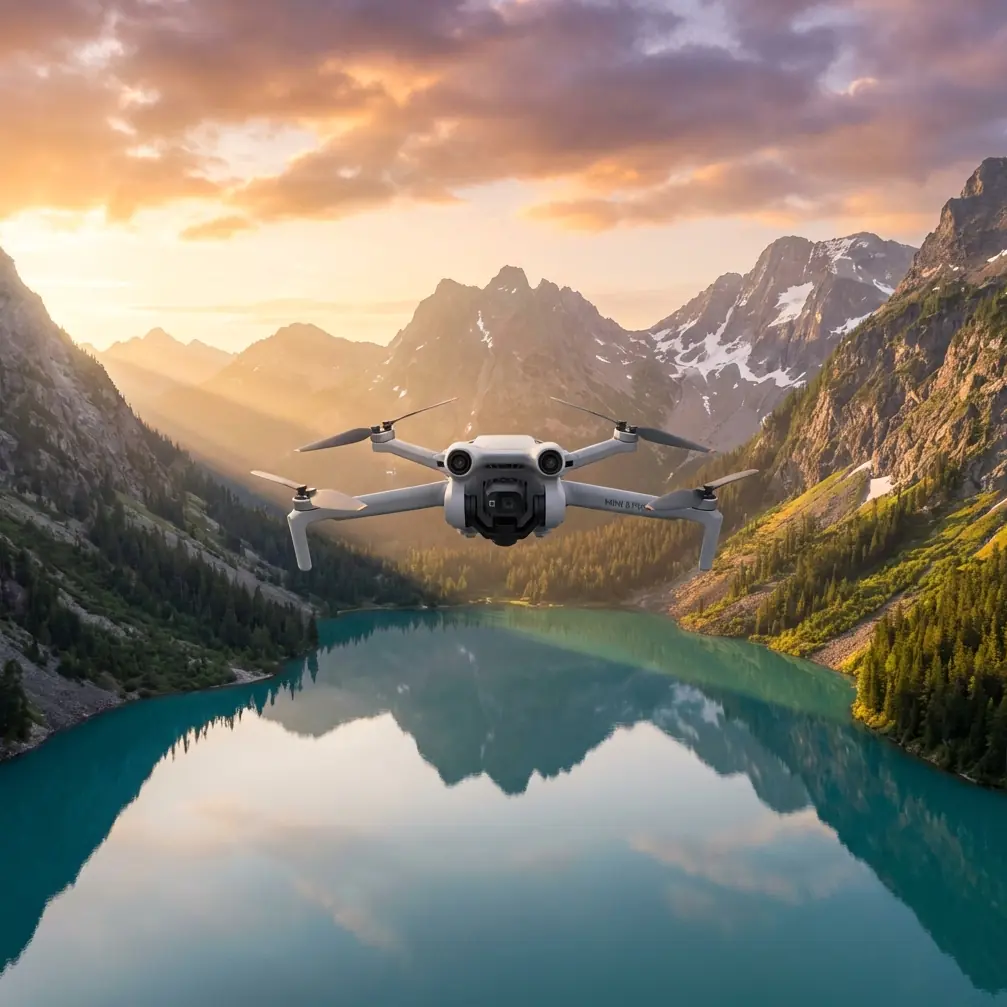
I am approaching this from the standpoint of a field shooter who cares about usable footage, not just attractive clips. The Mini 5 Pro sits in a category people often underestimate. Small aircraft usually get framed as casual tools. For dusty roadside documentation, that assumption can lead to poor mission planning. The real question is not whether a compact drone can get airborne and collect images. It is whether it can do so with enough consistency, detail discipline, and automation restraint to support repeatable inspection work.
There is also a timely reason to be careful about how people talk about drone tracking features. One recent report described a police force preparing its own drone fleet, with stated uses including tracking suspects. That detail matters because it highlights a line many operators blur too casually: subject tracking is a capability, not a mission plan. For civilian highway inspection, the value of tracking is not following people. It is maintaining framing on moving inspection vehicles, pacing corridor assets during visual review, or keeping a maintenance convoy centered while the pilot preserves attention for airspace and obstacles. The distinction is operationally significant. It keeps the Mini 5 Pro in the right lane: infrastructure work, not surveillance theater.
For dusty highway inspection, I would not build the workflow around automated tracking alone, even if ActiveTrack or subject tracking performs well in clean conditions. Dust changes edge clarity, weakens subject separation, and increases the chance that a vehicle being tracked blends into the road surface or surrounding haze. On an open road, that can degrade reliability right when operators become tempted to trust the feature most. The smarter play is to treat tracking as a support tool for short, controlled segments, then switch back to deliberate manual positioning when visual conditions soften.
That brings us to altitude. If you want one practical rule for this scenario, start around 18 to 30 meters above the inspection target for detail passes, then adjust based on traffic separation, wind behavior, and dust density. Below that range, the aircraft is more exposed to disturbed air from passing trucks and the dust plume they kick up. You may gain apparent detail, but you often lose stability and contrast. Much higher than 30 meters, you begin sacrificing the surface-level information that makes a highway inspection useful in the first place, especially for shoulders, barriers, drainage edges, patch transitions, and isolated surface defects.
For broad corridor context, a second layer at roughly 40 to 60 meters can make sense. That higher pass is not for defect discovery. It is for orientation. It helps document lane relationships, median structure, shoulder encroachment, signage spacing, and access-road connections. The mistake I see often is trying to collect everything from one altitude. Inspection footage becomes either too wide to diagnose or too tight to interpret. With the Mini 5 Pro, a two-altitude workflow is usually more productive than searching for one perfect height.
Obstacle avoidance deserves a more serious discussion than it usually gets in lightweight drone reviews. Highways are not obstacle-free environments. Gantries, sign frames, poles, cables near service areas, bridge edges, and temporary work-zone structures all compress your safety margin. Dust compounds that problem by reducing visual confidence. In clean air, obstacle avoidance can serve as a useful last layer. In dusty air, it should be viewed as an aid rather than a guarantee. Fine airborne particulate can reduce scene clarity for both pilot and sensing systems, and the Mini 5 Pro operator should plan flight paths that remain conservative even if the aircraft advertises sophisticated obstacle awareness.
That matters even more when flying lateral inspection lines parallel to traffic. A common temptation is to fly close and low beside the shoulder to dramatize the scene or maximize visible surface texture. That is a poor trade if dust is active. A slightly higher offset line often produces better footage because the aircraft remains out of the densest particulate layer while still preserving inspection relevance. You lose a little immediacy. You gain cleaner data.
Camera settings are where a compact platform can either punch above its class or create extra work. D-Log is highly relevant in this environment because dusty highways often produce harsh tonal separation: bright concrete or asphalt highlights, pale dust clouds, reflective vehicle roofs, and dark under-bridge sections in the same sequence. A flatter profile gives more room to recover those transitions during grading. It is not a magic fix for blown highlights or muddy exposure, but it gives inspection operators and media teams more flexibility when conditions change fast.
That said, D-Log only pays off if the rest of the workflow is disciplined. If your exposure floats unpredictably during a pass, your footage may become harder to compare across inspection segments. For highway work, consistency generally beats cinematic mood. Set a repeatable exposure strategy, preserve shutter behavior appropriate for your frame rate, and avoid chasing every lighting fluctuation mid-flight. When the purpose is documentation, continuity is part of image quality.
QuickShots and Hyperlapse are usually filed under creative features, but they are not automatically irrelevant here. Their value depends on how they are used. A Hyperlapse sequence, for instance, can document changing traffic density around a work zone or show how dust accumulates along a corridor edge over time. A QuickShot-style automated reveal may help establish context around an interchange or bridge approach before detail passes begin. The operational point is simple: automation is useful when it standardizes perspective or saves flight time, not when it substitutes for inspection logic.
This is also where the author persona matters. As a photographer, I care deeply about whether an image tells the truth of a scene. Dust can make footage look dramatic while actually concealing the thing you need to inspect. It softens contrast in a way that flatters wide shots and punishes detail work. The Mini 5 Pro may encourage confident movement because of its portability and automated features, but dusty inspection missions reward restraint. Slow passes. Planned headings. Repeated angles. Intentional altitude bands. Those choices create evidence, not just content.
The recent news about drones being positioned for suspect tracking is a useful reminder of how public perception around aerial tracking can drift. On paper, “tracking” sounds efficient and advanced. In real civilian infrastructure work, the better question is what exactly you are tracking and why. For highway inspection, a drone should track inspection-relevant motion only when it improves documentation. Examples include following a survey vehicle at a controlled pace to keep defects in frame, or maintaining consistent relative position while documenting barrier continuity. It should not become an excuse to hand judgment over to automation in low-visibility dust.
Operationally, this affects preflight planning. Before launch, define the trackable subject in plain language. Is it a maintenance truck moving at low speed? A bridge edge during an orbital review? A lane-closure setup? If the answer is vague, do not use tracking. Dusty environments narrow the margin between convenience and confusion. Pilots who decide this on the ground usually get better results than pilots who decide in the air.
Battery strategy also changes in these conditions. Dusty highways often require more repositioning than expected because the cleanest angle is rarely the first one. You may reject passes due to haze, traffic turbulence, glare, or particulate drift. Small-aircraft missions become better when crews stop planning for the minimum number of passes and start planning for the necessary number of usable passes. The Mini 5 Pro’s portability helps here. You can redeploy quickly, but only if the mission itself has enough slack to repeat key segments.
Another practical note: use the road geometry to your advantage. Longitudinal passes parallel to the highway are useful for continuity, but cross-angle passes often reveal rutting, shoulder drop-off, edge erosion, and drainage behavior more clearly because they create different shadow relationships. In dusty conditions, these oblique angles can sometimes cut through the visual flattening that makes top-down or straight-line footage less informative. If visibility is marginal, a slight change in angle is often more valuable than a large change in altitude.
For teams documenting highway conditions regularly, standardizing this workflow matters more than chasing a perfect one-off result. Keep a repeatable altitude framework. Record at least one broad contextual layer and one lower-detail layer. Treat obstacle avoidance as backup, not permission. Use ActiveTrack selectively and only for clearly defined civilian inspection tasks. Capture in D-Log when lighting contrast justifies the extra grading latitude. Save QuickShots and Hyperlapse for context-building, not for critical defect assessment.
If you are comparing flight plans or want to pressure-test an inspection setup for this exact scenario, you can reach a specialist through this field support chat: https://wa.me/85255379740
What makes the Mini 5 Pro genuinely useful here is not a single feature. It is the way several features interact under imperfect conditions. Obstacle avoidance can reduce workload, but only if your route is conservative. Subject tracking can stabilize framing, but only if dust is not undermining edge detection. D-Log can preserve tonal information, but only if your exposure discipline is solid. QuickShots and Hyperlapse can add context, but only if they are supporting the inspection story instead of distracting from it.
That is why a technical review of the Mini 5 Pro for dusty highway inspection should not read like a checklist. The aircraft’s value lives in operational choices. Fly too low and the dust layer and vehicle turbulence work against you. Fly too high and the inspection loses diagnostic value. Rely too heavily on tracking and you risk letting automation make decisions in the least forgiving conditions. Ignore tracking entirely and you may miss opportunities to standardize repeatable passes around moving work assets.
My preferred setup remains straightforward. Start with a high-context pass at 40 to 60 meters. Drop to 18 to 30 meters for detail work where air is still manageable. Keep lateral spacing generous near active traffic. Use D-Log when dynamic range is unstable. Reserve ActiveTrack for slow, clearly isolated vehicles or tightly controlled movement patterns. Watch the dust, not just the screen. If the atmosphere is visibly degrading the scene, change the pass early rather than hoping software will recover clarity later.
The Mini 5 Pro can be a very capable highway inspection platform in dusty environments, but only when the pilot treats its intelligent features as instruments, not shortcuts. That is the difference between attractive footage and dependable documentation.
Ready for your own Mini 5 Pro? Contact our team for expert consultation.