Mini 5 Pro for Construction Site Inspection in Complex Terra
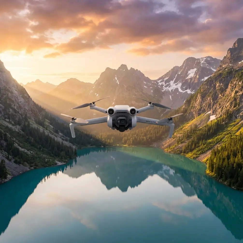
Mini 5 Pro for Construction Site Inspection in Complex Terrain: What Actually Matters in the Field
META: A field-based look at how Mini 5 Pro fits construction site inspection in complex terrain, with practical insight tied to low-altitude aerial imaging standards and real operational demands.
I’ve had inspection days where the drone was the easy part and the terrain was the real problem.
Not the dramatic kind of problem. The ordinary, expensive kind. A road cut with inconsistent elevation. A retaining structure halfway finished. Stockpiles shifting week by week. Temporary access paths. Cranes, cables, blind corners, dust, wind channels, and the constant pressure to document progress without slowing the job down.
That’s the context where a compact aircraft like the Mini 5 Pro becomes interesting. Not because “small” automatically means “better,” but because construction inspection in uneven ground rewards aircraft that can be launched quickly, flown precisely, and repositioned often. If you’re moving between grade changes, partial structures, drainage lines, and unstable footing, portability is not a lifestyle perk. It’s operational efficiency.
Still, compact size alone doesn’t solve the inspection problem. The real question is whether a Mini 5 Pro-type platform can produce dependable visual records in a way that respects established aerial imaging practice, especially when terrain complexity makes consistency harder.
That’s where the reference standard behind low-altitude digital aerial photography becomes useful. The Chinese standard CH/Z 3005-2010 was written around low-altitude digital aerial imaging for mapping outputs such as 1:500, 1:1000, and 1:2000. Even though the Mini 5 Pro is a modern prosumer-class tool rather than a legacy survey aircraft, the logic in that standard still matters: system capability, flight planning, image quality, and acceptance of results are all linked. You don’t get useful inspection records by focusing on camera specs alone.
Why complex terrain breaks casual inspection workflows
A construction site in flat, open ground is one thing. A site on slopes, in foothills, or near cut-and-fill transitions is another.
The first issue is altitude management. The reference standard states that relative flight height generally should not exceed 1,500 m, with a maximum of 2,000 m in its framework for low-altitude aerial photography. For typical construction inspection, you’ll be far below that. The significance is not the raw ceiling number; it’s the idea that altitude is a controlled variable tied to image usability.
On a complex site, “same altitude” on the controller does not mean “same inspection quality” across the ground. If the terrain rises beneath the aircraft, apparent detail, viewing angle, and overlap behavior all change. You can easily finish a flight with imagery that looks complete but is uneven in practical value. One slope face is crisp and measurable for visual review. Another section is too oblique or too distant to compare with last week’s capture.
That inconsistency creates arguments later. The superintendent wants confirmation of drainage installation. The engineer wants a clean look at slope stabilization progress. The owner wants a visual record of access road development. If your flight was casual, everybody sees something different, and nobody fully trusts it.
The better approach is to treat even a small inspection aircraft as part of an imaging system. That mindset comes straight out of the standard. It defines UAV aerial photography systems as using a digital frame camera of at least 20 megapixels mounted on an unmanned platform such as a fixed-wing aircraft, helicopter, or similar aerial vehicle. That 20-megapixel threshold matters because it reflects a baseline expectation: image capture has to be robust enough for meaningful downstream use, not just social-media clarity.
For construction inspection, the operational takeaway is simple. Resolution is not there to make footage look nice. It helps preserve detail when you need to zoom into edge conditions, material staging changes, erosion points, formwork alignment, façade progress, or temporary safety barriers after the flight is over.
What Mini 5 Pro changes on a difficult site
The Mini 5 Pro earns its place when the site demands frequent perspective changes without creating a slow setup cycle.
On complicated ground, inspection teams rarely need one long cinematic sortie. They need short, deliberate flights from different positions. A compact aircraft supports that rhythm. You can walk to the next vantage point, relaunch, and collect another set of images before site activity changes around you.
This is also where obstacle avoidance becomes more than a convenience bullet point. Construction environments are full of semi-permanent hazards that don’t read like textbook obstacles: rebar cages, temporary poles, scaffold edges, cables, parked machinery, and partially enclosed structural elements. In tight approaches around structures or when backing away from a slope face, obstacle sensing reduces the chances of turning a routine inspection into an incident report.
I learned this the hard way on a hillside project with segmented retaining walls. We needed visual documentation of drainage outlets and grading transitions along a long, curved section. Walking the entire length gave us ground truth, but not a coherent visual sequence. A larger platform would have handled the site, no question, but the launch zones were awkward and we had active work fronts nearby. The challenge wasn’t simply flying; it was repositioning safely and often.
A Mini-class workflow made the task easier because we could treat each segment as its own inspection block. Launch, capture nadir and oblique views, move 50 meters, repeat. The result was not one heroic flight. It was a dependable record.
That’s the real value proposition here. Not spectacle. Repeatability.
Flight planning matters more than people admit
The standard is explicit that low-altitude aerial photography is not just about the aircraft. It covers flight planning and aerial survey design requirements, flight quality, image quality, post-flight organization, and acceptance. That structure is useful for any serious Mini 5 Pro inspection workflow.
If I were building a reliable construction inspection routine around this drone, I’d separate the mission into three layers:
1. Baseline record capture
This is the repeatable, comparable layer. Same route logic, similar time of day when possible, similar camera settings, similar altitude reference strategy. This is where D-Log can help if your team wants more flexibility in grading footage for consistent visual comparison over time, especially when lighting changes from one visit to the next. D-Log doesn’t make poor field discipline disappear, but it can make archive footage easier to normalize.
2. Exception capture
This is where the pilot responds to what the site is doing now. New excavation edge, ponding water, crane interference, fresh fill placement, access washout, façade staging, or slope protection progress. Here the aircraft’s agility matters more than route symmetry.
3. Communication assets
This is the layer many firms neglect. Inspectors, PMs, consultants, and clients do not all read imagery the same way. QuickShots and Hyperlapse are not the core inspection tools, but they can be useful for stakeholder communication when used carefully. A short, controlled reveal of a work zone or a time-compressed progress sequence can explain change far faster than a folder full of stills. The mistake is treating those modes as substitutes for structured evidence. They’re not. They’re interpretive tools.
Used properly, they bridge the gap between technical capture and site communication.
Subject tracking sounds consumer-grade until you use it on machinery flow
ActiveTrack and subject tracking can sound like features meant for travel creators. On a live construction site, though, they have a narrower but legitimate role.
I would not use tracking as the backbone of an official inspection mission. But for documenting operational movement patterns—haul road use, material delivery paths, equipment circulation around a constrained area—it can save pilot workload and improve framing consistency. That matters when the point is to observe interaction between terrain and workflow, not just static conditions.
For example, if a site team is trying to understand how trucks are navigating a temporary switchback or whether an access lane is creating a bottleneck near a staging area, controlled tracking footage can expose the issue clearly. You still need pilot judgment and safe stand-off distances, but the feature becomes operationally relevant.
Again, the point is not gadgetry. It’s decision support.
The altitude capability detail most people overlook
One of the more revealing details in the standard is the required platform ceiling for different terrain classes. It says low-altitude aerial photography systems intended for plains and hilly areas should have a flight platform ceiling of at least 3,000 m above sea level, while systems intended for high mountains and plateau regions should reach at least 6,000 m altitude.
That doesn’t mean every Mini 5 Pro mission belongs at extreme elevations. It does highlight something site teams often underestimate: terrain complexity is not only horizontal. It is also atmospheric and topographic.
Why is that significant for construction inspection? Because a site in elevated or mountainous ground puts pressure on propulsion, stability, and mission planning at the same time. You may have less forgiving wind behavior, sharper terrain-induced drafts, and fewer practical launch points. A drone that feels effortless at a suburban test field may become much less relaxed at an upland infrastructure site.
So when evaluating Mini 5 Pro use on a difficult site, don’t ask only whether it can fly there. Ask whether it can fly there with enough control margin to collect repeatable, inspection-grade imagery. That is a very different standard.
How I’d use Mini 5 Pro on a real site visit
If I’m arriving at a complex construction site with this platform, my workflow is usually built around reducing ambiguity.
First flight: a broad overhead context pass to establish current site geometry and identify conflicts.
Second flight: targeted obliques on slopes, drainage, retaining elements, or access roads.
Third flight: close visual passes where workmanship or material condition needs a clearer look.
Optional follow-up: a short communication clip for non-technical stakeholders.
This sequence keeps the aircraft working in service of inspection logic rather than improvisation.
Obstacle avoidance is most useful during the targeted oblique stage, where partial structures and changing elevations can compress safe maneuvering space. D-Log matters most when the imagery will be reused in reports across multiple dates. ActiveTrack can support movement analysis when vehicle circulation is part of the issue. Hyperlapse only earns a place when progress communication over time is the goal and the team understands it as a supplement.
That distinction matters. Construction inspection is full of footage that looks impressive and says almost nothing.
A compact drone still needs standards discipline
One reason small drones sometimes disappoint on serious jobs is that teams fly them casually and then expect professional outputs. The reference standard pushes against that habit. It ties aerial imaging to defined requirements, not assumptions.
Even if your Mini 5 Pro mission is not a formal mapping contract, the same discipline improves results:
- Define the purpose of each flight before takeoff.
- Maintain consistency when progress comparison is the objective.
- Capture enough image detail for post-flight review, not just live viewing.
- Organize outputs so that acceptance and handoff are straightforward.
- Separate inspection evidence from presentation footage.
That final point is underrated. Site teams regularly mix together stills, screen grabs, cinematic clips, and ad hoc observations. Days later, nobody remembers which file documented what. A better archive saves time and reduces disputes.
If your team is refining that workflow and wants to compare notes on field setup, reporting logic, or Mini-class inspection routines, you can message a UAV specialist here.
So is Mini 5 Pro a serious construction inspection tool?
For complex terrain, yes—with limits, and only if it’s flown with a survey-minded mentality.
The strongest case for Mini 5 Pro is not that it replaces every heavier inspection platform. It’s that it lowers the friction of collecting useful imagery on terrain where access, slope, and constant repositioning make larger workflows less efficient. Pair that with obstacle avoidance, practical tracking tools, flexible capture modes, and disciplined flight planning, and the aircraft becomes far more than a convenience drone.
The standard behind low-altitude digital aerial photography gives a helpful reminder here. Serious aerial work has always been about system thinking: camera capability, flight envelope, planning, quality control, and result acceptance. The hardware may be smaller now, but the logic has not changed.
That’s why the Mini 5 Pro can make life easier on difficult construction sites. Not because it turns inspection into a one-button task. Because when the terrain fights your workflow, a compact platform with the right features lets you stay methodical.
And on inspection jobs, methodical wins.
Ready for your own Mini 5 Pro? Contact our team for expert consultation.