Mini 5 Pro Case Study: Capturing Mountain Power Lines
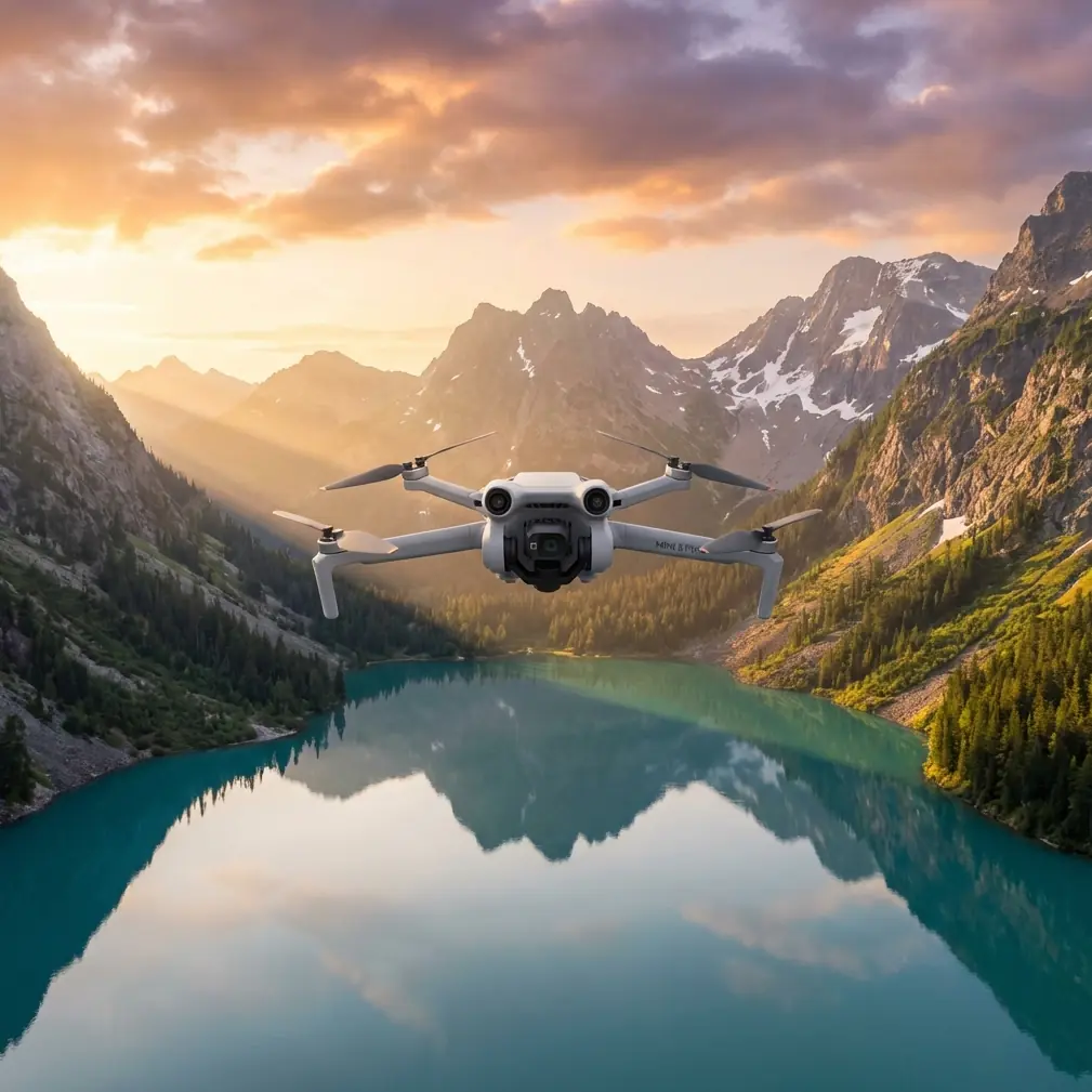
Mini 5 Pro Case Study: Capturing Mountain Power Lines Without Losing Vertical Control
META: A field-based Mini 5 Pro case study on filming power lines in mountain terrain, with practical insights on height stability, obstacle avoidance, tracking, D-Log workflow, and battery management.
Mountain power-line work exposes a drone’s weakest habits fast. A route that looks simple on a map becomes far less forgiving once ridgelines start creating uneven wind, shifting pressure, and abrupt elevation changes. If you are using a Mini 5 Pro to capture transmission corridors in this environment, the real challenge is not just getting sharp footage. It is holding a reliable vertical profile while staying composed around terrain, poles, and cable geometry.
That is where a useful engineering detail from a hexacopter design study becomes surprisingly relevant to Mini 5 Pro operations. In the referenced experiment, a sensor package was lifted to about 2 meters and returned to its original position and orientation. The measured height error stayed within roughly plus or minus 0.2 m through the test, while the broader comparison also referenced a range near plus or minus 0.50 m. Two things mattered in that result: barometric-altimeter stabilization, and compensation for barometer drift caused by atmospheric pressure changes using a reference barometer. There was also another detail with real operational value: when orientation error was removed from the measurement chain, the difference in height output changed very little, because the vertical-acceleration error tied to inclination was quadratic and usually small.
That sounds academic until you fly a mountain line inspection or media capture mission.
For Mini 5 Pro operators filming power lines in steep country, those facts point to a practical truth: altitude confidence is not a single-sensor story. It is a management problem. Pressure changes, local wind loading, terrain-induced updrafts, and pilot timing all affect how “steady” your aircraft feels when you are trying to hold a clean visual offset from conductors. The drone may look rock-solid in the monitor, yet small vertical deviations can still creep into a sequence and make line-following shots feel uneven.
Why vertical discipline matters more than people think
Most creators focus first on obstacle avoidance and side clearance. Fair enough. Power lines are linear hazards, and mountain slopes compress your available escape space. But for actual capture quality, vertical consistency often matters just as much.
If your altitude drifts while tracking a line across a slope, three things happen:
- The cable’s position in frame starts to breathe up and down.
- Parallax against towers and ridges becomes less predictable.
- Subject tracking logic can become less useful because the scene geometry changes more aggressively than expected.
This is especially noticeable in ActiveTrack-style sequences where you want the drone to maintain a stable relationship to a corridor while the background falls away into a valley. Even small changes in height can make a polished route look like a hesitant manual correction.
The research reference highlights why barometric behavior deserves respect here. In that experiment, barometer drift from atmospheric pressure change had to be compensated with a reference barometer. On a mountain route, you do not have laboratory conditions. Pressure can vary enough across the mission window to create subtle but cumulative altitude inconsistency, especially when the aircraft transitions between exposed ridges and calmer lee-side pockets.
The point is not that Mini 5 Pro cannot handle this. The point is that the pilot should not assume visual stability equals perfect vertical repeatability.
The mission profile: filming power lines in mountain terrain
Let me frame this as a realistic Mini 5 Pro case.
A content team needs clean corridor footage along mountain transmission lines for a civilian infrastructure client. The deliverables are not just scenic. They need readable alignment shots showing towers, span relationships, terrain context, and vegetation encroachment zones. The footage has to be smooth enough for presentation, but also disciplined enough to support practical review.
Mini 5 Pro is well suited to this kind of work because it combines portability with features that reduce pilot workload:
- obstacle avoidance helps around poles, tree margins, and uneven slope approaches
- ActiveTrack and subject-following tools can support repeatable motion when used conservatively
- QuickShots can be useful for context reveals around a tower site
- Hyperlapse can document corridor scale or changing weather over a ridgeline
- D-Log gives more control when balancing bright sky, dark forest, and reflective metal structures
Still, none of those features replace altitude planning.
Power lines in mountain environments are deceptive. The ground may rise under the aircraft while the line itself maintains a different spatial rhythm between towers. If you anchor your attention to terrain instead of conductor geometry, your vertical relation to the target shifts. If you anchor too tightly to the line and ignore terrain, obstacle risk increases.
That is why the most useful takeaway from the cited study is not the exact test setup. It is the principle behind it: stable height estimation depends on sensor fusion and reference behavior, not just one raw reading. In the study, the barometric-altimeter signal stabilized the height output, and compensating for drift mattered. For Mini 5 Pro fieldwork, the equivalent operational habit is to treat altitude as something you continuously validate through multiple cues: telemetry, visual framing, terrain awareness, and planned route structure.
A field method that works better than chasing the line
When I am capturing power lines in mountain terrain, I do not start with the hero shot. I start with an altitude rehearsal.
I fly a conservative offset line first, well clear of conductors and towers, to observe how the aircraft behaves over the route. Not just wind. Vertical feel. Does the drone subtly climb as it moves into a valley opening? Does it settle when it crosses a shoulder? Are there moments where obstacle avoidance, terrain texture, and visual perspective make your depth judgment less trustworthy?
This pre-pass is where Mini 5 Pro’s obstacle sensing and stable hover behavior do the quiet work that saves the mission later. If the route feels clean, I build the cinematic pass. If it feels inconsistent, I shorten segments and reset more often.
That second part is where many pilots lose quality. They try to force one continuous run when the mountain is clearly telling them to break the shot into manageable pieces.
The hexacopter test mentioned that the sensor was held at the original position and orientation for 10 seconds before the movement sequence. That small experimental detail has a practical echo in field operations. Giving your drone a brief settled hover before committing to a precision pass helps you read whether the aircraft is truly stable or merely appearing stable while the environment shifts around it. In the mountains, patience at the start of a shot usually produces cleaner footage than corrective input halfway through.
The battery management tip I wish more pilots used
Here is the battery habit that matters most on mountain power-line shoots: do not start your most altitude-sensitive pass on a pack that has already done your scouting.
I learned this the annoying way.
On one route, the reconnaissance leg consumed just enough battery to tempt a “one more run” mindset. The aircraft still had plenty of percentage left, but the mission quality had changed. Wind had freshened on the ridge, and my own decision-making got more conservative because I was already mentally accounting for return margin. The result was a technically safe shot that looked tentative.
Now I separate batteries by purpose whenever terrain and infrastructure are both in play:
- Battery 1: route reading, wind behavior, line geometry, safe pullout options
- Battery 2: primary capture pass in the best light window
- Battery 3 if needed: alternate angle, Hyperlapse, or tower reveal work
This is not about endurance anxiety. It is about protecting precision. A fresh battery gives you more than time. It gives you a clearer mind, stronger climb confidence if terrain surprises you, and less temptation to compress your shot planning. Around mountain power lines, those gains show up directly in smoother vertical management.
If you are planning this kind of corridor capture regularly and want a second opinion on setup choices, route spacing, or payload workflow, you can message our flight team here.
Using Mini 5 Pro features without letting automation drive the mission
A lot of operators ask whether ActiveTrack is useful for power-line capture. My answer: yes, but only after you define the corridor logic yourself.
Power lines are not ideal “subjects” in the same way a vehicle or cyclist is. The line can disappear against the background, tower forms can dominate the frame, and terrain can change the visual hierarchy unexpectedly. So the best use of subject tracking is often not literal cable tracking. It is using the system to support smooth motion around a stable visual anchor while you maintain manual responsibility for clearance and altitude.
The same goes for QuickShots. Around mountain infrastructure, they are most effective when used for establishing context, not for replacing deliberate route design. A short reveal that lifts from vegetation to a tower and then opens to the ridgeline can be useful. A fully automated flourish close to complex line geometry is rarely the smartest move.
Hyperlapse, on the other hand, has a strong place here. If your client needs to show weather movement across the corridor or the relationship between the line and the mountain landscape, a carefully positioned Hyperlapse can communicate scale better than a normal pass. Just make sure the launch point and route are chosen with enough clearance margin that you are not relying on last-second intervention.
D-Log deserves special mention because mountain power-line footage often contains harsh contrast. Bright cloud, deep forest, metallic towers, and thin cables in the same frame can easily push a standard profile into clipped highlights or muddy shadows. D-Log gives you more room to grade for structure visibility, especially if the deliverable needs both scenic appeal and utility for infrastructure review.
What the reference data tells us about real-world confidence
The referenced experiment reported height error staying within about plus or minus 0.2 m through the test. For anyone capturing infrastructure, that number is meaningful not because you should expect identical performance in all field conditions, but because it illustrates how well-managed sensing can produce tight vertical consistency over a controlled movement. The study also showed that correcting orientation error had little effect on height-output difference, which aligns with the theoretical point that vertical-acceleration error from inclination is quadratic and usually small.
Operationally, that means many pilots may be blaming the wrong thing when their mountain line footage feels uneven. They assume the issue is dramatic tilt or handling error, when often the problem is a mix of subtle altitude drift, timing, route segmentation, and environmental pressure behavior. Put differently: the footage gets better when you stop overcorrecting attitude and start managing vertical context.
That is the hidden value of the reference material. It shifts attention from “How steady is the drone?” to “How intelligently am I validating height over this specific route?”
A practical shot sequence for mountain power lines
If I were building a Mini 5 Pro capture plan from scratch for this scenario, it would look like this:
Pass 1: corridor read
Fly offset and high enough to study tower spacing, terrain rise, and wind seams. No pressure to record the hero take.
Pass 2: lateral tracking shot
Maintain a conservative side offset from the line corridor. Let obstacle avoidance support the route, but do not let it become your primary safety plan.
Pass 3: tower context reveal
Use a controlled ascent or arc to show tower placement against the ridgeline. This is where QuickShots may help if the area is open and the move has been tested manually first.
Pass 4: long environmental sequence
Capture a Hyperlapse or slow scenic traverse that explains why this line routing matters geographically.
Pass 5: detail pass in D-Log
Prioritize the shots where conductor visibility, insulator detail, or vegetation relation must survive post-production grading.
Throughout all of it, keep the battery roles separate. That one habit consistently improves both safety margin and footage quality.
The real takeaway
Mini 5 Pro can be a very capable aircraft for civilian power-line capture in mountain terrain, but the best results come from respecting a simple engineering truth: height stability is not magic. It is maintained through good sensing, drift awareness, and disciplined piloting.
The reference study makes that clear with concrete evidence. Barometric-altimeter stabilization mattered. Compensating pressure-related drift mattered. A test movement to about 2 meters and back still held height error near plus or minus 0.2 m. And orientation correction changed little in the final height difference, which tells us not to obsess over the wrong variable.
On a real mountain corridor, those lessons translate directly. Build your route in segments. Trust your eyes, but verify with telemetry and framing. Use Mini 5 Pro’s obstacle avoidance and tracking tools as support systems, not as substitutes for judgment. Save your best battery for the pass that actually matters.
That is how you get footage that looks calm in a place that is anything but.
Ready for your own Mini 5 Pro? Contact our team for expert consultation.