Mini 5 Pro for Coastal Power Line Work: A Technical Review
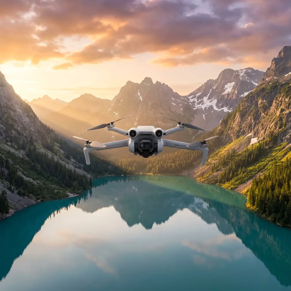
Mini 5 Pro for Coastal Power Line Work: A Technical Review from the Field
META: A technical Mini 5 Pro review for coastal power line capture, covering obstacle avoidance, tracking, D-Log workflow, wind exposure, and the pre-flight cleaning step that protects flight safety.
Anyone who has tried to photograph or film power lines near the coast knows the challenge is not just composition. It is air quality, glare, wind shear, salt residue, and a subject that can punish sloppy flying. The Mini 5 Pro, at least in the way serious operators are likely to use it, deserves to be judged on that kind of mission rather than on travel-drone talking points.
That is the frame for this review: not scenic beach footage, not casual vacation clips, but the specific job of capturing power lines in a coastal environment. From that perspective, the most important conversation starts before takeoff. Not with settings. With cleaning.
Salt haze and fine moisture do more than leave marks on the lens. They can compromise the aircraft’s vision system, and that changes the behavior of obstacle avoidance in ways pilots sometimes underestimate. On a platform expected to rely on obstacle sensing and intelligent flight support, a quick pre-flight wipe of the forward, rear, and downward sensors is not a cosmetic habit. It is a safety procedure. The same goes for the camera glass. When you are flying around wires, poles, crossarms, and insulators, degraded visual data can mean weaker braking decisions, reduced confidence in automated assistance, and footage softened by a film you may not notice until you are back at the monitor.
That single pre-flight step matters more on the coast because residue builds fast. If I were briefing a new operator assigned to utility imagery near shorelines, I would tell them to treat sensor cleaning as part of the checklist, not an optional courtesy to the drone. The Mini 5 Pro’s intelligence is only as reliable as the visibility feeding it.
That brings us to obstacle avoidance itself. On paper, obstacle avoidance sounds reassuring. Around power lines, it needs a more sober interpretation. Small wires are among the hardest real-world hazards for many compact drones to identify consistently, especially under flat light, backlight, or visually cluttered backgrounds like surf, scrub, and reflective water. So the Mini 5 Pro’s obstacle avoidance should be viewed as an additional protective layer, not permission to fly lazily around lines. Operationally, this changes how I plan every shot. I use obstacle sensing to help manage larger structures in the environment—poles, transformers, buildings, vegetation, service roads—but I still assume the lines themselves require manual respect, deliberate stand-off distance, and conservative approach angles.
That distinction is not academic. It affects route design. If I am capturing line corridors along a coastal strip, I do not run directly through the geometry of the infrastructure unless there is a compelling inspection reason and a fully controlled plan. I build oblique passes with visual separation. The Mini 5 Pro is most useful here when it stabilizes the overall flight experience, reduces pilot workload, and supports repeatable framing without seducing the operator into trusting automation where fine conductors are involved.
Subject tracking is another feature that gets misunderstood when applied to industrial scenes. ActiveTrack is often discussed in the context of sports or vehicles, but it can be useful in utility-adjacent filming when the objective is to maintain framing on a moving service truck traveling parallel to the line, or a vessel passing below a coastal span, while preserving the context of surrounding infrastructure. Used carefully, that can produce clearer storytelling and more readable footage. Used carelessly, it can pull attention away from fixed hazards.
For coastal power line work, I find ActiveTrack most valuable as a secondary tool for controlled, open-space segments where the drone has room to maneuver and the operator has already verified the environment. The operational significance is straightforward: tracking can reduce abrupt stick inputs and keep motion more consistent, which in turn helps the viewer understand the relationship between utility assets and the surrounding terrain. But the more congested the line environment becomes, the less I want tracking logic making interpretive choices near thin obstacles. This is where pilot discipline matters more than feature count.
The same logic applies to QuickShots. They are not gimmicks by default. In the right assignment, they can standardize repeatable reveals and orbit-style moves that show how transmission or distribution assets sit within a coastal landscape. A short programmed movement can be surprisingly useful for editorial work, stakeholder presentations, or site context clips that need to be visually tidy. Still, I would not use QuickShots casually near wire-heavy areas. The safer play is to launch from a clear zone, establish distance, and use automated motion only when the flight envelope is obviously clean. What matters is not whether the feature exists, but whether the operator understands where its boundaries are.
Hyperlapse is more interesting than it gets credit for in this scenario. Coastal utility corridors are shaped by changing light, moving weather, tidal atmosphere, and human activity. A well-planned Hyperlapse sequence can show fog lifting off a line route, storm bands approaching offshore structures, or traffic patterns moving beneath a utility crossing. For engineers, planners, or visual communicators, that is not just cinematic material. It can provide temporal context. The trick is that Hyperlapse increases the need for route certainty, battery discipline, and environmental awareness. In coastal winds, any long-duration automated sequence deserves extra caution. If the Mini 5 Pro is tasked with this kind of work, I would keep the route simple, the horizon references clear, and the return margins generous.
Color workflow is where a lot of otherwise competent footage starts to separate into professional and merely acceptable results. D-Log is one of the most relevant tools here because coastal power line scenes are contrast traps. You can have bright sky, reflective water, dark utility hardware, weathered timber or steel, and deep shadows under structures all in the same frame. A flatter capture profile gives you more room to protect highlight detail while holding the texture of poles, insulators, and surrounding terrain.
Operationally, that matters for more than aesthetics. If your goal is to communicate condition, environment, or line placement clearly, clipped skies and crushed shadows can erase useful information. D-Log lets the Mini 5 Pro produce footage that is more resilient in post, especially when shooting during difficult midday conditions that are often unavoidable in fieldwork. I would still caution operators not to treat log recording as a miracle fix. Exposure discipline remains essential. Coastal glare can trick screens and eyes alike. Histograms, zebra patterns if available in your workflow, and consistent ND use are often the difference between footage that grades cleanly and footage that falls apart.
There is also a practical photographic benefit in this kind of drone. The Mini 5 Pro’s compact form factor changes how often it actually gets used. Larger aircraft can absolutely outperform smaller ones in certain conditions, but a drone that is quicker to deploy tends to capture more of the moments that matter: a break in weather, a clean shaft of side light on the poles, a service crew arriving on location, or a brief lull in wind that opens a safe window for a pass. In the coastal utility context, portability is not a lifestyle perk. It is a response advantage.
Still, portability can hide the seriousness of the environment. Coastal air is unforgiving. Salt and moisture affect not only optics and sensors but also confidence in every automatic aid. That is why I keep returning to the cleaning step. It sounds small because it is physically small: a few seconds with the right cloth, careful attention to sensor faces, a lens check before lift-off. Yet on a mission involving obstacle avoidance, subject tracking, and precision framing near power infrastructure, that tiny maintenance action has outsized consequences.
This is also where operator judgment has to exceed marketing language. No intelligent feature cancels the fundamental risks of flying near utility assets. The Mini 5 Pro can help you work more smoothly, frame more consistently, and recover more dynamic range through D-Log. It can support thoughtful QuickShots in safe airspace and controlled ActiveTrack on appropriate moving subjects. But the platform performs best when flown by someone who understands that safety around lines is built on margins, not optimism.
If you are creating a repeatable workflow for coastal power line capture, mine would look something like this. First, inspect and clean the lens and all relevant vision sensors before every launch, especially after any previous beachside or near-surf operation. Second, plan your flight path around the assumption that wires may not be treated reliably by obstacle systems. Third, use manual positioning for the critical infrastructure passes and reserve automated features for cleaner, lower-risk segments. Fourth, record in D-Log when the scene carries harsh contrast and you expect to grade the footage seriously. Fifth, keep a close eye on weather movement and wind consistency because coastal air can shift fast enough to turn a comfortable route into a bad decision.
For photographers and small production teams, that approach makes the Mini 5 Pro far more than a convenient camera drone. It becomes a disciplined capture tool that can document infrastructure with nuance. You can reveal the line’s relationship to cliffs, dunes, roads, and shoreline without flattening the environment into generic aerial wallpaper. You can show scale. You can show vulnerability to weather. You can show maintenance context. And when the footage is clean, stable, and well-exposed, decision-makers who never step onto the site get a much clearer understanding of the terrain and the asset.
That is the real value here. Not novelty. Not check-box features. Practical image-making under demanding conditions.
If you want to discuss a coastal drone workflow in more detail, you can message me here and I will point you toward a safer planning approach for your shooting scenario.
The Mini 5 Pro makes the most sense when treated like a precision field camera with intelligent assistance, not an autopilot for complicated airspace. Around coastal power lines, its best features are meaningful only when paired with clean sensors, conservative route planning, and an operator who knows exactly where automation stops being helpful. That combination is what turns a compact drone into a reliable working tool.
Ready for your own Mini 5 Pro? Contact our team for expert consultation.