Mini 5 Pro in Mountain Fields: Why the Real Advantage Is
Mini 5 Pro in Mountain Fields: Why the Real Advantage Is What Happens After the Flight
META: A field-tested look at how Mini 5 Pro fits mountain-field aerial capture, from obstacle avoidance and ActiveTrack to the photogrammetry workflow that turns overlapping photos into accurate textured 3D models.
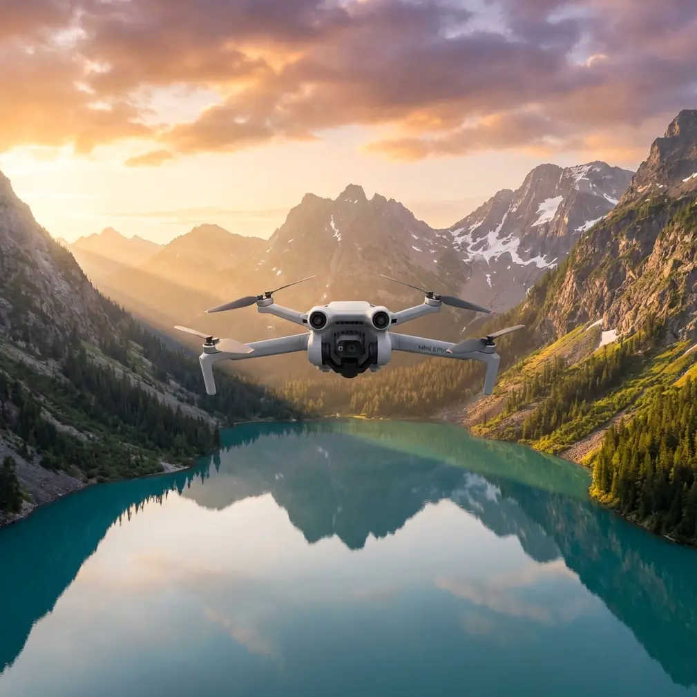
Mountain fields are unforgiving places to fly.
Terraced slopes fold into each other. Tree lines break sightlines. Light shifts fast as clouds move over ridges. And if your goal is more than a pretty clip—say, documenting orchards, tracking erosion, mapping access roads, or building a textured 3D surface of a hillside parcel—the drone itself is only half the story.
That is exactly where the Mini 5 Pro becomes interesting.
A lot of small drones can produce attractive footage in open terrain. The harder question is whether a compact platform can reliably collect image sets that still matter once the aircraft lands. For mountain agriculture, land documentation, and terrain-aware visual inspection, the answer depends on two things working together: safe capture in difficult airspace, and image consistency that feeds a serious photogrammetry pipeline.
The reference material behind this discussion is not generic consumer-drone marketing. It points directly to how modern aerial imaging workflows actually create usable models. One key detail stands out: Bentley ContextCapture relies on a set of digital photos taken from different angles around a static subject. Another matters just as much operationally: with the right inputs, that software can automatically generate a high-resolution textured triangular mesh in minutes or, for larger datasets, within hours. Those two facts tell us something essential about how to think about the Mini 5 Pro in the field.
The drone’s job is not merely to fly. Its job is to gather the right photo geometry.
The mountain-field problem most pilots underestimate
Photographers often focus on camera specs first. In practice, mountain-field capture fails earlier than that.
The first failure point is flight continuity. A narrow valley or stepped field edge can force abrupt trajectory changes. If the aircraft cannot maintain a clean path because branches, utility lines, slope changes, or rocky outcrops keep interrupting the route, the image overlap starts to suffer. That is where obstacle avoidance becomes more than a comfort feature. In a mountain setting, it protects the consistency of the dataset, not just the drone.
The second failure point is angle discipline. Photogrammetry software such as ContextCapture needs images from multiple viewpoints of a static target. On a mountain farm, that target might be a retaining wall, greenhouse cluster, irrigation corridor, or a full hillside field block. If the drone drifts too far, changes altitude inconsistently, or misses oblique perspectives, the resulting model can lose edge detail or surface continuity.
The third failure point is workflow mismatch. Many pilots capture cinematic footage and assume they can later repurpose it for mapping or 3D reconstruction. Usually, they cannot. Video clips, no matter how attractive, are not a substitute for intentionally planned still-image coverage with repeatable overlap and stable geometry.
This is where the Mini 5 Pro has to be judged differently from larger survey rigs. It is not replacing a dedicated heavy-lift mapping aircraft. It excels when access is tight, hiking is unavoidable, launch zones are limited, and the operator needs a lightweight aircraft that can still collect disciplined image sets in difficult terrain.
Why Mini 5 Pro makes sense for fields in the mountains
A mountain-field mission starts before takeoff. You may be walking along terraces or climbing a narrow farm track. Carry burden matters. Setup speed matters. Battery changes matter. A compact aircraft earns its place when the site itself is physically awkward.
That portability becomes more valuable when paired with intelligent stabilization features. On terraced land, a pilot often has to maintain framing while adjusting to elevation changes that would be trivial on flat ground but disruptive on a slope. Subject tracking and ActiveTrack can help hold visual attention on a tractor path, worker route, irrigation line, or inspection corridor while the pilot monitors terrain and spacing. In this type of setting, tracking is not just cinematic convenience. It reduces the mental load of manually keeping a moving subject centered while also watching for branches and contour changes.
Competitively, this is where a well-tuned mini platform can outperform bulkier alternatives that may offer more payload flexibility but are slower to deploy and harder to reposition repeatedly across steep parcels. In mountain agriculture and rural land capture, the best drone is often the one you can launch from three awkward spots in one afternoon without turning each move into a logistics exercise.
Obstacle avoidance is another major divider. In open-field marketing videos, every drone looks capable. In real mountain terrain, trees intrude from below, not just from the sides. Ridgelines compress your safe path. A drone that can better interpret and respond to these obstacles gives you a higher chance of completing a planned capture pattern cleanly. That directly affects data quality because clean patterns produce better overlap, and better overlap produces stronger reconstruction later.
The feature that matters most is not the one people talk about
Everyone asks about image quality first. They should also ask whether the image sequence is reconstruction-friendly.
The reference material mentions that ContextCapture can ingest not only photos from multiple angles but also optional supporting data such as focal length, sensor size, principal point, lens distortion, GPS position, attitude information, and control points. That detail has huge operational significance for Mini 5 Pro users.
Why? Because mountain-field modeling is rarely just about aesthetics. If you are documenting terrace deformation, embankment condition, drainage patterns, or crop-block layout, metadata integrity and viewpoint diversity become more valuable than a flashy one-tap mode. A drone that consistently records position and orientation data gives downstream software more context to align imagery accurately. Even when you are not building survey-grade outputs, better alignment means cleaner surfaces and more believable texture continuity.
This is also where D-Log deserves a practical explanation. For pure photogrammetry, neutral color is not magic by itself. But for mixed missions—where you need both reconstruction images and presentation visuals—D-Log gives more flexibility when the mountain light turns harsh. Bright cloud edges and shadowed terraces often exceed the comfort zone of standard profiles. A flatter profile can preserve highlight and shadow detail for visual deliverables, while a separate disciplined still-photo set can serve the modeling workflow. The Mini 5 Pro is valuable because it can support both objectives in one site visit if the pilot plans properly.
How to capture a mountain field so the software has something useful to work with
The source material emphasizes a simple truth: software like Bentley ContextCapture needs a collection of photos of a static subject from different angles. That sounds obvious, but many field operators still miss it.
If you are using the Mini 5 Pro around mountain fields, think in layers:
1. Start with a broad pass
Create an overall record of the parcel, including field boundaries, access paths, retaining structures, and adjacent slopes. This gives context and ensures the reconstruction software has large-scale spatial relationships to work from.
2. Add oblique coverage
Do not rely only on top-down imagery if the site includes terraces, embankments, or hillside cuts. Oblique images reveal vertical and near-vertical surfaces. This matters because textured mesh generation depends on visible geometry, not assumptions.
3. Keep the subject static
The source specifically frames modeling around a static target. That is critical. Avoid capturing during periods with heavy machinery moving constantly through the exact area you intend to model, or at least separate your passes. Reconstruction engines do best when the scene remains stable.
4. Prioritize overlap over drama
QuickShots and Hyperlapse are useful creative tools, especially for farm promotion, tourism-adjacent vineyard storytelling, or progress documentation. But they do not replace methodical still capture. Use them after the core dataset is secured.
5. Use tracking selectively
ActiveTrack can be excellent for following a worker along a contour path or recording vehicle movement on mountain access roads. Just remember that tracking footage serves communication and operational review; it is usually not the backbone of a 3D model. The backbone is still a planned image grid and oblique sequence.
Why the software references matter when discussing Mini 5 Pro
It would be easy to write about this drone as if mountain capture begins and ends in the air. The reference data says otherwise.
SkyPhoto-Super is described as a highly integrated UAV low-altitude photogrammetry data-processing system known for efficiency and precision. AT.Pips.Cloud is highlighted for automatically generating high-precision, high-density tie points while taking advantage of networked multi-machine, multi-core hardware resources, with particular strength in low-altitude aerial triangulation. Those details tell us that low-altitude drone capture is not a toy workflow. It belongs to a mature processing ecosystem.
That has direct implications for Mini 5 Pro users.
A compact drone becomes much more valuable when its imagery can feed professional-grade downstream processing. If you are working in mountain agriculture, slope documentation, or visual site records for land management, you do not need the aircraft alone to do everything. You need it to produce stable, consistent, information-rich photos that fit into triangulation, orthographic generation, and 3D reconstruction pipelines.
In other words, the Mini 5 Pro’s real ceiling is higher than its size suggests.
A realistic use case: terraced orchard documentation
Let’s say you are documenting a terraced orchard on a mountain shoulder.
You need:
- a visual overview for the landowner,
- close inspection of retaining walls and access tracks,
- a textured 3D model of the orchard block for planning repairs and drainage improvements,
- and a short presentation clip for seasonal reporting.
A larger platform may deliver longer endurance or a bigger sensor, but it may also be slower to move between launch points and less practical on narrow terraces. The Mini 5 Pro, by contrast, can be deployed quickly from compact spaces, flown carefully with obstacle avoidance near trees and slope breaks, and used to capture both top-down and oblique stills.
Those stills can then move into a workflow built around aerial triangulation and automated modeling. The reference material notes that ContextCapture can produce a high-resolution textured mesh after processing, with the timing ranging from minutes to hours depending on dataset size. For a terraced orchard, that means the field session can translate into something actionable: a model that shows surface form, wall condition, and spatial relationships rather than just isolated photos.
That is a stronger outcome than “nice drone footage.” It is a documented asset.
Where Mini 5 Pro clearly beats weaker alternatives
The easiest comparison is not against enterprise rigs. It is against mini drones that are fine for casual travel footage but become unreliable when terrain gets complex.
In mountain fields, the better aircraft is the one that:
- handles obstacle-rich flight paths with more confidence,
- supports dependable subject tracking when the pilot’s attention is divided,
- captures stable imagery for later triangulation,
- and transitions smoothly between creative and technical capture modes.
That is where the Mini 5 Pro stands out. Not because it turns every user into a surveyor, but because it closes the gap between lightweight portability and serious field output better than many small competitors do.
If your work includes mountain orchards, hillside tea plots, vineyard rows, irrigation corridors, forestry-edge farms, or slope-side infrastructure checks, that balance matters more than headline specs on paper.
The smartest way to use it
Treat the Mini 5 Pro as a capture node in a wider imaging system.
Fly the mountain field safely. Use obstacle avoidance to preserve route integrity. Use ActiveTrack when movement documentation matters. Save QuickShots and Hyperlapse for communication pieces, not for core reconstruction. Capture stills from multiple angles because that is what the modeling software needs. Keep the target as static as possible. Preserve metadata. Then process the imagery in tools designed for low-altitude photogrammetry and textured 3D reconstruction.
That mindset is what separates attractive flights from useful aerial work.
If you are planning a mountain-field workflow and want to compare capture approaches, message us directly here: https://wa.me/85255379740
The Mini 5 Pro is at its best when the pilot understands that the mission does not end at landing. In difficult terrain, the real win is collecting image data that survives contact with professional processing software—and comes back as something you can actually use.
Ready for your own Mini 5 Pro? Contact our team for expert consultation.